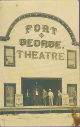
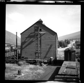
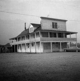
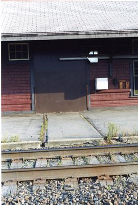
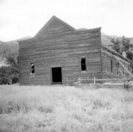
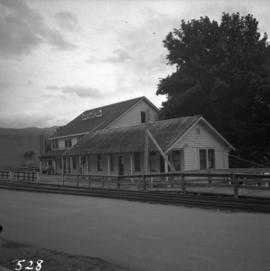
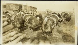
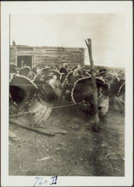
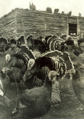
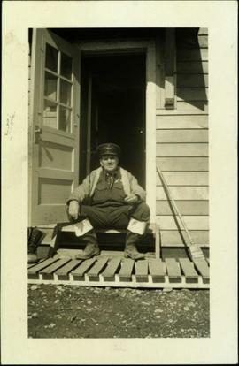
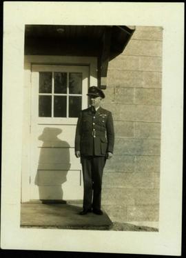
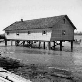
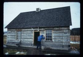
Image depicts a historic building in Fort St. James, B.C.
Image depicts an old log building in Fort St. James; the sign on it reads "Clerk's Living Quarters, Later Used as Fort St. James First School."
Image depicts a church in Fort St. James, B.C.
Six men stand on boardwalk in front of theatre.
Image depicts the Fort George Regional Museum in Prince George, B.C.
Image depicts the Fort George Regional Museum (now known as The Exploration Place) in Prince George, B.C. Map coordinates 53°54'18.6"N 122°44'09.8"W
Image depicts the Fort George Regional Museum in Prince George, B.C. Map coordinates 53°54'18.6"N 122°44'09.8"W
Image depicts the Fort George Park. Map coordinates 53°54'30.2"N 122°43'57.4"W
Wide angle photograph of a sparsely forested area with Prince/Fort George in the background. Printed annotation on recto reads: "Fort George, B.C."
Photograph depicts the early settlement of Fort George. The buildings to the left of the fence are believed to be owned by the Hudson's Bay Company. The land to the right of the fence belonged to the Fort George Reserve, the home of today's Lheidli T'enneh Band who relocated to a reserve at Shelley when this reserve was sold in 1912. Handwritten annotation on verso and recto of this photograph reads: "Fort George from opposite side of Fraser River".
Image depicts a building from the 1880's in Fort Fraser.
Handwritten annotation on recto of photograph: "FORMING FOOTING RETAINING WALL JULY 4/64." Photograph depicts construction workers
standing in forms for cement laid against mountain wall on high elevation of construction site. A retaining structure made with wood planks and rebar separates mountainside dirt from cement forms. A front end loader can be seen in midground, near unidentified building. Mountain range in background.
Photograph depicts the former "Terminus Hotel" on 32 Water St., 50 yards from the center of old Vancouver.
Photograph depicts a former store on main street in Pitt Meadows in the Fraser Valley.
Photograph depicts a former service station on the main street of Pitt Meadows in the Fraser Valley.
Photograph depicts a former Sailor's Home at the southeast corner of the intersection at Alexander St. and Jackson St. in Vancouver, B.C.
Photograph depicts a former icehouse at the Nelson CPR depot. It is located about 150 yards west of the main depot building. It also shows service boxcar CPR #412120, on the right track. The view is looking east.
Photograph depicts a former hotel, 300 yards from the former government wharf, in Squamish, B.C.
Photograph depicts a former gang car 'garage' in a station building.
Photograph depicts a former dance hall, now barn in the centre of Keremeos Centre. Only 2 buildings of the original village survived which included the dance hall and a hotel across the street.
Photograph depicts the former C.P.R. route connecting existing False Creek rail yards and the Burrard shoreline main line. The view is looking southwest from the intersection of Powell St. (in foreground) and Columbia St. (not seen) in Vancouver.
Photograph depicts a view of former C.P.R. steam locomotive sheds at North Bend, B.C. in the Fraser Canyon.
Photograph depicts a former C.P.R. connection between the False Creek yards and the south side of Vancouver harbour on West Pender St. in Vancouver, B.C. This spur used daily to get cars into the B.C. Electric Rail yard at the Georgia Viaduct from the C.P.R. False Creek yards.
Photograph depicts a former C.N.R. station at Youbou on Lake Cowichan on Vancouver Island. The track is still used to serve the plywood lumber mill at Youbou.
Photograph depicts a former car barn of the B.C. Electric Railway at New Westminster. Newly aligned track to doors (from left) #3 and #5.
Image depicts the abandoned and crumbling Forman's General Store somewhere in or near either Barkerville or Wells, B.C.
Image depicts several pieces of heavy machinery used in forestry. The Coast Inn of the North is seen in the background.
Image depicts an unidentified individual examining a piece of heavy machinery used in the forestry industry. It is located in Prince George, B.C.
Image depicts a forestry cabin located in Tête Jaune Cache, B.C.
Image depicts the Foothills Bridge over the Nechako river on the Foothills Boulevard in Prince George, B.C. Map coordinates 53°56'52.5"N 122°48'59.9"W
Image depicts a narrow footbridge suspended over a river at an uncertain location.
Image depicts what appears to be a footbridge at an uncertain location.
Image depicts the Flying U Ranch at 70 Mile House, B.C.
Photograph depicts lane in front of tent buildings flooded with water, forest trees in background. Photograph taken from canoe, portion of canoe visible in foreground. It is believed that this photograph may depict the Island Cache in flood, at Prince George, BC.
Photograph depicts lane in front of tent buildings flooded with water. Tree in midground, forest trees in background. A man can be seen between first and second row of tent buildings. Photograph taken from canoe, portion of canoe visible in right foreground. It is believed that this photograph may depict the Island Cache in flood, at Prince George, BC.
Firewood pile in left foreground. Buggy, wood house, and porch in background. Handwritten annotation on recto of photograph: "Wishing Aunt Lillian + Uncle Alan a very Merry Xmas and Happy New Year. Please do not criticize the stitches too closely Aunt Lillian. These snaps are some of part of my flock of 102 this year. These were snapped about a week before Thanksgiving. All the birds you see are this year's hatch. Some of them dressed 17 1/2 + 18 lbs at Thanksgiving. With love from Jean."
Barbed wire fence in foreground, shed in background.
Turkeys in foreground, shed in background.
Handwritten photo album caption beside and below this photo reads: "F/S. I[?].M. McLean, Ft. S. John. C.D. #2 Unit. N.W.S.R. 'Just as you see him'." Photograph depicts the Sergeant in sergeant's hat and rubber boots, sitting in open doorway of Officers' Quarters [see item 2006.20.12.15]. There is a broom on right, boots on far left, and wood slat sidewalk in foreground.
Royal Canadian Air ForceHandwritten photo album caption beside and below this photo reads: "F/S. J. Hone. C.D. #5 Unit. N.W.S.R. Whitehorse. A 100% soldier." Photograph depicts the Sergeant standing in uniform (wings medallion on left breast) in front of white doorway to unidentified building. A reflection of trees can be seen in door window.
Royal Canadian Air ForcePhotograph depicts two large metal structures on flatbed trailer. Trees visible in background.
Forest in background, wooden logs lie in foreground.
Typed annotation on recto: "Fishing Bungalows at Douglas Lodge Stuart Lake, B.C." Man stands in forest on dirt road in front of log bungalows.
Photograph of many fishing boats in a Prince Rupert harbour. Printed annotation on recto reads: "Fishing Boats Prince Rupert, BC Photo by J. Wrathall." Handwritten annotation on verso reads: "Greetings from British Columbia Ruth and Jim Warner[??]." Postcard is addressed to: "Mr. and Mrs. C. Ott 426 So. Humboldh Denver 9. Colorado U.S.A." Verso is affixed with a 4 cent Canadian stamp. Postmark reads: " Vancouver B.C. Canada. Jun 5 5 PM 1954."
Image depicts numerous boats docked by a buildings identified as the "Prince Rupert Fishermen's Co-operative Association."
Photograph depicts a fisherman's house, lived in and owned by a First Nations man (?), on the south bank of the south arm of the Fraser River. It is about 5 miles southeast of New Westminster at approximately 9000 block of River Road.