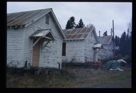
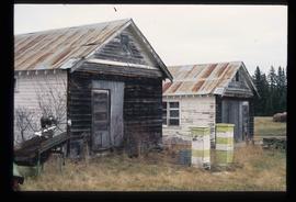
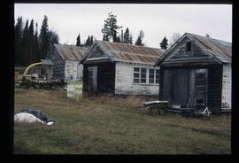
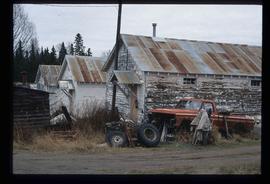
Photograph depicts large square model of the new mill building that was built at the Cassiar plant site in 1970. Model is displayed outdoors on a platform that stands on four saw horses. Machinery modeled inside the structure is colour-coded. Plant buildings and mountains in background.
Photograph depicts car parked in dirt yard. House stands in background on right, surrounded by miscellaneous items. White tent stands in left background. Water and shore visible in distance. House believed to belong to the Bourchier's niece Jean (see items 2009.5.3.120 & 2009.5.3.122).
Tall monument featuring a man's profile stands in foreground. Base of monument features writing on plaques.
Handwritten annotation on verso reads: "No. 30 Paul [Segaics?] Monument at Port Simpson".
Photograph of a group of male trappers posing in front of a log cabin. Printed annotation on recto reads: "Moonlight Cabin Enroute to Naas #90."
Image depicts a few old buildings, as well as several unknown individuals somewhere in Moricetown, B.C.
Image depicts a church on a hill in Moricetown, B.C.
Image depicts the Bulkley River running through Moricetown Canyon.
Photograph depicts a mortuary pole situated against a snowy landscape.
Handwritten annotation on verso reads: “Chapter XVIII, Nom. 1 Chief Gwaksho’s totem pole. The Great Hunter.”
Large bear carving sits on top of wide pole, erected in memory of a chief of the Bear crest. Lines of houses stand in background.
Printed below image: "Totem Pole. Old Massett. Q.C.I / J.D. Allen photo Co."; handwritten below: "Mortuary Pole Bear [Crest?]"; on verso: "For Chapt. XIX. The old style and the new. Mortuary Pole & modern houses. No. 3. W.H.C. Oct. [6/ ?] 13".
Photograph depicts Mount Pleasant Elementary School in Vancouver. Date over doorway was 1892.
Image depicts the Mount Robson Ranch.
Image depicts an old gas pump at the Mount Robson Ranch.
Image depicts the old trading post at Mount Robson Ranch.
Image depicts a field and a shack in the foreground and mountains in the background. The location is uncertain, likely Longworth, B.C.
Photo depict Movat's store where you could buy food, dry goods, and hardware among other things. Located beside the original pier on Salt Spring Island, now little used for general and commercial traffic.
Plaques on unidentified structure in foreground.
A man named Mr. Blamey sits beside dog while smoking a pipe. Unknown building in background. Ladder and stool on right, building material on left. Handwritten annotation on recto of photograph: "Mr. Blamey on Buddy when he was tiny" (see also item 2009.5.2.262 for reference to Blamey family).
Image depicts Mr. P.G. and the Tourism Information site at the intersection of Highway 16 and 97. Map coordinates 53°53'46.5"N 122°46'00.7"W
Image depicts a snow sculpture of the Mr. P.G. lounging on a couch, possibly during the Winter City Conference, in Prince George, B.C. Taken at the Prince George Civic Center. Map coordinates 53°54'45.6"N 122°44'59.6"W
Image depicts a river somewhere in Mt. Robson Provincial Park, with a bridge running over it. The slide itself is labelled "Robson station."
Image depicts what appears to be a mud house with grass and weeds growing on the roof at an uncertain location. An unknown woman is sitting on a bench outside of it.
Image depicts a rail road bridge over the Mud River.
Image depicts a muddy back road and an old shack at an uncertain location.
Left to right: Interior University Society President Murray Sadler, Prince George Mayor John Backhouse, Chancellor Iona Campagnolo, and President Geoffrey R. Weller.
Handwritten annotation on verso reads: “Construction of UNBC”.
Image depicts a woman standing next to a model of a ship in glass case in what appears to be a museum. The location is uncertain.
Photograph depicts the Mussenden Building used by the Hudson's Bay Company. It is located on Water St. in Vancouver, B.C. View is from the north side looking east.
Image depicts the old Myatovic schools.
Photograph depicts Myra depot on the CPR Kettle Valley line. The depot is at mile 83.8 and is only 8 miles from Kelowna but 2800 ft. above it. Trevor Davies, aged 8 3/4, is in the foreground.
Image depicts a bridge over the Nass River.