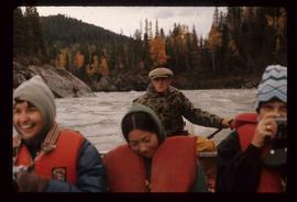
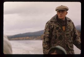
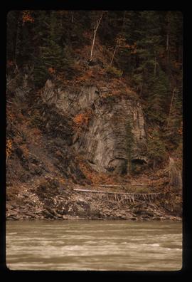
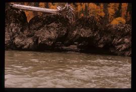
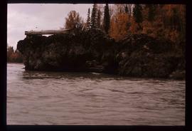
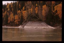
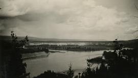
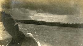
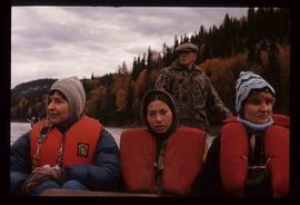
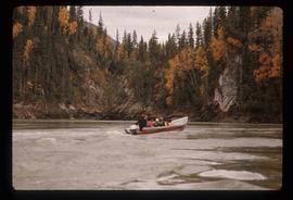
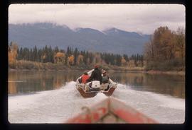
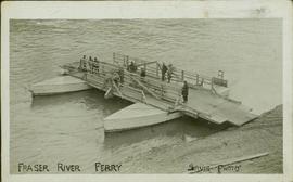
Image depicts three unknown individuals in a boat on the Fraser River; the man steering the boat is Ray Mueller.
Image depicts a group of people in boats on the Fraser River in the Grand Canyon, B.C.
Image depicts a bridge over the Fraser River in the Upper Fraser Canyon; possibly near Gang Ranch.
Image depicts a cliff side on the bank of the Fraser River in the Grand Canyon, B.C.
Image depicts the Fraser River from the Moran railway point in the Lillooet area.
Image depicts a view of the Fraser River in Lillooet, B.C.
Image depicts numerous logs piled up on rocks in the Fraser River.
Image depicts the Fraser River near Gang Ranch in the Upper Fraser Canyon.
Image depicts a view of the Fraser River, as well as a road and railroad, near the Moran Canyon.
Image depicts a rail road bridge over the Fraser River, possibly somewhere in the Lillooet area.
Image depicts Ray Mueller steering a boat on the Fraser River in the Grand Canyon, B.C.
Image depicts a rocky section of the bank of the Fraser River in the Grand Canyon, B.C.
Image depicts the bank of the Fraser River in the Grand Canyon, B.C.
Image depicts a formation of rocks in the Fraser River, with a dead tree stuck on top of them.
Image depicts a very small island in the middle of the Fraser River in the Grand Canyon, B.C.
Photograph depicts a view of Fraser River from a location near Marguerite, BC.
Photograph depicts view of the river from a boat. There is a silhouette of a person wearing a hat in the foreground.
Photograph depicts opposite shore in background behind river, bushes and trees in foreground. Handwritten photo caption on verso and recto of this photograph reads: "Fraser River at the mouth of the Clearwater".
Photograph depicts a Fraser River backchannel with logs at Peden Hill sawmill. The jackladder to the sawmill is visible on the bottom right.
Photograph depicts lush forest growth, a tent or tarp is set up on the left of the photo.
Photograph depicts the Pacific Great Eastern Railway bridge when the railway operated on the east side of the Fraser River.
Photograph depicts the Pacific Great Eastern Railway bridge when the railway operated on the east side of the Fraser River. The new grade being cut on the west side toward the site of the railway bridge is visible.
Panoramic perspective of bridge - two photographs were glued side by side. Typed annotation on recto: "Fraser River Bridge - McBride; Winter 1924-25"
Handwritten annotation on recto: "Fraser River Ferry, Sylvis Photo". Handwritten annotation on verso: "My Dear Floss, I thought yoiu would like this picture of Prince. The one I had taken on horseback didn't turn out good. The horse moved, I must try again. don't you think it pretty good of Prince. I have sent Ethel one thought she would like it. Write soon, your loving sis Alice XXX"
Photograph depicts view from a high mountain ridge. There is a river valley and clouds in the distance.
Photograph depicts a large river from a bird's eye view, forest and rocks on the water's edge, snow capped mountains in the background.
Photograph depicts the Fraser St. road bridge over the north section of the north arm of the Fraser River (ie. between Vancouver and Mitchell Island). Shot is looking northeast.
Photograph depicts the Fraser St. road bridge over the north section of the north arm of the Fraser River, looking north from Mitchell Island to Vancouver, BC
Image depicts the Fraser Valley, looking north, possibly from Marguerite, B.C.
Image depicts the small town of Fraser, B.C. Located on the Klondike Highway.
Image depicts a view of the Fraser-Nechako confluence from the Prince George cutbanks.
Unpublished results for the Sulphur stable isotope tracer study (E.P. 886.15) were presented in annual reports to the funding agencies, including this FRBC 2001 Preliminary Final Report from April 2002.
This document is an undated 1990s handout for a field trip to the Archie Road (North) demonstration plot.
Caption: Fred & Al. Here we cross Franks footsteps of 1913, Omineca River. Item is a photograph of Fred and Al holding their rifles and posing next to a tree that is inscribed with the names of members of Swannell's 1913 survey team: "1913. F.C. Swannell, A.H. Phipps, J. Davidon, J. Duncan, C. Pinker, F. Jorgensen, J. Mackenzie, W.H. Forrest, Oct-10-1931 B.C. Govt."
Photograph depicts Fred and Dick Jeffery. Handwritten annotation on verso reads, "Right Fred Jeffery, Maple Bay Vancouver Island. Left Dick Jeffery Boise Idaho".
Photograph depicts a spring salmon. Handwritten annotation below photograph reads, "A Spring Salmon four feet six inches long, 67 pound weight". Donor identifies the man in the photograph as Fred Jeffreys.
Caption: Our Cook. Item is a photograph of Fred, the survey camp cook standing with arms crossed, wearing only a small towel on a sandy shore.
Handwritten caption above this photo reads: "Fred Youngstrom in [church shirt?]" Photograph depicts two men (Fred on left) standing on snow-covered road in front of car with a British Columbia license plate "93-650". A wood pile and long building with porch can be seen in background in front of forest trees. It is believed that this photo was taken at the camp in Summit Lake, B.C. (see item 2005.3.57).
Handwritten caption beside this photo reads: "Fred Youngstrom & Kitchen Staff. 1946." Photograph depicts Fred standing to right of three woman, a young girl, and a dog. The group is standing on the snow-covered front steps of a (kitchen?) building, lumber pile on far right. A large metal triangle is hanging behind Fred. It is believed that this photograph was taken at the camp at Summit Lake B.C. (see item 2005.3.57).
Handwritten caption beside this photo reads: "Fred Youngstron [sic?]" "Foreman spotting for operator." Photograph depicts one man seated on D8 Caterpillar operating a haulback rig, and a second man (Fred?) standing behind him on Caterpillar. Image quality is poor and faces are not visible. Dirt and debris in foreground, forest in background. It is believed this rig is operating in a long-line skidding system.
Handwritten caption above this photo reads: "Fred Youngstron[sic?]" "Foreman spotting for operator." Photograph depicts one man (Fred?) seated on D8 Caterpillar operating a haulback rig, and a second man standing beside him on the Caterpillar. Dirt and debris in foreground, forest in background. It is believed this rig is operating in a long-line skidding system.
Caption: Our Cook.
Photograph depicts the south view of Fredricksen Lake with mountain ranges depicted in the background.
Photograph depicts a freight shed at the Nelson CPR depot. There is a terminal spur on the south side of the shed and road trucks on the north side. The road side of the main depot building can be seen in the left rear of the photo. The view is facing east.
Photograph depicts a freight shed located on the north side of the rail line and some 200 yards west of the Mission City CPR depot.