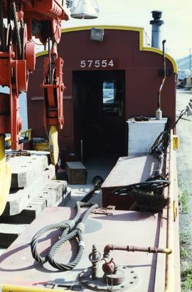
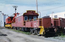
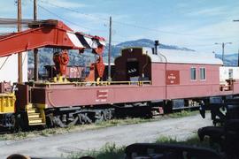
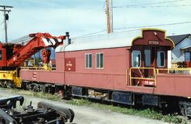
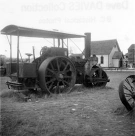
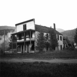
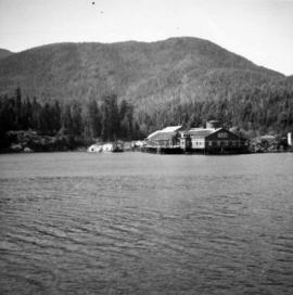
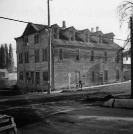
Photograph depicts the derelict Langham Hotel at Kaslo, B.C. on Kootenay Lake.
Photograph depicts a derelict locomotive shed at Union Bay on Vancouver Island. It is a Canadian Colliery Resources Ltd. shed, last used 15 Aug. 1960. Operations finished that day and disposal of all the equipment followed.
Photograph depicts a derelict mine electric railway. Some equipment that was auctioned in August 1975 included locomotive #4, a trolley, and 10 bottom dump hopper cars that were used to carry crushed ore.
Photograph depicts a derelict naval vessel at Wolfson Creek, in the booming grounds of Mahood Logging Co, about 6 -8 miles southwest of Powell River. There is a second identical vessel downstream about 200 yards away.
Photograph depicts a derelict pump in the middle of a pasture field adjacent to Kettle River. Made by "Jas Smart Mfr. Co. Ltd., Brockville, Ontario."
Photograph depicts a derelict shop on what was the Main St. of Slocan City.
Photograph depicts the Deroche post office that was well patronised for mail and newspaper distribution.
This document provides study descriptions, lab data, and images for sites Y04-01 to Y04-04 for the paleosols at the Goldbottom site study.
Photograph depicts a deserted cabin on the Indian Reserve above the PGE track at the northwest corner of Seton Lake. It probably had been occupied up until the last 5 years.
Photograph depicts a deserted cannery at Nootka, on west Vancouver Island.
Photograph depicts a row of small buildings constructed of lumber. These deserted buildings may be located in or near the Red Bluff Indian Reserve 88 of the Nisga'a People. Handwritten annotation below photograph reads, "Indian village of Red Bluff, deserted".
Photographed depicts part of a deserted roundhouse in the CPR Penticton yard. It is a 5 bay house, which all lead to the turntable that is still in use. The view is looking northeast.
Photograph depicts a deserted wharf and the Esquimalt & Nanaimo Railway, located in the foreground. It had its trackage and ties removed recently. Davies believed it to be a private wharf and railway for the Hartsville Coal Mine that operated in 1920-1941.
Photograph depicts an abandoned 3-track wharf leading to a north running connection with the Esquimalt & Nanaimo Railway. It connected on mile 85. The trackage beyond the wharf had recently been remove while the wharf itself had not been evidently been used for many years.
Photograph depicts an abandoned wharf with rail trackage that formerly led to the Esquimalt & Nanaimo Railway.
Caption: "Deserter Canyon"
Photograph depicts the design for the coin commemorating the 1978 XI Commonwealth Games in Edmonton Alberta. Design details both sides of the coin.
Photograph depicts two pick hammers laid in asbestos fibre. Annotations on note glued to recto of photograph: "ASBESTOS"; "Detail view of asbestos talus. Early test pit near top of showing. Western slope." Areas of image have been labeled "A" and "B". Photo caption under printed copy of image in 1952 Annual Report: "A - Asbestos fibre partially opened by frost action. B - Serpentine rock originally containing the asbestos fibre."
Photograph depicts a spare crane and an idler car.
Photograph depicts a spare crane and an idler car. Visible are the details of the rear end of the idle car.
Photograph depicts details of a CN derailment that occurred in Kamloops.
Photograph depicts the details of 3 axle trucks and car steps.
Photograph depicts details of a spout on a preserved water tank.
Item is a photocopied version of Slavoj Eis' "Development of White Spruce and Alpine Fir Seedlings on Cut-Over Areas in the Central Interior of British Columbia" reprinted from The Forestry Chronicle, December 1965, Vol. 41, No. 4.
Photograph depicts stalks of devil club. Handwritten annotation below photograph reads, "devil club stalks".
Map of Timber Sale X72108 shows area to be scarified. Location is outside Prince George in the Upper Fraser area near Kenneth Creek.
Map of Timber Sale X72108 shows area to be scarified, as well as previously logged areas. Location is outside Prince George in the Upper Fraser area near Kenneth Creek.
Image depicts an aerial view of Diamond Island, near Quesnel, B.C.
Summary of the diary of Willard Freer, April 1, 1942 to October 20, 1942:
- April 1-May 30, 1942: Trapping cabin along the Ingenika River
- May 30-June 16, 1942: In the Finlay River area, Freer sold furs to the HBC at Fort Grahame and helped portage supplied through Deserters Canyon for Del Miller and priest
- June 17-October 13, 1942: Employed with the United States Army in Northern BC, packing and outfitting for the survey crews of the Alaska Highway in the areas of Deserters Canyon, Fort Ware, Sifton Pass, and Fox Pass
- October 13-20, 1942: Journey to Skook Davidson's Diamond J Ranch
Caption: Dick, Shorty Haynes (6'4"). Trappers' lean-to, McGregor River, tributary to the Fraser [River]. Item is a photograph of "Shorty" Haynes in snow shoes and carrying a pack sack looking at a trappers' lean-to while pack dog "Dick" looks on.
Item is a photograph of Skookum Davidson holding Dick by the collar in an open field.
Item is a photograph of three husky pack dogs resting in the snow.
Item is a photograph of Skookum Davidson and Walter hunting in the grass with two pack dogs.
Photograph depicts a former steam roller that was converted to diesel drive. It was no longer working.