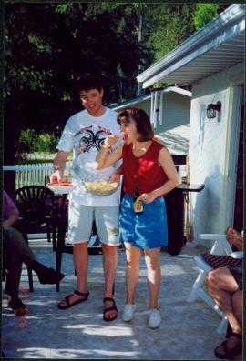
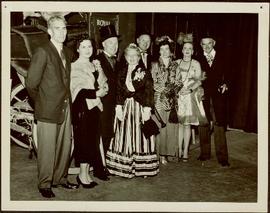
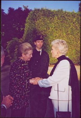
Aline’s son Dominic Dobrzensky stands in uniform in background.
Handwritten annotation on verso reads: “June 04”.
Aline’s son Dominic Dobrzensky stands in uniform in background.
Handwritten annotation on verso reads: “June 04”.
Photograph depicts man and woman speculated to be Pat (Bridget Moran's son) and Tracy holding food and beverage on deck in backyard. Unidentified individuals semi-visible on far left and right. Trees and building visible in background. Photo taken on the day Bridget Moran received an Honourary Law Degree from the University of Northern British Columbia in Prince George, B.C.
Woman pours drink into glass of man seated in chair. Handwritten annotation on recto of photograph: "Firm believers in the 'putting down' of drink. John [Ross?]." It is speculated that these may be the parents of H.F. Glassey.
Woman and man stand with baby on path, field in background. Handwritten annotation on recto of photograph: "Archie & I with the Bunker baby."
Man and woman sit on large barrels in dark area. Dog stands on right. Illegible annotation on recto of photograph: "Mr. Lev and self at Brew and [Chaisr?] Winery [Lakevill?] Cal. Sitting on '[puncheon?]' '[...?]' in the background."
Item is a photograph of Ray and Gladys Williston in fancy dress with a number of other people. Mr. & Mrs. Williston are the second couple from the left.
Photograph depicts large three story building, road and parked cars in foreground.
Annotation on verso: “Court House and Prov. Govt. offices at Pr. George. Once used to be 'Alexandra Hotel' now site occupied by Kresge’s. Alexander Hotel. Opened Sept 25, 1915."
Photograph depicts the Courtenay terminus of the Esquimalt and Nanaimo Railway. The view is looking north.
Photograph depicts a courthouse at Revelstoke, B.C. that was built in 1912-1913.
Photograph depicts a courthouse in Richfield, 1 mile above Barkerville. It was the only building left standing of the former mining community.
Photograph depicts a courthouse in Vancouver, B.C. Photo shows the ripped up forecourt.
Photograph depicts a courthouse on Georgia St., looking west towards the Vancouver Hotel. The fence surrounding the courthouse is covered with paintings.
Photograph depicts a courthouse in Vancouver, B.C. Photo shows the ripped up forecourt.
Photograph depicts a courthouse on Howe St. in Vancouver, B.C. There are paintings on the fence surrounding the forecourt.
Photograph depicts a courthouse in Vancouver, B.C. surrounded by a fence with paintings.
Photograph depicts water fountain in centre of grass courtyard at the Museum of King Jan III's Palace at Wilanów, Warsaw, Poland. Three unidentified women and one unidentified man can be seen walking in left foreground. Photograph taken during European Sports Tour with Team Canada.
Woman stands in walkway cleared of snow in front of tall brick home with a detailed porch, believed to be in Victoria, B.C. Woman wears long winter coat, fur hand-warmer, and large hat. It is believed this woman may be a cousin to Sarah Glassey's family, possibly through the Taylor line.
Two women stand in walkway cleared of snow in front of tall brick home with a detailed porch, believed to be in Victoria, B.C. The women wear long winter coats, fur hand-warmers, and large hats. It is believed that one or both of these women is a cousin to Violet Baxter's family, through the Taylor line.
Photograph depicts men standing near three covered wagons pulled by team of horses on street. Buildings line the street on left behind trees with protective structures built around their trunks. A windmill stands near small building and woodpiles in background on right. Trees on hill are visible in distance. Handwritten annotation on recto of photograph: "Quesnel".
Photograph depicts open field with dark clouds overhead. Cow grazing in left, forest in background.
Photograph taken at the Cowichan Valley Forest Museum.
Photograph taken at the Cowichan Valley Forest Museum near Sommos Lake in Duncan. Visible is a 2 truck shay owned by Gerry Wellburn. It was sited beside the Island Highway, at the entrance of the museum.
Photograph taken at the Cowichan Valley Forest Museum near Sommos Lake in Duncan.
Photograph taken at the Cowichan Valley Forest Museum.
Map reflects highways, main, branch and property roads, trails, public sustained yield unit boundaries, cutting permit boundary, contours, height of land, edge of lake, merchantable and immature timber, non-commercial cover, and swamps.
Photograph depicts CPR delivering 4 tank cars at an interchange track on Home Street. Kamloops Heritage Railways was commencing to build its facilities on the north side of the interchange track.
Photograph depicts a fuel storage shed in Harrison Mills.
Photograph depicts the switcher in Grand Forks. When CPR abandoned this city on KYR, there was a need for local switching to BN branch line, so a private company was created. 10 of these switchers were built in 1950/51 for the CPR. This particular locomotive retured in 1989 and was sold to GFR in 1993.
Photograph depicts the CPR Nelson Subdivision in Harrop.
Photograph depicts the CPR Nelson Subdivision in Procter. Located at a third of a mile spur to a barge slip. Its beginning is visible as a former switch site.
Photograph depicts the Nelson Subdivision in Procter. Until 1977, the rail/barge slip was used for lake traffic. All related facilities were removed. Track to slip located on the left. Rails were on existing spurs dated between 1898 and 1914.
Photograph depicts the CPR Nelson Subdivision in Procter. Passing siding rail dated 1954 as well as 1923. All Algoma Steel. The two spurs to the right usually only held work trains and ore rail of 1898-1914 vintage.
Photograph taken 20 miles east of Nelson at the Nelson Subdivision (Cranbrook to Nelson). The white substance near the track was a crude fill of some kind. Location was somewhere between Procter and Harrop.
Photograph depicts the C.P. pier in Vancouver. The ship "Chusan" is unloading cargo.
Photograph depicts the CP rail and the edge of the Homer St. warehouse complex in Vancouver. The view is looking northeast at the western end of Mainland St. The building is at #1152 Mainland St. The right hand track (man's shadow it) goes down Mainland and is in apparent use. The rail on the left hand track is dated 1938.
Photograph depicts the Hatzic Meadows crossing, east of Mission City in the Fraser Valley. It shows the westbound C.P. rail express running at 50-60 mph.
Photograph depicts CP rail interchange yards about 1/2 mile west of the city center of New Westminster. In the view is CP baggage car #272046 made by the Canadian Car Co. It is now in use as a horse box with end loading.
Photograph depicts the CP rail in the False Creek area in Vancouver. It is between Beatty and Cambie Streets with Smithe St. crossing from left to right in the foreground. The photo includes an insulated box car of the Southern Pacific Railway, #SP 67343, built in 1961. The track at the right is physically usable but is unused.
Photograph depicts the CP rail track beside Burrard Inlet, approximately parallel with Simon Fraser University. It shows the rear view of the eastbound "Canadian" at about 7 pm.
Photograph depicts CPR service flanger #400572 at Cranbrook. It was built in 1930.
Photograph depicts a CPR swing bridge in Harrison Mills. Looking east, towards Kilby Store. Swing section in the foreground. It was rarely used.
Photograph depicts a CPR swing bridge in Harrison Mills. Taken on the downstream side of Harrison River.
Photograph depicts a CPR swing bridge in Harrison Mills. Looking west, on the upstream side of the Harrison River.
Photograph depicts a swing bridge in Harrison Mills. It was rarely used, but all its controls were modern and maintained.
Photograph depicts what Davies noted to be a rare sight to be on a train. Visible are CPR way freight between Lumby and Vernon, travelling to Vernon. 31 of them built at CPR Angus shops in 1976. Only 10 survived at the beginning of 1997.
Photograph depicts CPR way freight and caboose on CN trackage between Lumby and Vernon, travelling to Vernon.
Photograph depicts CP/KVR trackae at the south end of the station in Summerland. The switch was put in by the restoration society. It was not there in CPR days.
Photograph taken at the Clayborn diamond crossing. The CPR runs north and south while the BC Hydro Railway crossing northwest and southeast. An interlocking hut is found at the upper left of the diamond crossing.