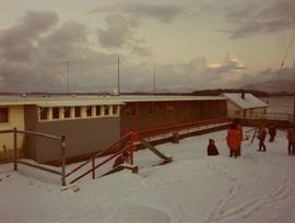
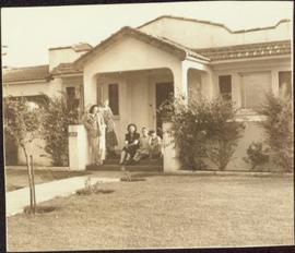
Print preview Close

Showing 3210 results

Archival description
3210 results with digital objects Show results with digital objects
2009.7.1.102 · Item · [ca. 1878 - ca. 1915]
Part of Archdeacon W. H. Collison fonds

Photograph depicts a totem pole supported by smaller poles, and a second totem pole standing straight in background. Beach in foreground, fence and hills in distance.

Handwritten annotation on verso reads: "Falling greatness, Chapt. XXI No. 5, A Chief's Totem Pole inclined to fall. [Gitaix?] Encampment, Nass River. Five illustration for Chapt. XXI."

Family on Front Steps
2009.5.2.262 · Item · [ca. 1950]
Part of Taylor-Baxter Family Photograph Collection

The group stands and sits with dog on front steps of house with veranda. Handwritten annotation on recto of photograph: "The whole 'Blamed Family'" (see also item 2009.5.2.267 for reference to Blamey family). Handwritten annotation on recto of duplicate: "All of us the same day, across the top Shirley Ed (Dorothy's husband) & Dorothy. Taken in front of their home."

Farm
2012.13.1.20.23 · Item · [2002 or 2003]
Part of J. Kent Sedgwick fonds

Image depicts a farm likely in Woodpecker, B.C.

Farm
2012.13.1.20.24 · Item · [2002 or 2003]
Part of J. Kent Sedgwick fonds

Image depicts a farm likely in Woodpecker, B.C.

Farm?
2012.13.1.50.111 · Item · 1980
Part of J. Kent Sedgwick fonds

Image depicts what appears to be a farm at an uncertain location.

Farm
2012.13.1.72.18 · Item · July 1981
Part of J. Kent Sedgwick fonds

Image depicts a farm at an uncertain location; possibly somewhere in the McGregor Valley.

Farm
2012.13.1.54.65 · Item · July 1980
Part of J. Kent Sedgwick fonds

Image depicts a farm at an uncertain location.

Farm Landscape
2008.3.1.22.43 · Item · [ca. 1995]
Part of Bridget Moran fonds

Photograph depicts two horses in one of many fenced areas, buildings and machinery in background. Highway, house, and forest also visible in distance.

Farmhouse
2012.13.1.3.012 · Item · Apr. 1972
Part of J. Kent Sedgwick fonds

Image depicts a farmhouse on Old Summit Road in Prince George, B.C.

Fence
2012.13.1.12.18 · Item · Sep. 1983
Part of J. Kent Sedgwick fonds

Image depicts a fence, perhaps somewhere in the Chilcotin region.

Fence
2012.13.1.12.15 · Item · Dec. 1980
Part of J. Kent Sedgwick fonds

Image depicts a fence in the Blackwater River area in the Chilcotin.

Fence
2012.13.1.12.17 · Item · Sep. 1983
Part of J. Kent Sedgwick fonds

Image depicts a fence somewhere in Anahim Lake, B.C.

Fence
2012.13.1.12.11 · Item · Aug. 1978
Part of J. Kent Sedgwick fonds

Image depicts a wooden fence at an uncertain location, perhaps somewhere in the Chilcotin region.

Fence
2012.13.1.12.12 · Item · Aug. 1978
Part of J. Kent Sedgwick fonds

Image depicts a wooden fence at somewhere in Meldrum Creek, B.C.

Fence
2012.13.1.12.16 · Item · Sep. 1983
Part of J. Kent Sedgwick fonds

Image depicts a fence somewhere in Anahim Lake, B.C.

Fence and Power Lines
2012.13.1.78.47 · Item · 1982
Part of J. Kent Sedgwick fonds

Image depicts a fence and power lines near the shore on Haida Gwaii. It is possibly a small community such as Masset.

Fernie CPR station
2013.6.36.1.028.06 · Item · Aug. 1983
Part of David Davies Railway Collection

Photograph depicts the Fernie CPR station, located at mile 34.7 on the Cranbrook Subdivision, which runs from Crowsnest to Cranbrook. In coal mining days this was a busy place but now it has sidings for 153 cars and nothing else. The view is looking east.

Ferry
2012.13.1.50.056 · Item · 1978
Part of J. Kent Sedgwick fonds

Image depicts a structure that appears to be a type of zipline, ferry platform at an unknown location.

Ferry
2012.13.1.50.057 · Item · 1978
Part of J. Kent Sedgwick fonds

Image depicts a structure that appears to be a type of zipline, ferry platform at an unknown location.

2009.7.1.154 · Item · [ca. 1880 - ca. 1915]
Part of Archdeacon W. H. Collison fonds

Two carved poles stand in foreground, a third smaller pole visible by wood structure in background.

Handwritten annotation on verso reads: "For heading of Page 12. Fin Back Whale Crest. [?] Totems, S.E. Alaska".

Finish Line
2012.13.1.129.01 · Item · 1971
Part of J. Kent Sedgwick fonds

Image depicts numerous skiers standing near a finish line somewhere on Tabor Mountain in Prince George, B.C.

Fire hall in Moyie, B.C.
2013.6.36.1.002.071 · Item · Oct. 1965
Part of David Davies Railway Collection

Photograph depicts the fire hall in Moyie, 20 miles south of Cranbrook. When the photo was taken there were 2 hose reel carts inside, a hose, and huge log stove under the hose drying tower (partially seen through window). Moyie was a prosperous village about 1900-1910.

2012.13.1.3.149 · Item · Apr. 1999
Part of J. Kent Sedgwick fonds

Image depicts a snow sculpted fire place and couch on a skating rink, possibly during the Winter City Conference, in Prince George, B.C. Taken at the Prince George Civic Center. Map coordinates 53°54'45.6"N 122°44'59.6"W

2011.3.3.101 · Item · May 1909
Part of North Coast & Central BC Postcard Collection

Photograph of two men in a car driving down a wooden road in Prince Rupert, BC. Printed annotation on recto reads: "First Motor Car in Prince Rupert, B.C., May 1909." Handwritten annotation on verso reads: "Milwaukee Ore. Nov 7 1913. Dear Friends. Just a line. We are comming[sic] over Sunday if it don't rain to[sic] hard. How is Fredie? Hope he is alright. If you had other plans for Sunday you can phone us. Best regards from us both. Mrs Ed Herry[??]." Postcard is addressed to: "Mrs. J Reichard 3404 34 L. St. Vancouver Wash." Verso is affixed with a one cent American stamp. Postmark reads: "Milwaukee [illegible] Oreg."