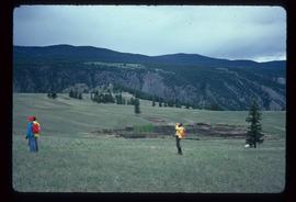
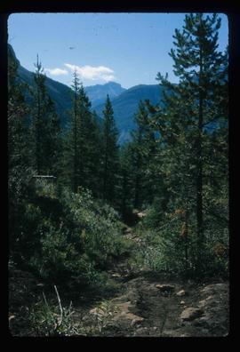
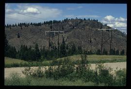
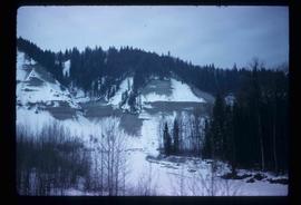
Image depicts a highway, possibly Highway 97, in Prince George, B.C.
Image depicts the Skeena River alongside Highway 16 en route to Prince Rupert, B.C.
Image depicts a view along Highway 97 in Prince George, B.C.
Image depicts Highway 97 at 15th Ave. looking north. Map coordinates 53°54'36.0"N 122°46'55.5"W
Image depicts Highway 97 at 15th Ave. looking north. Map coordinates 53°54'42.1"N 122°46'53.1"W
Image depicts a section of Highway 97 looking south. Map coordinates 53°55'10.3"N 122°46'54.9"W
Image depicts an aerial view of Highway 97 just north of Williams Lake, B.C.
Image depicts an aerial view of the Williams Lake Airport along Highway 97, just north of Williams Lake, B.C.
Image depicts a van on a highway with mountains in the distance; the location is uncertain, though it is possibly along the Alaska Highway.
Image depicts a hiker with a camera taking pictures.
Image depicts a group of hikers and a dog walking down a hill.
Image depicts a group of hikers standing on a slope.
Image depicts four unknown individuals hiking along a path in the woods somewhere near Miworth, B.C.
Image depicts a group of people hiking up a mountain side, possibly Mt. Robson.
Image depicts a large group of individuals preparing to hike up Mt. Robson.
Image depicts a group of hikers somewhere in Mt. Robson Provincial Park.
Image depicts a group of people hiking up a glacier, possibly the Robson Glacier.
Image depicts a group of people hiking on a glacier, possibly the Robson Glacier.
Image depicts a group of people hiking through trees somewhere in Mt. Robson Provincial Park.
Image depicts a hiking trail through the trees.
Caption: Slowly Upwards. Item is a photograph of three survey crewmen hiking up a slope through waist high snow. Mt. Clare-Marion visible in background.
Image depicts a group of hikers hiking up a slope.
Image depicts a hill in kettle Valley B.C.
Image depicts a hill and some power lines in Kettle Valley, B.C.
Flat grass-covered area in foreground.
Photograph depicts treed rolling hills near Fraser Lake, BC.
Photograph depicts a view from the water looking toward a treed, mountainous hillside. Handwritten annotation below photograph reads, "Hills north of Sicamous".
Photograph depicts a hillside flue and a 120 ft. stock of copper smelter that operated from 1901 to 1908. The stock was built sometime between 1903-1909.
Photograph depicts a hi-rail crane that was located in the Cn Junction yards, Kamloops.
Image depicts a view of the scenery near Hixon, B.C.
Image depicts an old building, possibly the old school, somewhere in Hixon, B.C.
Image depicts a few buildings, possibly an old school and teacherage, in Hixon, B.C.
Image depicts an old building, possibly the old teacherage, somewhere in Hixon, B.C.
Image depicts the power lines in the Hixon area south of Prince Georg, B.C.
Image depicts an area of placer mining at Hixon Creek in Hixon, B.C.
Photograph depicts a dam and wooden spillway along a creek. Annotation on verso reads: "This is the dam and spillway about 9 miles up Hixon Creek belonging to the Hixon Creek Cariboo Gold Co. Original handwritten annotations on verso of photograph are signed by Tom Marsh and covered by mounting the photo on paper. Photograph is taped to paper. Typed annotation on recto of paper reads: “This is the dam and spillway about nine miles up Hixon Creek belonging to the Hixon Creek Cariboo Gold Co., whose main camp on Hixon Creek was at the falls. A fellow Sterling or (Bill) Tordiffe & I took a contract to cut the logs for this dam in January 1934. The first few winters Quesnel Quartz had to shut down for snow."
Photograph depicts a dam and spillway obstructing a creek. Photo is adhered to paper backing, upon which handwritten annotation on recto reads: “This is the dam and spillway about nine miles up Hixon Creek belonging to the Hixon Creek Cariboo Gold Co., whose main camp on Hixon Creek was at the falls. A fellow Sterling or Bill Tordiffe & I took a contract to cut the logs for this dam in January 1934. The first few winters Quart [sic] Quesnel Quartz had to shut down for snow”
Image depicts several people standing near the Hixon Falls in Hixon, B.C.
Image depicts the Hixon Falls in Hixon, B.C.
Image depicts the Hixon School.