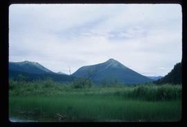
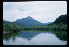
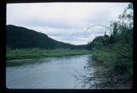
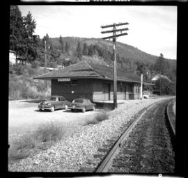
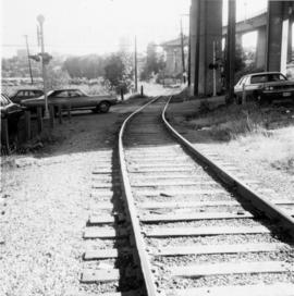
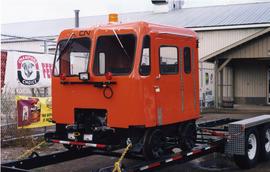
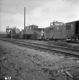
Photograph depicts a CN speeder.
Photograph depicts a row of spectators wearing nice clothing, sitting on the curb in the shade of mature chestnut trees. Many of the spectators appear to be Indigenous women and children. They may be gathered to watch a parade or special event. There are Union Jacks and Canadian Red Ensign flags hanging in the trees, suggesting the event may be a Dominion Day event. Although the location is unknown, the presence of the chestnut trees suggests that this may have been taken on Lillooet Main Street.
Image depicts mountains, taken from the river channel leading to the Spectacle Lakes.
Image depicts a mountain in the distance, and the river channel leading to the Spectacle Lakes.
Image depicts the river channel leading to the Spectacle Lakes.
Image depicts Spectacle Lake.
Photograph depicts a Pacific Great Eastern Railway "Special Train" that is "carrying a number of members of B.C. Legislature on their tour of inspection. First train into Lillooet, B.C. Feb. 20, 1915, 5 p.m." The train is depicted on the grade along the Seton River as it leaves Seton Lake.
Photograph depicts special equipment opposite a car barn of the B.C. Electric Railway, at New Westminster.
Photograph is one of five depicting EP 106.
This souvenir token from Edmonton, Alberta was given to Minister Iona Campagnolo when she attended Klondike Days as Yellowhead Highway Association representative. On the front of the coin pioneers McDougall and Secord are depicted, while on the reverse is the Klondike Mike figure with inscription "Klondike Mike Salutes XI Commonwealth Games." This token was equal to $1 in Edmonton during the games and expired August 15, 1978.
This antler was a gift to Minister Iona Campagnolo commemorating her visit to Atlin, British Columbia. Inscribed on the antler are the words "Iona Campagnolo - Atlin Fun Days 1977" and a silhouette of dogsled team.
Image depicts the interior of the ferry at Southbank, B.C.
Image depicts Southbank, B.C.
Photograph taken at the east end of False Creek, looking south towarsd Quebec and Ontario Streets.
Image depicts an aerial view of what is likely Turner Lake in South Tweedsmuir Provincial Park.
Image depicts an aerial view of South Tweedsmuir Provincial Park. The lake is possibly Lonesome Lake.
Image depicts an aerial view of a lake in South Tweedsmuir Provincial Park. It is possibly Lonesome Lake.
Image depicts an aerial view of Glacier Mountain in South Tweedsmuir Provincial Park.
Image depicts an aerial view of what is likely Glacier Mountain in South Tweedsmuir Provincial Park. The two lakes present are possibly Vista and Junker.
Image depicts an aerial view of a "glaciated valley" in South Tweedsmuir Provincial Park. Glacier Mountain is present in the image.
Image depicts an aerial view of a chain of lakes in South Tweedsmuir Provincial Park.
Image depicts an aerial view of South Tweedsmuir Provincial Park.
Image depicts a view of South Tweedsmuir Provincial Park.
Image depicts an aerial view of South Tweedsmuir Provincial Park.
Image depicts a lake and mountain somewhere in South Tweedsmuir Provincial Park.
Image depicts an aerial view of a lake in South Tweedsmuir Provincial Park.
Image depicts an aerial view of South Tweedsmuir Provincial Park.
Image depicts a view of South Tweedsmuir Provincial Park. An unidentified man stands on the side of the image.
Photograph depicts the South Slocan Junction at mile 11.9 on the CPR line on the Nelson Boundary Subdivision. It closed as an agency in June 1969 but the telegrapher still maintained it. Three to four freights pass per day on the main line: 2 to Trail, 1 to Castlegar pulp mill, and 1 every other day to Midway. On the branch there is 1 train per week to Nakusp that leaves Nelson on Monday, arrives in Nakusp on Tuesday, and returns to Nelson on Wednesday. The view is looking east.
Photograph depicts the south shore line of the B.C. Electric Railway in False Creek, Vancouver. B.C. Hydro operated it, if not owned it. The location was directly opposite from Granville Island.
Lofty view of stern wheeler in river. Scattered buildings and tents in background. Printed annotation on recto reads: “South Fort George Oct 30th 1910”
Photograph depicts scattered buildings, an outhouse, and tents on a rough clearing. A river and its cutbacks are in the background.
Overhead view of downtown Prince George with a forested area in the background. Printed annotation on recto reads: "South Fort George- 1914."
Image depicts a house somewhere in the South Fort George subdivision of Prince George, B.C.
Image depicts a cemetery in the South Fort George suburb of Prince George, B.C.
Wooden piles driven into a river bed, pile driver visible in background. Handwritten annotation on recto reads: "South fork intake before gate built, pile driven to refusal".