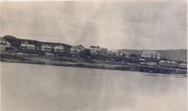
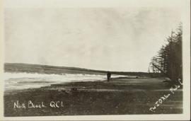
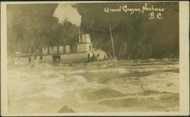
Image depicts what appears to be an old mill at an unknown location.
Image depicts an old house missing windows and doors in the foreground, and a bunkhouse in the background, in Sinclair Mills, B.C. Map coordinates 54°01'17.4"N 121°40'53.0"W
Image depicts an old house in Penny and a woman, possibly Sue Sedgwick, standing in front of it. The location is uncertain.
Image depicts an old house with a torn up roof. The location is uncertain.
Image depicts an old house missing windows and doors at an uncertain location.
Image depicts Sue Sedgwick and a dog standing next to an old, collapsing cabin which is sloped sideways. The location is uncertain.
Image depicts an old, collapsing cabin which is sloped sideways. The location is uncertain.
Image depicts several old log cabins, possibly at McLeod Lake.
Image depicts an old cabin in the woods at an uncertain location.
Image depicts a couple of old buildings, and a field full of tree trunks and dead wood. Located somewhere in or around the Upper Fraser Canyon.
Image depicts several old buildings at an uncertain location. The slide is simply labelled "Spring house?"
Photograph of a long bridge spanning two rock faces. Below is a smaller, half demolished wooden bridge. A small settlement is visible on the lower right. Annotation on recto reads: "Haquelqet Bridge." Handwritten annotation on verso reads: "Old & New. Old Indian built bridge & later one at Hazelton, BC."
Image depicts a view of Old Aiyansh.
Image depicts an old, abandoned church located somewhere in Seton Portage, B.C.
Image depicts an old abandoned cabin at an uncertain location.
Image depicts an oddly shaped tree branch that appears to have grown downwards, and is covered in green, mossy growths. Located somewhere on Haida Gwaii.
Image depicts the Oblates of Mary Immaculate Catholic Church in Aleza Lake, B.C. Map coordinates 54°07'08.2"N 122°02'00.0"W
Photograph depicts numerous buildings along a shoreline with water in the foreground.
Image depicts the Northwood pulpmill in Prince George B.C.
Image depicts the Northwood Pulpmill in Prince George, B.C. taken from above the Nechako River looking east. Map coordinates 53°56'00.0"N 122°44'29.7"W
Image depicts the Northwood pulpmill in Prince George B.C.
Image depicts the Northwood Bridge crossing in Prince George B.C.
Photograph depicts the North peak of McDame mountain after extensive strip mining, South peak unmined in background. Old mine garage visible on right of West peak in foreground. Crusher plant partially visible on far right. Photograph believed to have been taken just prior to the development of the pit mine between the North and West peak.
Image depicts numerous power lines and a road somewhere north of Squamish.
Image depicts a field north of Dog Creek in the upper Fraser Canyon.
Wide angle shot of North Beach with an unidentified solitary man in the distance. Annotation on recto reads: "North Beach QCI" and "The JD Allen Photo C."
Image depicts Noralee, B.C.
Campagnolo sits in centre, wearing black and green. Photograph is one of 13 images printed from digital format on a CD-R featuring members of a group referred to as 'Terracites' (see item 2009.6.1.697) pictured in the gardens; see also items 2009.6.1.698 - 2009.6.1.710.
Image depicts an old shack buried in snow, possibly in Newlands, B.C.
Image depicts an old building that was possibly once a gas station in the community of Newlands, B.C.
Image depicts what is possibly the community of Newlands, B.C.
Photograph of a long bridge spanning two rock faces. A small settlement is visible on the lower right.
Image depicts New Aiyansh.
Handwritten caption beside this photo reads: "Ned got a Moose". Photograph depicts a man named Ned holding the antlers on the head of a bull moose protruding from the fender of a car. Buildings and trees in background.
Image depicts the bank of the Nechako River at Island Cache.
Image depicts what is possibly a small section of the Nechako River on Cottonwood Island.
Image depicts a body of water in Island Cache. It is possibly a small section of the Nechako River.
Image depicts the Nechako River on Cottonwood Island.
Image depicts the Nechako River from Cottonwood Island.
Image depicts the cutbanks on the other side of the Nechako, taken from the nature trail at Island Cache. Map coordinates 53°55'34.6"N 122°45'52.4"W
Image depicts a cutbank on the Nechako River in Prince George, B.C.
Handwritten annotation on verso of photograph: "Grand Canyon, Nechaco, B.C.", on recto: "Steamer Nechacco in the Grand Canyon 1909." River rapids in foreground, opposite shore in background.
Image depicts a stretch of land from Highway 97 near Williams Lake, B.C.
Image depicts an aerial view of some scenery near Williams Lake, B.C. The highway and BCR tracks are visible among the trees.
Image depicts an aerial view of a stretch of power lines somewhere near Williams Lake, B.C.
Image depicts an aerial view of the Fraser River near Soda Creek, B.C.