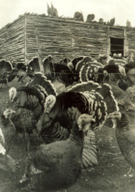
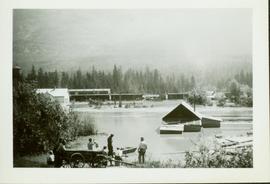
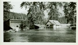
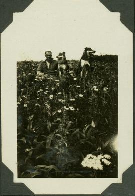
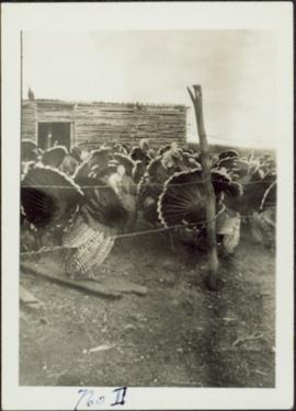
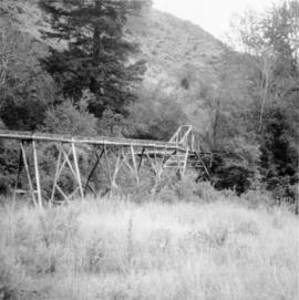
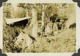
Barbed wire fence in foreground, shed in background.
Turkeys in foreground, shed in background.
Firewood pile in left foreground. Buggy, wood house, and porch in background. Handwritten annotation on recto of photograph: "Wishing Aunt Lillian + Uncle Alan a very Merry Xmas and Happy New Year. Please do not criticize the stitches too closely Aunt Lillian. These snaps are some of part of my flock of 102 this year. These were snapped about a week before Thanksgiving. All the birds you see are this year's hatch. Some of them dressed 17 1/2 + 18 lbs at Thanksgiving. With love from Jean."
Photograph taken between Tulameen and Coalmont. Visible is flood damaged trackage, subsequent to May 1989.
Buildings partially submerged by the high waters of the Skeena River. Handwritten annotation on verso: "R.R. & yards near Pacific Station".
Wagon load of people looking at the fully submerged train tracks and partially submerged buildings effected by the high waters of the Skeena River.
Flood waters rise in foreground, buildings, train cars and water tower visible in background against a forested mountainside.
Photo taken from top of railcar featuring submerged train tracks and partially submerged buildings effected by the high waters of the Skeena River.
In 1936 a flood covered CN tracks in the Prince George area.
Image depicts a flooded area with an old sawdust pile in the background. Likely near McGregor, B.C.
Photograph depicts lane in front of tent buildings flooded with water, forest trees in background. Photograph taken from canoe, portion of canoe visible in foreground. It is believed that this photograph may depict the Island Cache in flood, at Prince George, BC.
Photograph depicts lane in front of tent buildings flooded with water. Tree in midground, forest trees in background. A man can be seen between first and second row of tent buildings. Photograph taken from canoe, portion of canoe visible in right foreground. It is believed that this photograph may depict the Island Cache in flood, at Prince George, BC.
Handwritten annotation on verso reads: "Nass River canyon at flood water". A building is visible on shore in distance, and mountains can be seen in background.
Photograph depicts carpenter Florian Osorio.
Photograph taken at Government House in Victoria, B.C.
Item is a photograph of Skookum Davidson sitting in a field of wildflowers next to two pack dogs.
Photograph depicts a line of wooden piles that have been driven into the ground and lead through a forested landscape. Handwritten annotation on verso of photograph: "part of flume construction piles driven down to refusal".
Photograph depicts a flume crossing over a creak near the centre of Keremeos, close to the Penticton highway.
Photograph depicts a wooden flume being constructed along a hillside through a forest landscape. Handrwitten annotation on recto of photograph: "Flume over pile trestle, sec. #1, 8ft. wide"
Carved wooden flute. Stamped annotation on verso reads: “Department of Mines and Resources, Photographic Section. Oct. 6, 1939”. Numeric annotation on verso: “33-6”
Item is a photograph of John Ogilvie "Skookum" Davidson standing by a tent.
Typed annotation on recto: "Rainbow Trout fishing (Fly fishing) Tachi River - Stuart Lake, B.C." Two men fishing in a canoe with rope tied to another object, and one fish caught in net. Trees on shore in background.
Image depicts the Flying U Ranch at 70 Mile House, B.C.
Photograph taken at the main main fire station on the site of the former RCAF station near the Vancouver Airport. Visible is foam pumper #2, operated by the Federal Department of Tranpsort, as well as a Sicard truck.
Photograph depicts a view of fog over the Fraser River in the Lillooet area.
Photograph depicts a man standing to the left of a CF-ABK float plane and a Fokker AAM float plane resting on the water on Takla Landing.
Photograph depicts the folding steel stern door of the S.S. Canora C.N.R. ferry to Vancouver Island. The door is raised and lowered by a 2 cylinder steam winch.
Image depicts the foot of Indianpoint Lake.
Image depicts a camp at the foot of Isaac Lake.
Image depicts a narrow footbridge suspended over a river at an uncertain location.
Image depicts what appears to be a footbridge at an uncertain location.
Photograph depicts range of hills, clouds in background.
Photograph depicts hill, trees in foreground.
Photograph depicts range of hills, trees at base.
Photograph depicts range of hills, trees in valley.
Photograph depicts range of hills. Trees in valley, clouds in background.
Photograph depicts range of hills, trees in valleys.
Photograph depicts hill, trees in foreground.
Image depicts an esker at the Foothills Boulevard in Prince George, B.C.
Image depicts the Foothills Bridge over the Nechako river on the Foothills Boulevard in Prince George, B.C. Map coordinates 53°56'52.5"N 122°48'59.9"W
Photograph depicts an unidentified guide lying in the snow on top of a mountain peak searching for game through a pair of binoculars. In the foreground footprints in the snow are visible while the background features a snow-covered mountain range.
Photograph depicts a CF-AAM float plane stopped after a forced landing on Sustut Lake in front of Sentinel Peak.