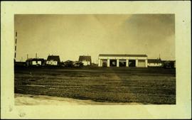
The item is a 35 mm photograph depicting a stucco duplex on the Cariboo Highway.
Item is a photograph of the women and children on Rathrevor Beach.
Photograph depicts a building structure in an unknown location.
Photograph depicts a building structure near a train in an unknown location.
Railroad ties beside a track waiting to be laid.
Image depicts an unknown building under construction at the corner of 6th Avenue and Dominion Street in Prince George, B.C.
Handwritten photo album caption below this photo reads: "D.O.T [Department of Transportation?] Bldgs & Garage, Whitehorse." Photograph depicts numerous buildings and a four-door garage on streets in Whitehorse. Dump trucks and other various vehicles surround garage. Road and gravel covered area crosses foreground.
Royal Canadian Air ForcePart of a set of 41 original black & white photographs [1908-1933-?]) of the Grand Trunk Pacific Railway line in BC depicting surveying crews, town sites (Prince Rupert and its port, Hazelton and Fort George), and First Nations Peoples.
Photograph of Prince Rupert businesses amidst clear cut stumps. Businesses include "Stewart and Mobley Groceries, Fruits and Produce." Printed annotation on recto reads: "Prince Rupert, B.C., Oct. 09."
Image depicts numerous buildings and a dock on the shore of Haida Gwaii, B.C..
Photograph depicts two large buildings across street in foreground, van visible on left.
The photograph depicts three buildings, white, beige, and blue at the Prince George airport. Annotations on the photograph describe the buildings as, "RCMP, airport terminal building, [and] small arms building."
The photograph depicts two buildings, one beige, the other white, at the Prince George airport.
The photograph depicts three buildings, white, beige, and blue at the Prince George airport.
Photograph copy print contains the following writing on verso:
British Columbia Archives and Records Service Visual Records Unit
Negative No. H-5387
GR 1348
B.C. Forest Service : The Young Men's Forestry Training Plan
September 1, 1935
Photograph depicts a possible storage and coal shed, and toilets located on the west side of track about a quarter mile north of the McCulloch depot building. McCulloch depot is located at mile 76.6 on the Carmi Subdivision.
Photographer's photo number R878. No caption on back of photograph to glean further information. Title provided based on contextual information from related photographs and documents.
Image depicts several old buildings in a field, one of which has a caved-in roof, in Newlands, B.C. Map coordinates 54°06'28.2"N 122°12'01.0"W
Image depicts a row of buildings in Upper Fraser, B.C. with the store (titled "Paradise") with a Pepsi sign. Map coordinates 54°07'09.1"N 121°56'47.0"W
Photograph depicts buildings looking north of the Empress Hotel on Douglas Street in Victoria, BC. The Belmont is on the right and the Customs Building on the left.
Photograph depicts small buildings sited on the north side of the tracks and just west of the Mission City CPR depot. They are all in use and well cared for.
Photograph depicts buildings of the former Vancouver-Lansdale ferry. They appeared to now be used by Kingcome Navigation Co. as well as other businesses.
Typed caption glued to album page directly below photograph reads: "25. Building on Block 152." Photograph depicts two wooden buildings situated on a cleared section of land. Photographer: Dominion Stock & Bond Corporation.
Photograph depicts three buildings and a water tower on top of a deforested hill with water in the foreground.
Photograph is a printed postcard depicting scattered small buildings and a tent. Trees have been removed from the area around the buildings and many stumps remain.
Photograph depicts a wooden building under construction and piles of wood planks on the shoreline.
Image depicts the Bulkley River.
Image depicts the Bulkley River near Moricetown, B.C.
Image depicts numerous unknown individuals standing by the Bulkley River near Moricetown, B.C.
Image depicts a small group of people standing near the Bulkley River at Moricetown, B.C.
Photograph depicts the Bulkley River and rocky bank with a red-roofed house set behind.
Photograph depicts the aftermath of the flooded Bulkley River near Moricetown.
Photograph depicts a view looking down on the Bulkley River, forested banks on both sides of the river, high mountains in the distance.
Image depicts a section of forest in the Bulkley Valley.
Image depicts a view of Bulkley Valley.
Image depicts a stretch of road through the Bulkley Valley.
Image depicts a bulldozer and truck in an unknown location.
Photograph depicts man believed to be Bob Baxter on bulldozer by large framework structure in snow. House stands in background as well as a truck with "CITY OF PRINCE GEORGE" visible on its passenger door. Handwritten annotation on recto of photograph: "Civic centre 1948."
Photograph depicts a person operating a bulldozer to clear a path through the snow in a forested landscape.
Photograph depicts a bulldozer clearing land for road making north of Stuart Lake.
Photograph depicts a bulldozer convoy freighting supplies into camp in winter.
Photograph depicts a bulldozer driving down a shallow ditchline with a forested area in the background.
Photograph depicts a bull dozer driving down a gravel road through a forested landscape.
Photograph depicts a bulldozer in a winter landscape pulling sleds loaded with large pipes and steel drums potentially heading for the mines for assembly.