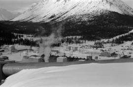
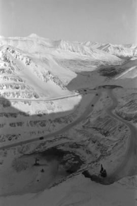
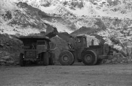
Photograph depicts the Cassiar mine on McDame Mountain. West peak semi-visible in foreground. Drills and ore haulage trucks visible below in pit and on switchback roads.
Plant buildings stand in midground. Conveyor believed to be leading to tailings pile can be seen in foreground. Valley and mountains in background.
Mill building in left midground. Conveyor believed to be leading to tailings pile can be seen in foreground. Valley and mountains in background.
Photograph depicts a shovel loading what appears to be a Euclid ore haulage truck in excavation area of mine.
Image depicts Kent Sedgwick standing beside a wrecked plane somewhere in South Tweedsmuir Provincial Park.
Image depicts an unknown individual pointing at some writing on a rock; it possibly reads "ACC Aug 10 1911."
Photograph taken at Government House in Victoria, B.C.
Image depicts a field of yellow plants at an uncertain location.
Image depicts the Fraser River and the Yellowhead and Grand Trunk Railway Bridges from LC Gunn Park. Map coordinates 53°54'30.7"N 122°43'27.0"W
Image depicts the Yellowhead Bridge across the Fraser River. Map coordinates 53°54'45.2"N 122°43'27.9"W
Image depicts Yellowhead Lake, located near the Yellowhead Pass.
Image depicts a view of what is possibly the Yellowhead Pass on the British Columbia-Alberta border, west of Jasper A.B.
Image depicts the boundary line between British Columbia and Alberta at the Yellowhead Pass.
Photograph depicts a young caribou visible in the distance standing on a rocky mountain slope. In the background a mountain range is visible.
Photograph depicts a young child petting a small fawn surrounded by lush greenery.