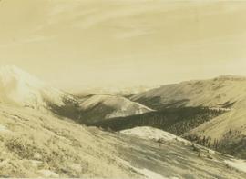
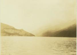
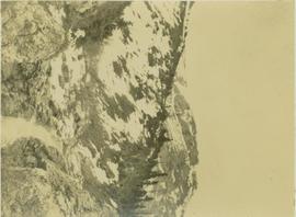
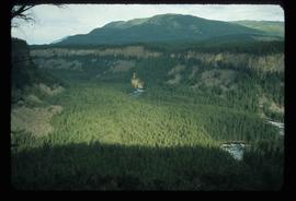
Handwritten photo album caption below this photo reads: "Whitehorse, & Alaska Highway, from below R.C.A.F. Barracks." Photograph depicts the cityscape of Whitehorse in valley. Alaska Highway can be seen in left foreground behind road railings in mountainside.
Royal Canadian Air ForceImage depicts a view south, possibly of an abandoned grade for the BCR; possibly somewhere near Woodpecker, B.C.
Postcard overview of the Bulkley River running closely past the village of Telkwa. Handwritten annotation in pen on verso reads: "Don Choracy [?] Prince Rupert, B.C. c/o Wrathall's Photo Shop. Aug. 9 Lake Kaetlyn. We had to drive all the way to Telkwa the other nite for postcards, imagine. We were sure glad and surprised to see Jack & Dick drive in at 7 to-nite. Just like being home. We are having so much fun. The boys are out on Lake to-nite, went to visit Dr. Macdonald's me thinks. I have bad head cold so have to stay home first nite at home I've since we came, Dieks is taking me on Lake tomorrow I hope, Love Bea-P."
Photograph depicts a vista from the Canadian Rockies with patches of snow.
Image depicts a section of the Peace River blocked off by the W.A.C. Bennett Dam. The dam itself is not visible in the image.
Item is a photograph of construction of the W.A.C. Bennett Dam.
Photograph depicts the wake from a weather ship in a large body of water.
Handwritten annotation on recto of photograph: "Omineca Dist Walcott Suspension Bridge West Approach - looking East May 26 - 1932". Photograph depicts two white horses pulling a wagon in front of Walcott bridge. This bridge was moved from its original location in the Hagwilget Canyon, downstream from Walcott on the Bulkley River. It is a pedestrian bridge at the time of this photograph, though it was originally used by motor vehicles. Dirt road leading to bridge in foreground, with lumber and brush piles on either side. Trees and hills on opposite shore in background.
Photograph depicts Wapiti Lake and a mountain range seen behind the trees of a forested slope.
Photograph depicts Wapiti Lake and an unidentified mountain range as seen behind the trees of a forested slope.
Photograph depicts Wapiti Lake and an unidentified mountain range seen from behind the trees of a forested slope.
Photograph depicts Wapiti Lake with an unidentified mountain range in the background.
Photograph depicts Wapiti lake surrounded by an unidentified mountain range and a forested shoreline.
Photograph depicts Wapiti Lake surrounded by unidentified mountains and a forested shoreline.
Image depicts War Lake.
Photograph depicts large swath of dark waste down mountainside to right of valley. The waste dump is believed to be visible at top of swath on right of image. Bench mining visible on the North and South peak in background. Handwritten annotation on recto of photograph: "Oct. 25 / 65 4:25 PM."
Photograph depicts benches of Cassiar's open mine. Men can be seen standing near machinery speculated to be blasthole drills in bottom left of image. Handwritten annotation on recto of photograph: "Waste Stripping Operations on McDame Mt. Ore Mining in lower right Corner.", on verso: "1961".
Unidentified woman stands on grass beside pond with water fountain. Trees and large building in background. Handwritten annotation on recto of photograph: "this was taken in August in the C.N.R. Gardens."
Photograph depicts an unidentified man standing to left of large puddle in gravel pit, mountain peaks in background. Photo speculated to have been taken on the plant, or near the Cassiar airstrip, facing south west. Stamped annotation on recto of photograph: "JUN. 1987".
Photograph depicts water pooled on the deck of a weather ship with rough water in the background.
Photograph depicts a stream of water running through mountainous terrain.
Photograph depicts a weather ship in rough water with water spilling onto the bow end of the ship.
Photograph depicts water from a wave spilling over the bow of a weather ship.
Photograph depicts a water swelling over the bow of a weather ship.
Image depicts a waterfall somewhere in South Tweedsmuir Provincial Park.
Image depicts a waterfall on a mountain side in Mt. Robson Provincial Park.
Image depicts a small waterfall at an uncertain location.
Image depicts an aerial view of a waterfall in South Tweedsmuir Provincial Park.
Image depicts a waterfall in what is possibly the Robson River.
Image depicts a waterfall with a mountain peak in the background; it is most likely Mt. Robson.
Photograph depicts piles of wood planks and log booms in the foreground with a waterfall in the background.
Photograph depicts a waterfall in a forested area with a riverbank in the foreground.
Wide angle view of Prince Rupert harbour taken from the water. Forest and mountains are visible in the background. Annotation on recto reads: "Prince Rupert BC '07."
Image depicts the Watson Mansion at Mile 108 of Highway 97. It was built by Captain Geoffrey Watson in 1904, and was burned down by a chimney fire in 1983.
Archdeacon W.H. Collison and an unidentified man on the "Dawn," Collison's boat. Forested hills and several buildings are visible in the background. Handwritten annotation on verso reads: "The 'Dawn' Archdeacon Collison's boat."
Photograph depicts a weather balloon ascending into the air with a clear sky in the background.
Image depicts Wells, B.C.
Image depicts the Helmcken Falls in Wells Gray Provincial Park.
Image depicts the drainage area for the Helmcken Falls in Wells Gray Provincial Park.
Photograph depicts the old hospital building in Wells. At the time the photo was taken, 1978, it was being used as an apartment building, and that is still its current use.
Image depicts woods located west of Leo Creek, with mountains in the distance.
Photograph depicts the West peak of the Cassiar mine, pit partially visible below. Drill visible in left foreground at highest elevation of mine, north west mountain range in background.