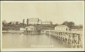
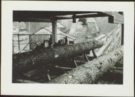
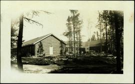
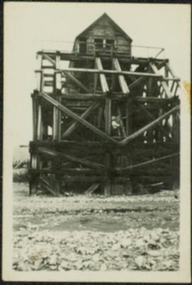
Photograph depicts two men standing on large wood framework structure. Rocky ground in foreground, trees visible in background.
Photograph depicts a crowd of men standing under balcony of three story hotel. Handwritten annotation on verso of photograph: "South Fort George, B.C."
Photograph depicts men working on different levels of construction site, some in dangerous areas, one man driving unidentified machinery in foreground. Long hose in right of image. View facing into the mountain.
Men standing behind saw horses on bottom level of crusher building site, lumber scattered throughout. View facing into mountainside.
View of crusher building from above, featuring the bottom level foundation. A dirt road and long building believed to be housing conveyor "B" cross the midground. Valley in background.
Photograph depicts four construction workers in front of tall wood structure extending to top level of construction area. Building material and supplies cover the ground: lumber, saw horses etc. Barricades against loose rock enclose area in midground (see item 2000.1.1.2.352). Plastic-covered pile sits at top level in background.
The item is a photograph of Merle Norman Cosmetics and an unknown commercial building on 3rd Avenue in Prince George.
The photograph depicts a metal engraving that is likely on a metal door at the roundhouse in the CN Railyard in Prince George, B.C. Engraving reads "GTPRY 296." Reproduction of photograph from 1984.
Photograph depicts a brick Methodist church on a street beside houses. Annotation on recto of photograph states: "METHODIST CHURCH, ENDERBY, B.C."
Photograph depicts the exterior of a church with a steeple surrounded by trees. Annotation on recto of photograph states: "Methodist Church Port Simpson BC"
Photograph depicts a multi-level hospital surrounded by smaller buildings and a wooden walkway. Annotation on recto of photograph states: "Methodist Hospital, Bella Bella B.C. George E. Darby, B.A., M.B., Superintendent"
Image depicts buildings in the village community of Metlakatla, B.C.
Image depicts Metlakatla, located near Prince Rupert, B.C.
Image depicts buildings in the village community of Metlakatla, B.C.
Photograph depicts large buildings on shore. Three unidentified individuals can be seen walking on dock in foreground.
Printed on image: "METLAKATLA B.C. / McRAE BROS"; handwritten annotation on verso reads: "A section of Metlakahtla, showing Church & Schoolhouse." See also item 2009.7.1.58 for similar image also featuring the new church building at Metlakatla, B.C.
Image depicts several individuals looking down into a closed off section of a river in Meziadin Lake Provincial Park. They are counting fish.
Image depicts the fish ladder of the Meziadin Falls, designed to help fish swim upstream.
Photograph depicts the Midway CPR depot located at the eastern terminus of Kettle Valley Railway. It was a subdivisional point with way freights originating at Nelson and Penticton, and running west and east respectively to Midway. There are two to 3 freights weekly from Nelson and 1 to 2 from Penticton. It lost its agency in June 1969 and all small freight [
Image depicts a river in the Miles Canyon near Whitehorse Y.T. The Robert Lowe Bridge, built in 1922, can be seen over the canyon.
Image depicts the Robert Lowe Bridge, built in 1922, in the Miles Canyon near Whitehorse Y.T.
Handwritten photo album caption below this photo reads: "Barracks at Ft. S. John." Photograph depicts two long buildings with many tall windows on the side. The buildings are in a muddy area, and wood slat sidewalk runs in front of them. There is a large gravel pile between the buildings, enclosed with a short log fence. A man can be seen in front of second barrack in background.
Royal Canadian Air ForceHandwritten photo album caption below this photo reads: "Barracks at Watson Lake". Photograph depicts long building built in U shape. Wood piles and miscellaneous items can be seen in foreground.
Royal Canadian Air ForceParade of uniformed marchers with sign that reads: “Every little helps, Do your share” (with a large cross). Buildings on street in background. Printed annotation on recto reads: “Prince Rupert B.C.” Handwritten annotation in pencil on verso reads: “Prince Rupert B.C.”
Photograph depicts a mill and beehive burner.
Man driving a two horse cart in front of beehive burner, cart is full of bark presumably sawed off the logs.
Handwritten annotation in pencil on verso: "Mill Burner".
Photograph depicts the Mill of Kintail in Ontario after renovations circa 1976 when it became the R. Tait McKenzie Memorial Museum and conservation site, located near Almonte, Ontario.
Photograph depicts the Mill of Kintail near Almonte, Ontario prior to 1930.
Item is a photograph of a small mill operation.
Overview of the Giscome sawmill behind road. Lumber yard is visible in foreground while mill stands in background.
Handwritten annotation in pencil on verso: "Giscome Mill / lumber yard in foreground".
Image depicts a view of the Millar Addition suburb in Prince George, B.C.
Photograph depicts the Cassiar mine. North and South peak featured in background, and West peak in left foreground. Pit is being developed between South peak and West peak. Old mine garage is visible in lower centre of image, and crushing plant in right foreground. Mountain range in distance.
Photograph depicts the pit mine, and road in valley below. Town of Cassiar can be seen in distance at foot of south mountain range.
Photograph depicts the town of Cassiar in distance behind pit mine in foreground. South mountain range in background. Photograph was taken from the air, portion of plane visible in top left of image.
Photograph depicts the pit mine, and road in valley below. Town of Cassiar can be seen in distance at foot of south mountain range.
Photograph depicts a mine building at the copper mine in Britannia Beach. The mine was still in use and well maintained.
Photograph depicts the mine buildings of the mine at Coal Creek that closed in 1959. The newer buildings date to circa 1930. Much of the standard gauge trackage of Morrissey, Fernie, and Michel railway (subsidiary of the Great Northern Railway) in mine area remains. The track between Coal Creek and Fernie has not been lifted.
Photograph depicts a mine 200 yards south of Moyie village, which is 20 miles south of Cranbrook. It produced silver, zinc, and lead from 1900-1910 and had a smelter a quarter mile away. The shaft was 900 ft. deep, with levels going under Moyie Lake. The head gear dates from 1925-1935 and has electric winding.
Switchback road, power lines and tramline towers are believed to be visible in the background valley. Construction of a long structure near the edge of the excavation area can be seen in midground; this is speculated to be the section of the crusher building which housed conveyor "B".
Photograph depicts the primary crushing plant in foreground. Mine road can be seen below, and plant is visible in distance. South mountains in background. Handwritten annotation on recto of photograph: "1961-1962".
Photograph depicts the mine road in valley bellow mine. Cassiar plant and tailings pile in foreground. Handwritten annotation on recto of photograph: "Oct. 25 / 65 4:25 PM."
Photograph depicts view of mine road in valley, from mountain above. Plant, tailings pile, and town visible in distance. South mountains in background. Handwritten annotation on verso of photograph: "1961", on recto: Townsite and Plantsite from mine."
Photograph depicts the mine road in valley, view from mountain above. Plant, tailings pile, and town visible in distance. South mountains in background. Handwritten annotation on recto of photograph: "1961-1962".
Photograph depicts the Cassiar mine in foreground, north east mountain range in background. Tramline station and crushing plant visible in foreground in front of pit. Photograph was taken from the air, portion of plane visible in top left of image.
Photograph depicts the Cassiar mine in foreground, north east mountain range in background. Tramline station and crushing plant visible in foreground, west of pit. Photograph was taken from the air, portion of plane visible in top left of image.
Photograph depicts the Cassiar mine above valley, north mountain range in background. Tramline station and crushing plant visible to west of pit. Photograph was taken from the air, portion of plane visible in top left of image.
Photograph depicts lumber piles and what appears to be a very long sluicing trough along Otter Creek. Forest and hills in background. Handwritten annotation on verso of photograph: "Otter Creek 6/6/37". See also item 2009.5.2.70.
Photograph is a printed postcard depicting an unidentified mining building situated on a hillside surrounded by mining debris. Possibly located in Stewart B.C.
Handwritten annotations on verso read: “East Berlin GDR, Spt. Minister,” and “16394/2”. Photograph taken during European Sports Tour with Team Canada.
The item is a photograph depicting the front of a white house. The sign on the front reads, "Ministry of Agriculture & Food Reception."