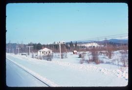
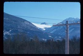
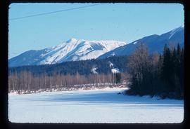
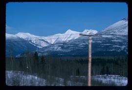
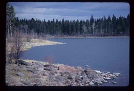
Showing 3165 results

Archival description
3023 results with digital objects Show results with digital objects
Near McBride
2012.13.1.85.08 · Item · 1976
Part of J. Kent Sedgwick fonds

Image depicts a view of either the Rocky Mountains or possibly the Columbia Mountains near McBride, B.C.

Near Williams Lake
2012.13.1.50.032 · Item · 1974
Part of J. Kent Sedgwick fonds

Image depicts an aerial view of some scenery near Williams Lake, B.C. The highway and BCR tracks are visible among the trees.

Nechako Cutbanks
2012.13.1.3.090 · Item · 12 Oct. 1989
Part of J. Kent Sedgwick fonds

Image depicts the cutbanks on the other side of the Nechako, taken from the nature trail at Island Cache. Map coordinates 53°55'34.6"N 122°45'52.4"W

Nechako Cutbanks Trail
2012.13.1.3.092 · Item · 12 Oct. 1989
Part of J. Kent Sedgwick fonds

Image depicts the cutbanks on the other side of the Nechako, taken from the nature trail at Island Cache. Map coordinates 53°55'34.6"N 122°45'52.4"W

Nechako Cutbanks Trail
2012.13.1.3.091 · Item · 12 Oct. 1989
Part of J. Kent Sedgwick fonds

Image depicts the cutbanks on the other side of the Nechako, taken from the nature trail at Island Cache. Map coordinates 53°55'34.6"N 122°45'52.4"W

Nechako River?
2012.13.1.23.08 · Item · 1973
Part of J. Kent Sedgwick fonds

Image depicts what is possibly a small section of the Nechako River on Cottonwood Island.

Nechako River?
2012.13.1.22.19 · Item · 1970
Part of J. Kent Sedgwick fonds

Image depicts a body of water in Island Cache. It is possibly a small section of the Nechako River.

Newlands?
2012.13.1.89.028 · Item · Mar. 1975
Part of J. Kent Sedgwick fonds

Image depicts what is possibly the community of Newlands, B.C.

North Peak Strip Mining
2000.1.1.3.13.10 · Item · [1961?]
Part of Cassiar Asbestos Corporation Ltd. fonds

Photograph depicts the North peak of McDame mountain after extensive strip mining, South peak unmined in background. Old mine garage visible on right of West peak in foreground. Crusher plant partially visible on far right. Photograph believed to have been taken just prior to the development of the pit mine between the North and West peak.

Northwood Pulpmill
2012.13.1.3.160 · Item · Nov. 2000
Part of J. Kent Sedgwick fonds

Image depicts the Northwood Pulpmill in Prince George, B.C. taken from above the Nechako River looking east. Map coordinates 53°56'00.0"N 122°44'29.7"W