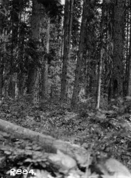
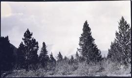
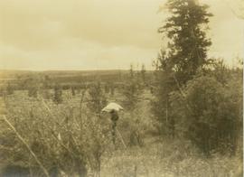
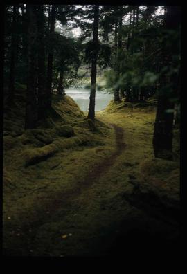
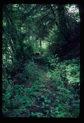
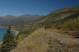
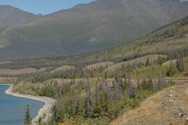
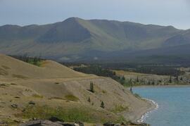
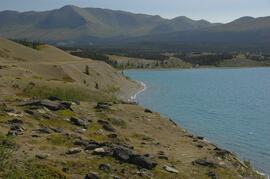
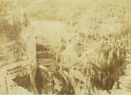
Photograph depicts a forest along the edge of the striated and deeply cut banks of an unseen river at the base of the banks.
Item is a photograph of a forested area with a partially frozen river, exact location unknown.
Image depicts a view of a forest and river somewhere along the White Pass railway. The thin line in the mountain side is possibly a highway.
Photographer's photo number R884. No caption on back of photograph to glean further information. Title provided based on contextual information from related photographs and documents.
Caption of back of photograph states: "R877 Forest Branch Cabin X9696"
Photograph depicts the location of the proposed powerhouse on Klemtu Lake.
Photograph depicts a roughly cleared area with large trees on the perimeter. Handwritten annotation below photograph reads, "Langley B.C.".
Item is a photograph of a copy print that has been reproduced as a slide, resulting in low photographic quality. Location of original photograph unknown.
"A large Douglas-fir veteran on the ridge above the camp towered above the Spruce-Balsam forest. A decision was made to convert it into a forest fire lookout. This photo shows a climber going up to top it. After the top was removed, a platform was built. Large spikes were used to provide steps." --from the notes of Ralph Schmidt in accompanying file
Photograph depicts an unidentified forest fire site with an area of dense shrubbery in the foreground.
Image depicts a group of trees in the Cottonwood Park, with a sign which reads: "This is the primary plantation for the 'Forest for the World' project. These trees were planted on August 5, 1985, commemorating Prince George's 70th birthday by the citizens of Prince George & Expo 86'."
Item is a photograph of a forested area southwest of Chittagong, Bangladesh close to the border with Burma.
Image depicts a forested area located somewhere near the Tseax Lava Flow.
Image depicts a forested mountain side somewhere near Murray Ridge.
Slide depicts a heavily forested area with fallen logs, likely at the Aleza Lake Experiment Station.
Item is a negative reproduced from the British Columbia Forest Service photographic records held at BC Archives.
Item is a copyprint reproduced from the British Columbia Forest Service photographic records held at BC Archives.
Image depicts a trail through the forest somewhere on Haida Gwaii.
Image depicts a trail through the forest somewhere in or near Seton Portage, B.C.
Photograph depicts a forested landscape with leafy trees and bushes in the foreground.
Photograph depicts the tops of trees in a forested landscape.
Photograph depicts an unidentified forested landscape with leafy bushes in the foreground.
Photograph depicts a forest in the foreground with a tree covered valley in the midground. In the background of the image a snow-covered mountain peak is visible.
Image depicts a forested mountain side somewhere along the White Pass railway. The thin ridge along the mountain side is possibly either a highway or part of the railway.
Photograph depicts a forested mountain slope leading up to a snow-covered peak.
Image depicts a view of a forested, mountainous area and a river, somewhere along the White Pass railway. The slide is labelled "begin climb," suggesting the image was taken at the beginning of the White Pass Train's ascent into the mountains.
Image depicts a view of a forested valley in the mountains somewhere along the White Pass railway.
Photograph depicts men on river boat and small canoe floating just off shore. Men sit and stand on shore among square bales and large cut lumber. Forest in background. Handwritten annotations on recto of photograph: "Fort Fraser wooding up at Giscome Portage", "Chilco at Giscome Portage".
Image depicts a forestry cabin located in Tête Jaune Cache, B.C.
Image depicts several pieces of heavy machinery used in forestry. The Coast Inn of the North is seen in the background.
Image depicts an unidentified individual examining a piece of heavy machinery used in the forestry industry. It is located in Prince George, B.C.
Photograph depicts one woman with her back turned, and four men standing on scow next to chairs and table adorned with food. Trees on shore in background. Handwritten annotation on recto of photograph reads: "Bourchier Scow".
Image depicts the abandoned and crumbling Forman's General Store somewhere in or near either Barkerville or Wells, B.C.
Photograph depicts the former "A" Pier of the CPR near the entrance to Coal Harbour. Undergoing dismantling or major renovation of the pier. The steam crane on a scow belonged to Vancouver Pile Driving and Contracting Co. Ltd. Left of the crane's jib was a new CPR rail slip in construction.
Photograph depicts the former automobile, passenger ferry, "San Diego," that had been acquired for conventions and sightseeing purpsoses. It was believed to have been a San Francisco ferry before being purchased by its present owner in 1973.
Photograph depicts the former B.C. Electric Railway spur running westwards along Bridgeport Rd., leading from the former main trackage. It was not in use for many years and was lifted in 1965, except for road crossings. The photo is taken from the intersection with Sexsmith Rd., looking east. The former main trackage is sited about 300 yards in the background and at right angles to the track in the foreground.
Photograph depicts the former B.C. Electric Railway track crossing Sea Island Way near Bridgeport, Lulu Island, and looking north to the Oak St. road bridge. The track was lifted in 1965 when the new Steveston route went into service.
Photograph depicts a former boiler house and machine shop built in 1929. Located at the CNR Kamloops Junction.