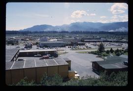
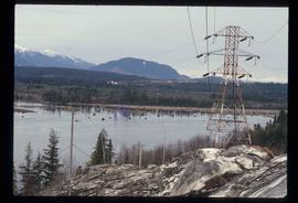
Image depicts numerous docked boats in Kitimat, B.C.
Image depicts numerous businesses, such as the Bay, Overwaitea, and Dairy Queen, somewhere in Kitimat, B.C.
Image depicts several buildings in Kitimat, with the Bay being the tall one on the left.
Image depicts numerous docked boats, as well as many houses on the shore in the background; located in Kitimat, B.C.
Image depicts what is possibly the Alcan smelter in Kitimat, B.C.
Image depicts a view of the area surrounding Kitimat, with power-lines in the foreground the city partially visible in the distance.
Image depicts the Kiteen River at Dragon Lake near Aiyansh, B.C.
Image depicts the mouth of the Kispiox River.
Image depicts numerous totem poles in Kispiox, B.C.
Image depicts an old house in Kispiox, B.C.
Image depicts a van on a narrow road, likely the Kettle Valley Trail.
Image depicts a woman walking along a trail somewhere in Kettle Valley, B.C.
Image depicts a view of Kettle Valley, with a bridge of the old Kettle Valley Rail Road visible on a slope.
Image depicts a woman walking along the trail of the Kettle Valley Rail Road.
Image depicts the trail of the old Kettle Valley Rail Road.
Image depicts a man standing on the old Kettle Valley Rail Road.
Image depicts the old Kettle Valley Rail Road.
Image depicts several unknown individuals standing on the old Kettle Valley Rail Road.
Image depicts the Okanagan Kettle Valley, with the Kettle Rail Road faintly visible among the trees
Image depicts the trail of the old Kettle Valley Rail Road.
Image depicts a woman standing on the old Kettle Valley Rail Road.
Image depicts a view of the Okanagan Kettle Valley.
Photograph depicts Kettle River canyon near Cascade, BC.
Photograph depicts a lofty view of the Kettle river near Cascade, BC.
Photograph depicts looking down on a canyon, steep cliffs on either side, a traffic bridge crosses the chasm. Near Cascade BC.
Photograph depicts a view of the Kettle River canyon and traffic bridge.
Photograph depicts a view of the Kettle river with mountains in the background.
Photograph depicts a view of the Kettle River with sparse vegetation in the background and a mountain range in the background.
Image depicts a man fishing in the Kettle River.
Image depicts Kent Sedgwick sitting on a log with a dog on a beach somewhere in Haida Gwaii, B.C.
Image depicts Kent Sedgwick sitting with a dog on a log on the shore of Haida Gwaii, B.C.
Image depicts Kent Sedgwick sitting on a log on the shore of Haida Gwaii, B.C.
Image depicts Kent Sedgwick standing in a forest somewhere on Haida Gwaii.
Image depicts Kent Sedgwick standing on a beach in Haida Gwaii, B.C. He is holding seaweed.
Image depicts Kent Sedgwick smoking a pipe at camp, with two other unknown individuals nearby.
Image depicts Kent Sedgwick pointing out what is possibly the Robson Glacier in the background. Another, unknown individual is also present in the image.
Image depicts Kent Sedgwick crouching and holding a stick; the slug on the end is barely visible. Located somewhere on Haida Gwaii.
Image depicts Kent Sedgwick with a dog at his feet, somewhere in Mt. Robson Provincial Park.
Image depicts Kent Sedgwick walking along the coastline of Haida Gwaii, B.C.
Image depicts Kent Sedgwick speaking to a group of hikers.
Image depicts a man looking at some papers. It is most likely Kent Sedgwick.
Image depicts Kent Sedgwick sitting on the bank of a river. An old beehive burner is visible in the background. Located somewhere in or near Penny, B.C.
Image depicts a boat dock on the Nechako Reservoir at Kenny Dam.
Image depicts a boat on the Nechako Reservoir at Kenny Dam.
Image depicts Kenny Dam, south of Francois Lake, and southwest of Vanderhoof, B.C.