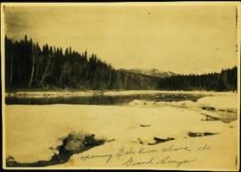
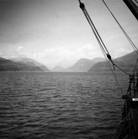
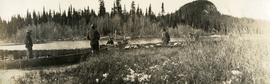
Photograph depicts a view looking northwest at Osoyoos Lake, B.C.
Image depicts the north aspect of Oscar Peak overlooking Lava Lake in the Nass Valley.
Image depicts an old road through the trees near Yellowhead Pass. The slide labels it as the origin of the Yellowhead highway.
Image depicts water flowing through an irrigation channel in an orchard, somewhere in or near Seton Portage, B.C. There is a sign which reads: "Danger Keep out."
Image depicts water flowing through an irrigation channel in an orchard, somewhere in or near Seton Portage, B.C.
Stern wheeler in river. Printed annotation on recto reads: “Operator 1913, Prince George, B.C. Canada” Handwritten annotation in pencil on verso reads: “Operator 1913”
Photograph depicts river between opposite shore and rock landings in foreground. Mountaintops visible in background. Handwritten photo caption on verso and recto of this photograph reads: "Opening of the River above the Grand Canyon".
Photograph depicts a muddy road in the middle of open range land with low treed hills in the distance.
Photograph depicts a large corral surrounded by open range with low hills in the distance.
Photograph depicts open range land, a river and sparsely treed hills in the distance.
Photograph depicts a double exposed photograph, a buckboard and open range land with horses and low hills in the distance.
Photograph depicts open range land with sparsely forested pine in the background.
Photograph depicts a log "snake" fence surrounded by open range land and low hills.
Photograph depicts open range land with forest in the background.
Photograph depicts open range land, stumps in the foreground and some small buildings with a river behind in the distance.
Photograph depicts grassy vegetation, open range land.
Image depicts an open mining pit at an uncertain location; it is possibly Gibraltar.
Image depicts a field in Giscome, B.C. On the right side of the image, in the background, is a grey strip that appears to be a mine, possibly the quarry at Eaglet Lake in Giscome, B.C. Map coordinates 54°03'52.9"N 122°22'10.0"W
Image depicts an open field and Giscome, B.C. in the background. Map coordinates 54°03'52.9"N 122°22'10.0"W
Image depicts an open field and numerous buildings, including a church in Giscome, B.C. Map coordinates 54°04'03.2"N 122°22'04.6"W
Photograph depicts a man standing on the edge of a trail looking to the treed hills in the distance.
Photograph depicts man (presumably A.H. Holland) with survey pole standing next to loaded pack horse.
Image depicts a lake somewhere along what is possibly the Atlin Road to Atlin, B.C.
Photograph depicts thickly forested area.
Photograph depicts five men with a loaded wagon, pulled by a team of two horses.
Photograph depicts four men with a loaded wagon, pulled by a team of two horses. The wagon is approaching a small bridge on a dirt road. There is a forest in the background, a small stream in the foreground.
Photograph depicts two canvas tents set up near the shore of a small lake or stream. There is a wooden structure on the opposite side of the water. Rough cleared land in the foreground, forested hills and low mountains in the background.
Photograph depicts several men standing on the river bank. Possibly A.H. Holland in center of photo.
Front view of two men sitting on a pile of supplies with a mountain in the background. Printed annotation on recto reads: "On the Divide Enroute to Naas #96."
Photograph depicts three boats on the edge of a small river. Two men attend each boat. Wild grasses with a skiff of snow in the foreground, river, forest and a low forested bluff in the background.
Image depicts a cabin on the "west arm" of Takla Lake.
Image depicts the "west arm" of Takla Lake.
Image depicts the "north-west arm" of Takla lake.
Image depicts a mountain and Takla Lake.
Image depicts a view of Takla Lake, "looking south-east."
Image depicts a view of Takla Lake, "looking north-west."
Image depicts a view of Takla Lake.
Image depicts several individuals walking on a trail somewhere near Raven Peak.
Photograph depicts a view near Nootka, looking north towards Bligh Island. Photo taken from the M.V. Uchuck III.
Photograph depicts a view of Friendly Cove, near Nootka, on the west coast of Vancouver Island. View is taken from the M.V. Uchuck III.
Image depicts four individuals canoeing on Lanezi Lake.
Image depicts two individuals canoeing on Lanezi Lake.
Image depicts an unknown individual in a canoe on Indianpoint Lake.
Image depicts Haida Gwaii.
Image depicts a bridge over the Omineca River near Germansen Landing, B.C.