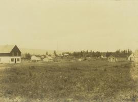
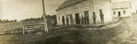
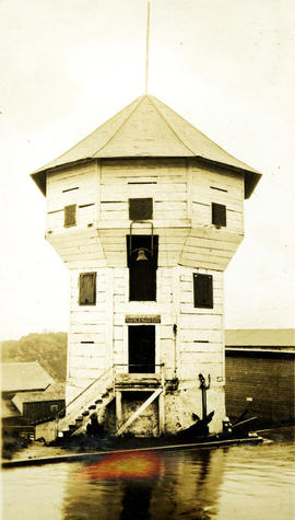
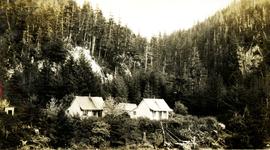
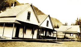
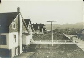
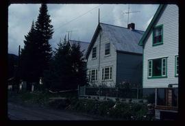
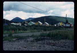
Image depicts what appears to be a Fire Hall in Hudson's Hope, B.C.
Image depicts a street in Hudson's Hope, B.C.
Image depicts a road and numerous buildings in Hudson's Hope, B.C.
Image depicts a cabin and several other buildings, possibly located in Hudson's Hope, B.C.
Photograph depicts a cluster of buildings at Hudson's Hope with a grassy field in the foreground. Hudson's Bay post is the building on the left.
Photograph depicts the townsite of Hudson's Hope featuring a number of small wooden buildings clustered in a field. The Hudson's Bay post is building visible on far left.
Postcard featuring the Fort St. James HBC Post. Printed annotation on recto reads: "H.B.C. Post Ft. St. James."
Hudson's Bay Company store visible at the end of a long wharf. Handwritten annotation on verso reads: "Hudson Bay store at end of wharf, Port Simpson, 1932 ."
Photograph depicts view looking down railroad tracks toward a snow capped mountain. Survey of 55th parallel.
Photograph depicts ten men standing on a boardwalk outside a large building. Another building, boardwalks and fences nearby. Forest in the background. The buildings are constructed from lumber.
Typed annotation on recto: "Fort St. James H.B.Co. Post Stuart Lake, B.C." Photograph depicts a variety of numerous white buildings enclosed behind wood fence. Field in foreground, distant hills in background.
Photograph depicts two buildings behind fence, sheds visible in background. Unidentified men can be seen walking in foreground. Small structures believed to be teepees can be seen behind fence.
Photograph depicts four buildings behind wood fence. Cleared area in foreground, forest in background. Handwritten annotation on verso and recto of this photograph reads: "H. B. Post - Fort George".
Photograph depicts an octagon shaped fortification at Nanaimo, BC built by the Hudson's Bay Company between 1853 and 1855. Handwritten annotation below photograph reads, "Bastion H.B. Co Fort Nanaimo, BC".
Photograph depicts a large white building surrounded by a fence.
Photograph depicts a cluster of seven or more buildings, fences and a flag pole. A grassy field in the foreground, rolling hills in the background.
Photograph depicts a group of buildings in distance behind fenced area. Field spans foreground and stand of trees in background. Handwritten photo caption below photograph reads: "H.B.C. Fort St. James ."
Photograph depicts buildings, field, and fenced areas with forest in the background.
Photograph depicts the Hudson Bay buildings at Fort St. James.
Photograph depicts "H.R. Macmillan," a private yacht.
Image depicts a view of Howe Sound from the Stawamus Chief Nature Trail to the Stawamus Chief Mountain, which is often incorrectly referred to as "Squamish" Chief.
Image depicts the Britannia Mine, which closed in 1974 and is now a museum. "Anaconda" was the last operating owner.
Image depicts Howe Sound.
Photograph depicts a few houses on Beach Ave., Vancouve. They were examples of about a dozen surviving homes on Beach Ave.
Photograph depicts two wood frame houses with gardens, and expanse of lawn in the foreground, a clothes line with fresh laundry in the midground and a treed mountainside in the background. Handwritten annotation reads, "wash day".
Image depicts a number of houses built on stilts over a body of water in an uncertain location.
View of peninsula with houses and trees. Dock in mid ground, trees and grasses in foreground. Recto stamped “Port Simpson DE 17" and "Port Essington DE 18". Handwritten annotation on recto of photograph: "W. J. O'Neill Esq. Telegraph Point Via Pt. Essington B.C. Don't you think this pretty [Weggs & Mr. Byron?] was over last night - said he saw you and [Halie?]. Yours - BaBa".
Image depicts houses on Dogwood Street in the Millar Addition neighbourhood of Prince George, B.C. On the left is 1610 Dogwood Street and 1630 Dogwood Street is the middle house; 1650 Dogwood Street is the blue house on the right.
Photograph taken looking northwest at a corner house and another home to its left. They were 2 of 9 houses in this Beach Block, the last block of houses on Beach Ave.
Photograph depicts a cluster of small buildings on a hill. Handwritten annotation below photograph reads, "Houses of "Ned" & Barney".
Image depicts a row of houses in Upper Fraser, B.C. Map coordinates 54°06'51.6"N 121°56'26.3"W
Image depicts the Giscome B.C. townsite from across the railroad tracks looking southeast. Map coordinates 54°04'19.7"N 122°22'04.7"W
Photograph depicts a street view looking toward homes build next to a boardwalk, dirt street in the foreground, homes in midground, treed hillsides in the background. Handwritten annotation below photograph reads, "Houses at Naas Harbour".
Image depicts the Giscome B.C. townsite from across the railroad tracks looking southeast. Map coordinates 54°04'19.7"N 122°22'04.7"W
Image depicts several houses, and three goats standing on a narrow dirt road. The location is uncertain, likely Sinclair Mills, B.C.
Image depicts a row of houses, as well as a United Church of Canada on the right side of the image, located in Wells, B.C.
Image depicts a view of numerous houses and a ballpark at an uncertain location. It is possibly located somewhere in the Peace River Region.
Part of a set of 41 original black & white photographs [1908-1933-?]) of the Grand Trunk Pacific Railway line in BC depicting surveying crews, town sites (Prince Rupert and its port, Hazelton and Fort George), and First Nations Peoples.
Image depicts many houses somewhere in Wells, B.C.
Image depicts a row of houses somewhere in Wells, B.C.
Image depicts a row of houses in Tumbler Ridge, B.C.
Image depicts a number of houses at an uncertain location, possibly Williams Lake, B.C.
Image depicts numerous houses, and an unknown child standing in a street at Island Cache.
Image depicts a few houses in Island Cache.
Image depicts a number of small houses at Island Cache.
Image depicts a few houses in Island Cache. There are two unknown individuals present.
Image depicts a row of houses in Wells, B.C.
Image depicts a row of houses somewhere in Wells, B.C.