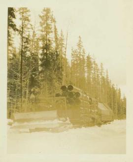
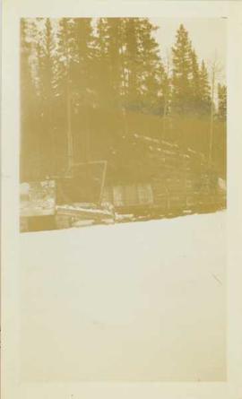
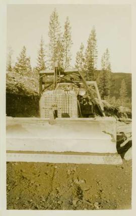
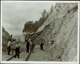
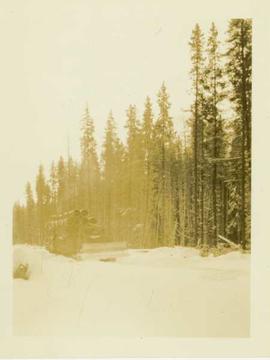
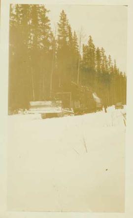
Photograph depicts a distance perspective of a bulldozer pulling sleds loaded with large pipes and steel drums potentially heading for the mines for assembly.
Photograph depicts a bulldozer pulling sleds loaded with large pipes and steel drums potentially heading for the mines for assembly.
Photograph depicts a bulldozer pulling sleds loaded with large pipes and steel drums potentially heading for the mines for assembly. Close up of 2004.8.1.57
Photograph depicts the front end of a bulldozer being operated by an unidentified man in front of a forested background.
Photograph depicts man driving bulldozer in front of framework for Crusher building, view facing into the mountain. Excavated dirt in foreground.
Photograph depicts man driving bulldozer in thick forest, small cleared area in foreground.
Slide depicts a bulldozer clearing ground, likely at the Aleza Lake Experiment Station.
Bulldozer visible to left of road in distance, mountain in background.
Bulldozer works along talus slope in top right of image. Photograph believed to have been taken during an outside exploration trip led by Cassiar's Chief Geologist Bill Plumb.
Photograph believed to have been taken near Kutcho Creek, BC during an outside exploration trip led by Cassiar's Chief Geologist Bill Plumb. Bill stands to left of man believed to be Matt Bell in right foreground. Bulldozer works along talus slope in left foreground.
Bulldozer works along talus slope in centre of image. Photograph believed to have been taken near Kutcho Creek, BC during an outside exploration trip led by Cassiar's Chief Geologist Bill Plumb.
Item is a photograph of a bulldozer removing debris from train tracks on August 27, 1956 location unknown.
Photograph depicts a bulldozer transporting mining supplies (pipes) in a snow covered forest landscape.
Image depicts an old, half-collapsed house in Likely, B.C.. The slide labels it as "Bullion house."
Image depicts the upper end of the Bullion Pit in Likely, B.C.
Photograph depicts a sculpted bull's head by Cuban artist Rita Longa. Photograph was used to request aid from Canada Council to finish the sculpture; the request was denied.
Attached description: Unitized bundles of eight strapped pulp bales weighing 16 tons are loaded into the ship's hold by specially designed over-running cranes.
Group stands on path, field in background. Handwritten annotation on recto of photograph: "Granny, Miss Jennie Pomeroy a school mate of mine who is visiting Granny, myself, Mrs. Bunker, Archie, Governor (Jim), Mrs. B's children her oldest boy is not here we could not find him in time for picture."
Overview of Giscome, BC showing built and natural landscape.
Handwritten annotation in pencil on verso: "Bunkhouse & Dining Room / Giscome BC".
Image depicts bunkhouse, restaurant and store in Sinclair Mills, B.C. Map coordinates 54°01'17.4"N 121°40'53.0"W
The item is a photograph depicting a blue bunkhouse in the Upper Fraser, possibly from Crescent Spur. Annotation on reverse side of photograph states, "Crescent Spur bunkhouse?"
Photograph depicts a bunkhouse style home. Handwritten annotation below photograph reads, "Little grey home in the north".
Photograph depicts a snow covered landscape covered with small trees, many of which are lacking branches.
The item is a photograph that depicts three veteran houses on Burden Street. Houses include beige siding, beige stucco and a white siding house.
Photograph depicts Burger the German Shepherd.
Photograph depicts a snow covered cemetery with gravestones, tombstones, and monuments.
Photograph depicts disused, but perhaps not legally abandoned, track 2 miles south of Keremeos on the old Keremeos branch. The track was broken in several places and fences were also erected across its length.
Photograph depicts a disued or abandoned track 2 miles south of Keremeos. Tracks was broken at one bridge and at least one cover was as well. Fences were erected across it.
Photograph depicts a BN snow plow in Fruitvale.
Photograph depicts boat named "Burnaco."
Image depicts Burns Lake, B.C.
Image depicts a stretch of road somewhere at Burns Lake, B.C.
Image depicts a street in Burns Lake, B.C.
Image depicts the welcome sign in Burns Lake, B.C.