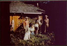
Print preview Close

Showing 17214 results

Archival description
2021.06.012 · Item · [July 1930]
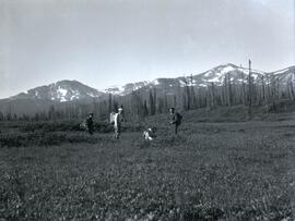
Part of Emil Bronlund Photograph Collection

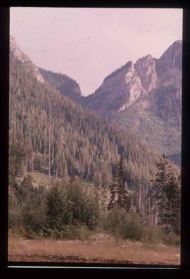
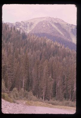
Photograph depicts (from left to right) Bill McPhee, an unidentified man, a dog, and Frank 'Shorty' Weber standing in tall meadow grass in front of a sparsely forested landscape in front of a mountain range. The location of the photograph is noted to be at Duck Creek below Copper Mountain; however, those names may no longer be in current use. Location is assumed to be approximately 55.979291, -125.208415 near what is currently named Wasi Peak.

Frank ‘Shorty’ Weber had a trapline on the upper Ingenika for over 30 years. and he was well-known in the Finlay River area.

McLean sawmill switcher
2013.6.36.1.136.29 · Item · [May 2007]
Part of David Davies Railway Collection

Photograph depicts a tiny switcher that belonged to the McLean sawmill and was buily by Buda of New Westminster, circa 1927. Sat on unconnected trackage adjacent to the Alberni Pacific Railway and was part of a sawmill exhibit.

McKee Creek, BC
2009.5.2.81 · Item · 27 June 1937
Part of Taylor-Baxter Family Photograph Collection

Photograph depicts dry creek bed, tall banks on either side. Hills and lake cross midground, mountains visible in background. Handwritten annotation on verso of photograph: "Looking down McKee Creek across Atlin Lake Towards Taku Glacier 6/27/37."

McGregor Valley - Dam Site
2012.13.1.72.04 · Item · Sep. 1976
Part of J. Kent Sedgwick fonds

Image depicts a red vehicle parked on the side of the road with a view of the McGregor Valley behind it. The slide is labelled "dam site."

McGregor River - Bridge
2012.13.1.72.34 · Item · July 1981
Part of J. Kent Sedgwick fonds

Image depicts a bridge over the McGregor River. A sign in the image reads: "Danger. The river is not navigable for any type of boat. Down stream falls and rapids impassible!"

McGregor Canyon?
2012.13.1.63.14 · Item · Aug 1989
Part of J. Kent Sedgwick fonds

Image depicts a view of the Herrick River in what is possibly McGregor Canyon; the slide is simply labelled "McG above Canyon."

McGregor Canyon?
2012.13.1.63.13 · Item · Aug 1989
Part of J. Kent Sedgwick fonds

Image depicts a view of the Herrick River in what is possibly McGregor Canyon; the slide is simply labelled "McG Canyon."

McGregor Canyon?
2012.13.1.63.12 · Item · Aug 1989
Part of J. Kent Sedgwick fonds

Image depicts a view of the Herrick River in what is possibly McGregor Canyon; the slide is simply labelled "McG Canyon."

McGregor Canyon?
2012.13.1.63.15 · Item · Aug 1989
Part of J. Kent Sedgwick fonds

Image depicts a view of the Herrick River in what is possibly McGregor Canyon; the slide is simply labelled "McG above Canyon."

McDame Creek Road
2000.1.1.1.03.08 · Item · 24 December 1951
Part of Cassiar Asbestos Corporation Ltd. fonds

Photograph depicts McDame Creek road, snow-covered and taken from center of road, 1.5 miles from the early construction camp at Cassiar. Trees and mountains in background.