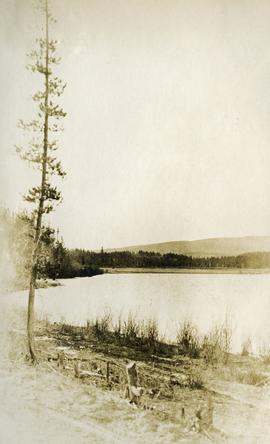
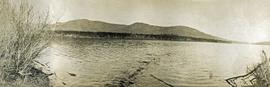
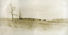
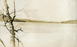
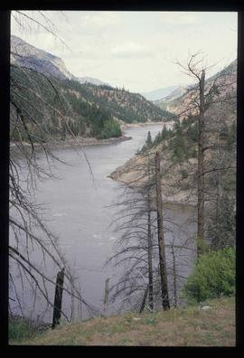
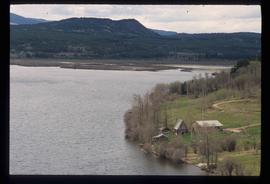
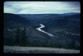
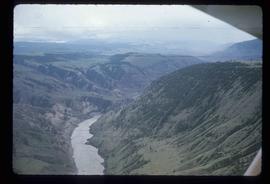
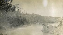
Photograph depicts Fort George Canyon from a lofty view. A small building is situated on the river's edge.
Photograph depicts the early settlement of Fort George. The buildings to the left of the fence are believed to be owned by the Hudson's Bay Company. The land to the right of the fence belonged to the Fort George Reserve, the home of today's Lheidli T'enneh Band who relocated to a reserve at Shelley when this reserve was sold in 1912. Handwritten annotation on verso and recto of this photograph reads: "Fort George from opposite side of Fraser River".
Wide angle photograph of a sparsely forested area with Prince/Fort George in the background. Printed annotation on recto reads: "Fort George, B.C."
Image depicts an aerial view of Fort George Park.
Image depicts a partially frozen lake, most likely Stuart Lake in Fort St. James, B.C.
Image depicts a lake, possibly Stuart Lake in Fort St. James, B.C.
Image depicts a view of Fort St. John, B.C.
Image depicts an area of forests and fields somewhere near Fort St. John, B.C.
Image depicts a view of Fort St. John, B.C.
Image depicts numerous pieces of what appears to be old farming equipment. There is also an unidentified individual sitting aginst the side of a building. The location is possibly Fort St. John, B.C.
Image depicts numerous unknown individuals searching through a fossil bed, possibly in the Bulkley Valley.
Image depicts a fossil bed, possibly somewhere in the Bulkley Valley.
Image depicts four hikers putting on rain parkas.
Photograph depicts four men pinning a "Union Jack" flag to the exterior of a building.
Image depicts four unknown individuals studying a plant.
Image depicts Francois Lake.
Image depicts a view of Francois Lake.
Image depicts a section of land on the east end of Francois Lake. The lake is visible in the distance.
Image depicts the Nadina Delta at Francois Lake.
Image depicts a view of the forest surrounding Francois Lake.
Photograph depicts a view of François Lake taken from the ferry going to Northbank Point on right-hand side. The survey crew camped there in June 1936.
Image depicts a view of the Fraser Lake.
Photograph depicts roughly cleared land in the foreground, a lake and rolling forested hills in the background.
Photograph depicts the lake from the water's edge. Low forested hills in the background.
Image depicts a view of Fraser Lake.
Image depicts a view of the Fraser Lake from the Fraser Lake campsite.
Photograph depicts view from behind the ferryman and ship's wheel. Fraser Lake and treed hills in the background.
Photograph depicts a view of the Fraser Lake ferry house from a distance.
Photograph depicts a lake. Photograph is framed by a deciduous tree on the left. Forest and rolling hills in the background.
Image depicts a view of the Fraser Lake skyline.
Image depicts what is possibly either the Fraser or Chilcotin River.
Image depicts what is possibly either the Fraser or the Thompson River.
Image depicts the Fraser River in the Fraser Canyon.
Image depicts the Fraser River in the Lillooet, B.C.
Image depicts a view of the Fraser River near Lillooet, B.C.
Image depicts the Fraser River near Lillooet, B.C.
Image depicts an aerial view of the Fraser River.
Image depicts the Fraser River in Fort George Canyon Provincial Park, B.C.
Image depicts the Fraser River, along with an unknown individual and his dog, in Fort George Canyon Provincial Park, B.C.
Image depicts the Fraser River in Fort George Canyon Provincial Park, B.C.