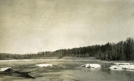
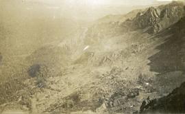
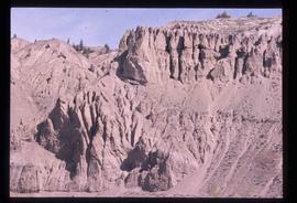
Image depicts a lake at an uncertain location, likely Eaglet Lake.
Image depicts Eaglet Lake, north-east of Prince George, B.C.
Image depicts the site of Giscome's first quarry, with Eaglet Lake located in the foreground.
Image depicts the site of Giscome's first quarry, with a train passing by and Eaglet Lake located in the foreground.
Image depicts an eastern view over Eaglet Lake.
Image depicts the creek flowing into Eaglet Lake. A grey area of hill on the right side of the image appears to be the Giscome Quarry. Map coordinates 54°04'26.2"N 122°22'04.3"W
Image depicts Eaglet Lake in the winter taken from Giscome, B.C. Map coordinates 54°04'20.9"N 122°21'53.1"W
Early spring landscape with roadbed and track in foreground, river in midground, and hill in background.
Handwritten annotation on recto: “PRINCE GEORGE 4-20-13”.
Photograph depicts wood houses behind stand of trees in Cassiar valley. Truck, power poles, and road in foreground, mountains in background. Typed caption below photo in original duotang album: "Two Bedroom Pan-Abode Houses - Cassiar Townsite". Handwritten annotation on verso: "Sept 1954".
Photograph depicts open river waters with some patches of ice on the river shore. There are riverbanks and trees in the background.
Hills on opposite shore in background.
Handwritten annotation on verso reads: "Early steamship off mouth of Nass River".
Image depicts an earth flow north of Stone Creek, B.C.
Photograph depicts a view from a high ridge looking over vast forest.
Photograph depicts a rocky, mountain slope.
Photograph depicts unidentified individual and cars on street in foreground, snow banks, trees, and power poles on either side. Buildings can be seen on far right, mountains visible in background. Handwritten annotation on recto of photograph: "townsite Looking East".
Photograph depicts town buildings on opposite shore. Beach and dock can be seen in foreground.
Handwritten annotation on verso reads: "Chapter XXII, No 1. Eastern Section of Port Simpson as christianized."
Photograph depicts a large totem pole next to groomed dirt paths. Power poles and river visible in background.
Handwritten annotation on verso reads: "Edenshaw pole in park at Prince Rupert."
Forest and hills on opposite shore in background.
Photograph depicts the El Dorado fishing boat off the coast of British Columbia, possibly near Haida Gwaii.
Elevated photograph of Prince Rupert taken from a hill. Printed annotation on recto reads: "Prince Rupert BC W.W.W." Handwritten annotation on verso reads: "2402 Cork Street."
Elevated photograph of Prince Rupert taken from a hill. Printed annotation on recto reads: "Prince Rupert BC McRae Bros." Handwritten annotation on verso reads: "11/June c/o PG Prince Rupert, B.C. Dear Rae[??], How about a letter. Love for all, Frank." Postcard is addressed to: "Miss R Boew. Bernie PG [illegible]." Postmark on verso reads: "Prince Rupert BC Jun 11 1 PM 1915."
Elevated photograph of Prince Rupert taken from a hill. Residential and business buildings are visible. Background shows water and wooded hills. Printed annotation on recto reads: "Prince Rupert BC 22."
Photograph of several vehicles parked along a road. A large crowd is visible gathering in the background. Printed annotation on recto reads: "Elks Flag Day, McBride, B.C." Handwritten annotation on verso reads: "Jan. 5th 1945. Dear Dad, Am working in a lumber camp, advised by Prof. Johnson and Prof Casey. Altitude about 2,300. Think I will like it, if they don't make me work to[sic] heavy. the Climate and the grub is swell. Otherwise not so hot. Bye for now. Love Will." Postcard is addressed: "To: Mr. A.W. Hockin Big Valley, Alberta. From. W. Hockin c/o E.U. Lamming McBride, B.C."
Violet Baxter's older sister Ellen and younger sister Lucy are among other unknown individuals who stand and sit on a car in the road. Ellen stands second from left, and Lucy sits in back behind other girls. Forest and hillside can be seen in background.
Image depicts employee houses on mill site in Giscome, B.C. Tug boats are in the foreground on the right. Map coordinates 54°04'23.4"N 122°22'16.9"W
Image depicts a building surrounded by a tall, circular enclosure somewhere on Haida Gwaii, B.C.
Photograph of a team of sled dogs and resting men silhouetted against snowy mountaintops. Printed annotation on recto reads: "#92 Enroute to Naas On the Big Glacier."
Photograph depicts two men standing and paddling in canoe on river, trees stand above rock face on opposite shore in background. Handwritten photo caption on verso and recto of this photograph reads: "Entering the Grand Canyon."
Photograph depicts the entrance to the Squamish River at Squamish, looking upstream. The pier on the left belongs to the original logging railway, circa 1909-1925.
Image depicts what appears to be an eroding rock face. The slide itself is labelled "ash loger at top" for unknown reasons. Possibly located somewhere near Whitehorse, Y.T.
Image depicts an eroding rock face at an uncertain location.
Image depicts an eroding rock face; the river in the right corner of the image is possibly the Fraser River.
Image depicts Eskers Park, near Prince George, B.C.
Image depicts an atmometer. According to the slide, it is being used for measuring the rate of water evaporation "from carborundum stone." The location is uncertain.
Image depicts a group of individuals who appear to be examining a rock. It is possibly part of an educational trip.
Image depicts three unidentified individuals examining rocks near a set of railway tracks at an uncertain location in the Peace River Region.
Image depicts a view of an experimental farm, possibly taken from Tabor Mountain.
Item is a photograph of the explosion which opened up the diversion route for the Peace River during construction of the W.A.C. Bennett Dam.
Photograph depicts Shannon Falls near Squamish, which was formerly named Fairy Falls.
Image depicts some fallen trees at Island Cache.
Image depicts a farm at an uncertain location.
Image depicts a farm on the west side of the Fraser, south of Quesnel, B.C.
Image depicts what appears to be a farm at an uncertain location.
Image depicts a farm at an uncertain location.
Image depicts a farm at an uncertain location; possibly somewhere in the McGregor Valley.
Image depicts a farm at an unknown location.
Photograph depicts a field in the foreground, trees and mountains in the distance.