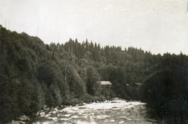
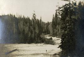
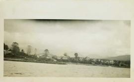
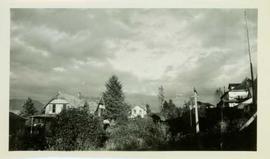
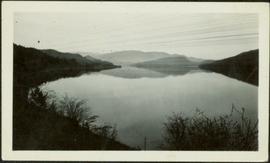
View of the road descending to the waterfront. Buildings and forested area are visible on either side of street. Annotation on recto reads: "Prince Rupert BC. '07."
Photograph depicts former street car tracks in New Westminster.
Photograph depicts a street car body that formerly belonged to Vancouver, but was found by Davies in Penticton.
Photograph depicts a stream, forest and buildings. Location is not named.
Image depicts a small stream running through a cluster of trees somewhere in or around Seton Portage, B.C.
Image depicts a small stream somewhere on Cottonwood Island.
Photograph depicts a stream bed surrounded by forest. One person is walking on the stream bed.
Photograph depicts a stream and forest.
Photograph depicts a view from above, looking down on a stream with forest on both sides.
Photograph depicts a stream with a rocky bank surrounded by forest.
Image depicts a stream somewhere along the White Pass railway.
Image depicts a downhill stream somewhere in the area surrounding Stewart, B.C.
Image depicts a view of the Dunkley Lumber Mill in Strathnaver, B.C.
Image depicts the BCR, as well as the Dunkley Lumber Mill, in Strathnaver, B.C.
Image depicts what is likely the Dunkley Lumber Mill in Strathnaver, B.C.
Image depicts an aerial view of Strathnaver, B.C.
Photograph depicts stoves taken from railway equipment at the C.N. Port Mann repair shops. Left and middle stove are of the same design.
Photograph depicts a posterboard display entitled "The Story of Asbestos."
Handwritten annotation on verso reads: "Port Simpson Village threatening storm in background."
Handwritten annotation on verso reads: "A storm brewing over Port Simpson."
Photograph depicts stores in Kaslo on Kootenay Lake, 40 miles northeast of Nelson. This town still has 15 miles of dirt road leading to it.
Photograph depicts machinery stored in Summerland beside KVR track. Property of the KVR Historical Society.
Photograph depicts a store 50 yards south of the B.C. Electric Railway on the west side of the Vedder crossing road in Sardis, Chilliwack, B.C.
Photograph depicts the only store in the small, derelict village of about 12-15 houses of which only one is occupied.
Image depicts a few storage sheds somewhere in Prince George, B.C.
Photograph taken at the CN Kamloops Junction on a storage line.
Image depicts a group of people stopped in the middle of the Fraser River in the Grand Canyon, B.C.
Image depicts the school site in Stoney Creek.
Photograph depicts the ruins of a possible stone wall in Friedrichshafen, Germany.
Image depicts a stone marker in Lamming Mills, B.C.
Photograph depicts a stone house on 17th St. and Esquimalt St. in West Vancouver, B.C.
Stone figure carved in the likeness of a fish. Stamped annotation on verso reads: “Department of Mines and Resources, Photographic Section. Oct. 6, 1939”. Numeric annotation on verso: “48-5”
Photograph depicts unidentified river or lake. Bushes in foreground, hills in distance.