Print preview Close
Showing 408 results
Archival description
"Cottonwood River"
"Cottonwood River"
Corner Brook, Newfoundland Tourist Map
Corner Brook, Newfoundland Tourist Map
"Coquitlam, Port Coquitlam, Port Moody"
"Coquitlam, Port Coquitlam, Port Moody"
"Comox & Nanaimo Coalfields Properties and Geology"
"Comox & Nanaimo Coalfields Properties and Geology"
Colonial exploration maps
Colonial exploration maps
Clinton Creek Aerial - Flight Index
Clinton Creek Aerial - Flight Index
City of Victoria: Proposed electoral district boundary
City of Victoria: Proposed electoral district boundary
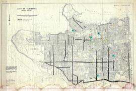
"City of Vancouver, British Columbia"
"City of Vancouver, British Columbia"
City of Vancouver: Proposed electoral district boundary
City of Vancouver: Proposed electoral district boundary
City of Prince George: Proposed electoral district boundary
City of Prince George: Proposed electoral district boundary
"City of Prince George Boundary Expansions Since Incorporation in 1915"
"City of Prince George Boundary Expansions Since Incorporation in 1915"
"City of Prince George Boundary Expansions Since Incorporation in 1915"
"City of Prince George Boundary Expansions Since Incorporation in 1915"
"City of Prince George"
"City of Prince George"
City of Prince George
City of Prince George
"City of Prince George"
"City of Prince George"
Central Fort George lots
Central Fort George lots
"Central Coast Regional District (CCRD) - Scentless Chamomile, Sheep Sorrel, Spotted Knapweed, St Johns Wort, Thistle spp, Water Hemlock, Western Goats beard, Wildlife Mustard, Yellow Toadflax"
"Central Coast Regional District (CCRD) - Scentless Chamomile, Sheep Sorrel, Spotted Knapweed, St Johns Wort, Thistle spp, Water Hemlock, Western Goats beard, Wildlife Mustard, Yellow Toadflax"
"Central Coast Regional District (CCRD) - Canada Thistle, Common Tansy, Diffuse Knapweed, Hawkweed spp, Curled Dock, English Ivy, Knotweeds"
"Central Coast Regional District (CCRD) - Canada Thistle, Common Tansy, Diffuse Knapweed, Hawkweed spp, Curled Dock, English Ivy, Knotweeds"
"Central Coast Regional District (CCRD) - Blueweed, Broadleaf Plantain, Bull Thistle and Burdock"
"Central Coast Regional District (CCRD) - Blueweed, Broadleaf Plantain, Bull Thistle and Burdock"
Central British Columbia Map
Central British Columbia Map
Centennial Map of Canadian History and Achievements, 1867 to 1967
Centennial Map of Canadian History and Achievements, 1867 to 1967
Cassiar District mining claims
Cassiar District mining claims
"Cariboo-Chilcotin Existing Tourism Use"
"Cariboo-Chilcotin Existing Tourism Use"
Cariboo Estate Map
Cariboo Estate Map
Canadian Pulp and Paper Industry 1975 Mill Location Map
Canadian Pulp and Paper Industry 1975 Mill Location Map
"Canadian Pacific Railway and Connecting Lines - Ticketing Routes"
"Canadian Pacific Railway and Connecting Lines - Ticketing Routes"
"Canadian National Railways Western Region: Plan of part of Central Fort George showing Hammond Street diversion as proposed"
"Canadian National Railways Western Region: Plan of part of Central Fort George showing Hammond Street diversion as proposed"
"Canadian National Railway System: The Only Railway Serving All Ten Provinces of Canada"
"Canadian National Railway System: The Only Railway Serving All Ten Provinces of Canada"
"Canadian National Railway System"
"Canadian National Railway System"
Canadian Highway System
Canadian Highway System


![City of Prince George - Schedule C of the Official Community Plan - Long Range Land Use Map [October 2006 Amendment]](/uploads/r/northern-bc-archives-special-collections-1/6/d/6/6d643c10801eba2ac493689972e57429dba42ec7592f54cb55151b96362d7048/2023.5.1.40_-_2006_Oct_-_City_of_Prince_George_Long_Range_Land_Use_Map_JGP85_tb_142.jpg)
![City of Prince George - Schedule C of the Official Community Plan - Long Range Land Use Map [May 2008 Amendment]](/uploads/r/northern-bc-archives-special-collections-1/4/3/a/43a9e75941f1542735d999de340307d163e79dffdadbf4546bb9346b63f7e734/2023.5.1.41_-_2008_May_-_City_of_Prince_George_Long_Range_Land_Use_Map_JPG85_tb_142.jpg)
![City of Prince George - Schedule C of the Official Community Plan - Long Range Land Use Map [May 2006 Amendment]](/uploads/r/northern-bc-archives-special-collections-1/6/5/5/65536bc04aa97580c140131651dc357dfe5c3a1315822394f388d96940bc39cb/2023.5.1.39_-_2006_May_-_City_of_Prince_George_Long_Range_Land_Use_Map_JPG85_tb_142.jpg)

![City of Prince George - Schedule B of the Official Community Plan, Bylaw No. 5909 [2001 Amendment]](/uploads/r/northern-bc-archives-special-collections-1/c/3/6/c36392b90696286cc6281e8cc2efbf7691c2617726495fa28db2cbdcc20e4e4c/2023.5.1.36_-_Official_Community_Plan_City_of_PG_Schedule_B_2001_JPG85_tb_142.jpg)
![City of Prince George - Schedule B of the Official Community Plan, Bylaw No. 5909 [1998 Amendment]](/uploads/r/northern-bc-archives-special-collections-1/d/6/d/d6d1c4e7e37fc948b97b3caa36447b52f7d2b76b13d45e3710aefee7b13840f0/2023.5.1.33_-_1998_Official_Community_Plan_City_of_PG_JPG85_tb_142.jpg)


