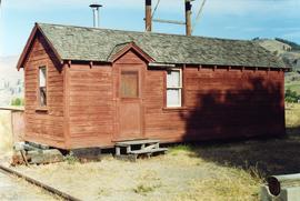
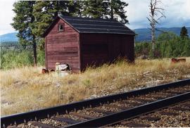
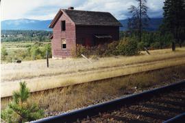
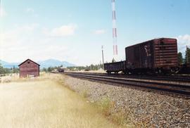
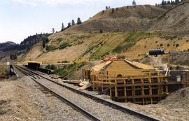
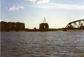
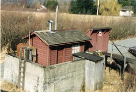
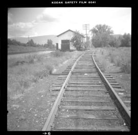
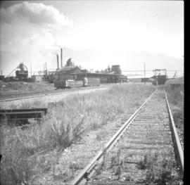
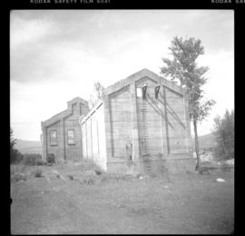
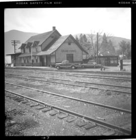
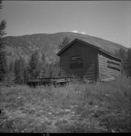
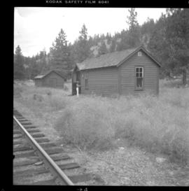
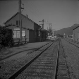
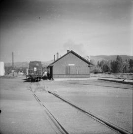
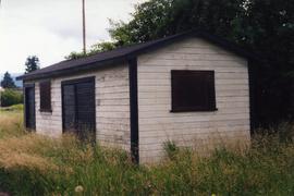
Photograph depicts a tool house on a CNR curve in Armstrong. Not in frequent use.
Photograph depicts typical 'set on' rails for speeders that were often made of wood.
Photograph depicts a former gang car 'garage' in a station building.
Photograph depicts the rear view of an elevator showing its name. Track was on the far side.
Photograph depicts a CPR section bunk house in Midway. On the left was a living room with two windows, stove, and sink. Bedroom with one window and two beds located on the right.
Photograph depicts a disused tool house in Wasa, at the CPR Windermere Subdivision. Davies notes the structure was rarely seen at the time the photograph was taken.
Photograph depicts the side view of an abandoned section house in Wasa, on the CPR Windermere Subdivision.
Photograph depicts a grain elevator which Wynndel was famous for.
Photograph depicts an abandoned section in Wasa, on the CPR Windermere Subdivision. Built in 1914-20. Very rare at this date. The only known of the same type was in Brookmere (private and lived in).
Photograph depicts a tool house in Wasa, at the CPR Windermere Subdivision. Before 1970, the station had siding for 37 cars. Now it had two sidings for a total of 150 cars. Note the old box car with old lettering that was presumably on non-reserve service.
Photograph depicts a grain elevator that had a 7 car spur to service it. Davies doubted if grain traffic ever moved by rail near Wynndel. Two flat cars appeared to have used the platform to overload machinery and vehicles.
Photograph taken looking north, with a spur in the foreground. It was used by ore mixed freight daily. It was believed that at the bottom of the grade was a junction with a GNR branch that ran from the US border south of Creston to Kootenay Lake (built in 1904, then was hardly used, finally ceased in 1910).
Photograph depicts an existing girder bridge, in use since 1962. A new concrete bridge was being built on the left.
Photograph depicts an old girder bridge.
Photograph depicts a new CN overpass in Campbell Creek. The new part of the Trans-Canada Highway beneath it had yet to be paved.
Photograph depicts a replacement rail bridge. Forms sat on a temporary pile of dirt, which in turns sat on a road bed of a new highway that had just been cut.
Photograph depicts a new CN overpass in Campbell Creek. The grade crossing at the newly created service/business road was built on the south side of a road/rail complex.
Photograph depicts a new concrete bridge being constructed. The old one is one the right.
Photograph depicts a new CN overpass in Campbell Creek. Looking at new eastbound lane of the Trans Canada Highway. It was all paid for by the Provincial Department of Highways in order to convert the 2 lanes into 4 in order to improve visibility and stretch the highway.
Photograph depicts a new bridge on the CNR Okanagan Branch. The old steel bridge on the right had been dismantled.
Photograph depicts railway track previously owned by BCER. It led onto the east end of Lulu Island and then to Annacis Island. Looking from the Naew West River Walk to the Queensborough bridge that was protected by signals and had a high chain link fence to deter pedestrians. It was likely that the rail was only used at night. Originally built by Canadian Northern Railway to reach Steveston, circa 1917.
Photograph depicts the Pitt River swing bridge in an open position. Apparently, it opened up to half a dozen times a day to allow large pleasure crafts to go through. Photograph taken at high tide when little clearance occurred.
Photograph depicts the CPR Pitt River swing bridge in an open position.
Photograph depicts a CNR bascule bridge across the upper waters of Victoria Harbour. The rest of the trackage had been removed, except for the bridge itself.
Photograph depicts a CPR swing bridge in Harrison Mills. Looking east, towards Kilby Store. Swing section in the foreground. It was rarely used.
Photograph depicts a CPR swing bridge in Harrison Mills. Taken on the downstream side of Harrison River.
Photograph depicts a fuel storage shed in Harrison Mills.
Phoyo depicts a CPR swing bridge in Sicamous.
Photograph depicts a CPR swing bridge in Harrison Mills. Looking west, on the upstream side of the Harrison River.
Photograph depicts a swing bridge in Harrison Mills. It was rarely used, but all its controls were modern and maintained.
Photograph depicts the CPR line at Notch Hill in the Shuswap. At one time this was a busy place, as helper engines were stationed here to push heavy trains over the hill. This spur is on the north side of the depot and has rails from 1902. The view is looking west, depicting the mainline to the left and just in view.
Photograph depicts the Fernie CPR station, located at mile 34.7 on the Cranbrook Subdivision, which runs from Crowsnest to Cranbrook. In coal mining days this was a busy place but now it has sidings for 153 cars and nothing else. The view is looking east.
Photograph depicts the Creston Sawmills Ltd on the CPR line. Here the southern BC CPR mainline passes through the center of trackage, looking eastbound. A chip car is on the spur directly leading from the camera.
Photograph depicts an outhouse on Notch Hill in the Shuswap. Helper locomotives were stationed here to lift heavy trains over Notch Hill. It was presumably used by waiting engine crews.
Photograph depicts the a grain elevator at Wynndel, located at mile 73.8 on the CPR line on the Nelson Subdivision. It is between Creston at mile 67.2 and Kootenay Landing at mile 83.1. Grain elevators are rare in BC and this one belongs to the United Grain Growers. The view is looking east.
Photograph depicts all that remained of Lumberton Spruce Mills Ltd, circa 1912-1939.
Photograph depicts the Grand Forks CPR depot, located at mile 94.8 on the Boundary Subdivision, which runs from Nelson to Midway (127 miles). It was originally built by the Columbia & Western Railway in 1899. IT has not seen a passenger train in years but it is still in use for administrative purposes.
Photograph depicts the Nelson CPR depot, built in 1899. Since there are no passenger trains, freights used the front line, adjacent to the depot. The photograph was taken from the platform and shows a view looking east.
Photograph depicts the Nelson CPR depot, built in 1899 and still well-maintained. Streetcars had a terminal in this yard from 1899-1949, for what was probable the shortest street car system in Canada. The view is looking north and shows the rear view.
Photograph depicts two grain elevators at Creston, BC. The Creston CPR yard lies behind the camera. The line is on a downgrade away from the camera, starting its descent to the valley bottom for Kootenay Lake. The grain elevators are a rare sight in BC.
Photograph depicts the CPR line at McConnell, BC, which is located at mile 55 on the Nelson Subdivision and 12 miles east of Creston. The view includes the signalman's shanty, which is still in occasional use.
Photograph depicts a surviving but disused water tower at Cranbrook. Cranbrook is located at mile 0 on the CPR line of the Nelson Subdivision.
Photograph depicts "Six Mile House Stable" on the west side of Okanagan Lake.
Photograph depicts a pump house on the Island Highway, north of Qualicum Beach, Vancouver Island.
Photograph depicts the post office in Union Bay. It was a "Heritage" building and internally restored. Believed to have been built in 1908.
Photograph depicts one of the churches on Denman Island.
Photograph depicts a meat carcass windlass.
Photograph depicts the CPR Faulder depot on the Kettle Valley Railway. It is located at mile 15.5 from Penticton, on the Princeton Subdivision.
Photograph depicts the CPR depot at Armstrong. It is located about mile 32 from Sicamous on the Okanagan Subdivision. The view is looking south.
Photograph depicts the CPR Princeton depot. The view is looking east.