File consists of:
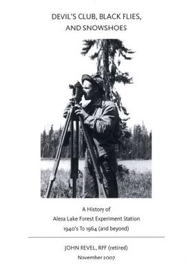
- "Devil's Club, Black Flies, and Snowshoes" by John Revel, 2007, 44 p. (3 copies)
File consists of:
File consists of:
File consists of a transcript of an oral history interview with Ken and Donna Quinn.
File consists of a transcript of an oral history interview with Jim Burbee.
File consists of a transcript of an oral history interview with Jack Boudreau. Also includes photocopies of Jack Boudreau's personal records, such as the Diary of Ada (Adelia) Sykes.
File consists of an audio recording of an interview with Jack Boudreau. Includes one original recorded audio cassette and one copy.
File consists of:
File consists of a photograph commemorating the signing of the first Aleza Lake Research Forest Management Plan. Front row, left to right: Ken Pendergast, BC Forest Service Prince George District Manager; Harry Coates, BCFS Forest Research Technician (1957-1993); John Revel, BCFS Silviculture Forester (1960-1993). Back row, left to right: Mike [?], BCFS Prince George Silviculture Manager; Henry Benskin, BCFS Research Branch; Michael Jull, BCFS Research Silviculturist, Prince George Region; Dan Lousier, BCFS Prince George Region Research Section Head; Brian Harding, Northwood Pulp & Timber Ltd. Woodlands Manager.
File consists of memoranda from Per Saxvik to Bell-Irving regarding "Fraser River Flow Analysis with Reference to Fish Passage Capacity through the Main Fishways at Hell's Gate". Also includes a "Fraser River Canyon Fish Passage Summary Report (June 1988) Updated October 1989" by Per Saxvik of SEP Engineering.
File is a Resource Folio of maps and accompanying information created by Northwood Pulp & Timber regarding Timber Sale Harvesting Licence A01847, Willow River Block, Willow River P.S.Y.U. Includes maps that depict ungulates, waterfowl, recreation areas, special influence areas, and timber types. Most of the sheets have a duplicate, some with very slight variations. The following maps are supposed to be included in the but were missing upon arrival at the Archives: fish & topography, cutting permits & roads, and soils.
Photographs are panoramas taken from the Churchill BC Forest Service Lookout, located at latitude 54°04' and longitude 122°16'. The photographs were bound together and include a transparent grid that was intended to be used for locating forest fires.
File consists of:
File consists of the following items:
File consists of photocopies of various report front covers and references to Knox McCusker from 1926-1931.