Print preview Close
Showing 189 results
Archival description
Job 65 - Environment Canada, Lands Directorate - Okanagan Fruitlands: The Location, Nature, Amount and Rate of Land Use Change - Penticton South
Job 65 - Environment Canada, Lands Directorate - Okanagan Fruitlands: The Location, Nature, Amount and Rate of Land Use Change - Penticton South
Job 650 - Canoe Creek Indian Band - Overview of Issues and Concerns Related to Transmission Line Corridor Component - Dog Creek
Job 650 - Canoe Creek Indian Band - Overview of Issues and Concerns Related to Transmission Line Corridor Component - Dog Creek
Job 671 - B.C. Women's Institutes - Site C - Environmental Impact Statement Technical Review - Site C
Job 671 - B.C. Women's Institutes - Site C - Environmental Impact Statement Technical Review - Site C
Job 79 - BC Ministry of Lands, Parks and Housing - Moberly DPA - Fort St. John
Job 79 - BC Ministry of Lands, Parks and Housing - Moberly DPA - Fort St. John
"Land Capability Analysis: Canada Land Inventory - Prince George Special Sales Area"
"Land Capability Analysis: Canada Land Inventory - Prince George Special Sales Area"
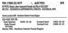
M PSYU Aleza Lake Research Forest Old File #051597
"Map of Northern British Columbia and the Peace River Country"
"Map of Northern British Columbia and the Peace River Country"
"Map of the Central Section of British Columbia Shewing the Country Served by the Grand Trunk Pacific Railway"
"Map of the Central Section of British Columbia Shewing the Country Served by the Grand Trunk Pacific Railway"
Maps
Maps
Maps
Maps
Maps and aerial photographs of Prince George
Maps and aerial photographs of Prince George
McLeod Lake Band physical development plans
McLeod Lake Band physical development plans
"McLeod Lake, British Columbia" 1969 map
"McLeod Lake, British Columbia" 1969 map
Mining in the Cariboo
Mining in the Cariboo
Miscellaneous material
Miscellaneous material
"Mount Waddington, British Columbia" 1969 map
"Mount Waddington, British Columbia" 1969 map
"Mount Waddington, British Columbia" 1984 map
"Mount Waddington, British Columbia" 1984 map
Nadleh Whut'en Band core area planning
Nadleh Whut'en Band core area planning
"Nass River, British Columbia" 1972 map
"Nass River, British Columbia" 1972 map
"Nechako River / Isle Pierre"
"Nechako River / Isle Pierre"
"North Western British Columbia Travel and Recreation Guide"
"North Western British Columbia Travel and Recreation Guide"
"Official Regional Plan - Greater Prince George and Mackenzie"
"Official Regional Plan - Greater Prince George and Mackenzie"
"Outdoor Recreation Maps of British Columbia - 100 Mile House Region"
"Outdoor Recreation Maps of British Columbia - 100 Mile House Region"
"Paldi New Townsite"
"Paldi New Townsite"
"Peace River - Liard, British Columbia" 1986 map
"Peace River - Liard, British Columbia" 1986 map
"Plan No. 1268 Subdivision of part of Indian Reserve No. 1 Lot 343 Cariboo District British Columbia"
"Plan No. 1268 Subdivision of part of Indian Reserve No. 1 Lot 343 Cariboo District British Columbia"
"Plan No. 1268 Subdivision of part of Indian Reserve No. 1 Lot 343 Cariboo District British Columbia"
"Plan No. 1268 Subdivision of part of Indian Reserve No. 1 Lot 343 Cariboo District British Columbia"
Plot maps, photos, and reports
Plot maps, photos, and reports

PP 160 - Conditions after Logging of a Spruce-Balsam Forest in Relation to Spruce Reproduction and to the Rate of Growth of the Second Story
"Pre-Emptor's Map Fort George Sheet" 1915
"Pre-Emptor's Map Fort George Sheet" 1915
"Pre-Emptor's Map Fort George Sheet" 1923
"Pre-Emptor's Map Fort George Sheet" 1923
"Pre-Emptor's Map Fort George Sheet" 1930
"Pre-Emptor's Map Fort George Sheet" 1930
"Pre-Emptor's Map Fort George Sheet" 1930
"Pre-Emptor's Map Fort George Sheet" 1930
"Pre-Emptor's Map Fort George Sheet" 1943
"Pre-Emptor's Map Fort George Sheet" 1943
"Pre-Emptor's Map Fort George Sheet" 1949
"Pre-Emptor's Map Fort George Sheet" 1949
"Pre-Emptor's Map Quesnel Sheet" 1935
"Pre-Emptor's Map Quesnel Sheet" 1935
"Pre-Emptor's Map Tete Jaune Sheet" 1919
"Pre-Emptor's Map Tete Jaune Sheet" 1919
"Prince George" 1967 map
"Prince George" 1967 map
"Prince George" 1976 map
"Prince George" 1976 map
Prince George Forest District timber distribution
Prince George Forest District timber distribution
Prince George Forest Region materials and maps
Prince George Forest Region materials and maps
Prince George Indian Reserves
Prince George Indian Reserves
"Prince George" map
"Prince George" map
"Prince George" map
"Prince George" map
Prince George street names
Prince George street names
Prince George townsite plan surveys
Prince George townsite plan surveys
"Prince George, British Columbia" 1969 map
"Prince George, British Columbia" 1969 map
"Prince George, British Columbia" 1982 map
"Prince George, British Columbia" 1982 map
"Prince Rupert - Terrace, British Columbia" 1976 map
"Prince Rupert - Terrace, British Columbia" 1976 map
"Province of British Columbia (Road Map)"
"Province of British Columbia (Road Map)"