2023.2.2.5.8
·
File
·
2004
Part of Dr. Paul Sanborn fonds
796 results with digital objects
Show results with digital objects
2023.2.2.3.3
·
File
·
July 2004
Part of Dr. Paul Sanborn fonds

2023.2.2.7.4.002
·
Item
·
2009
Part of Dr. Paul Sanborn fonds

2023.2.2.7.4.003
·
Item
·
2009
Part of Dr. Paul Sanborn fonds
2023.2.2.4.4.122
·
Item
·
2004
Part of Dr. Paul Sanborn fonds
2023.2.2.4.4.121
·
Item
·
2004
Part of Dr. Paul Sanborn fonds

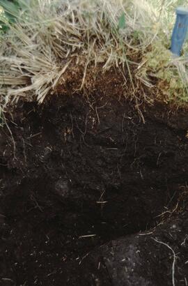
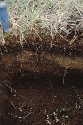
2023.2.2.5
·
Subseries
·
1991-2023, predominant 2004
Part of Dr. Paul Sanborn fonds
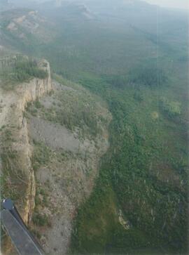
The Lost Chicken Mine, a placer gold mine in eastern Alaska, approximately 120 km west of Dawson City, Yukon, is an important fossil locality for the late Pliocene (approximately 2.5 – 3.0 million years ago). A comprehensive account of the stratigraphy and paleontology of this site was given by:
Matthews, J.V., Jr., J.A. Westgate, L. Ovenden, L.D. Carter, and T. Fouch. 2003. Stratigraphy, fossils, and age of sediments at the upper pit of the Lost Chicken gold mine: new information on the late Pliocene environment of east central Alaska. Quaternary Research 60: 9-18. https://doi.org/10.1016/S0033-5894(03)00087-5
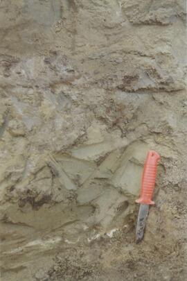
Dr. Paul Sanborn visited the site on July 20, 2004, as part of a group led by Duane Froese (Professor, University of Alberta). The group concentrated on a single exposure (~ 2 m thick) straddling the Lost Chicken tephra, a volcanic ash bed (2.9 ± 0.4 myr) which is a major stratigraphic marker at the site. Sanborn described, photographed, and sampled this exposure, and obtained a basic set of characterization data. Intact samples were collected but thin sections were never produced.

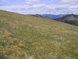
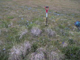
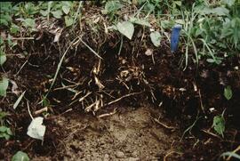
2023.2.2.3
·
Subseries
·
2004-2006
Part of Dr. Paul Sanborn fonds
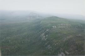
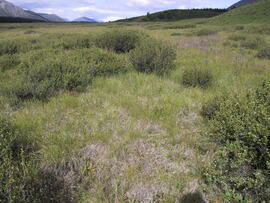
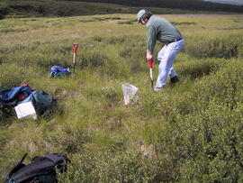
As part of a multidisciplinary team led by Grant Zazula (then a Ph.D. student at Simon Fraser University; later a palaeontologist with the Government of Yukon) and Duane Froese (Professor, University of Alberta), Dr. Paul Sanborn examined a set of buried paleosols (fossil soils) preserved in frozen sediments exposed by placer mining in the spring of 2004.
The findings were published in:
Zazula, G.D., D.G. Froese, S.A. Elias, S. Kuzmina, C. La Farge, A.V. Reyes, P.T. Sanborn, C.E. Schweger, C.A.S. Smith, and R.W. Mathewes. 2006. Vegetation buried under Dawson tephra (25,300 14C yr BP) and locally diverse late Pleistocene paleoenvironments of Goldbottom Creek, Yukon, Canada. Palaeogeography, Palaeoclimatology, Palaeoecology 242: 253–286.
https://doi.org/10.1016/j.palaeo.2006.06.005

2023.2.2.4.1
·
Item
·
Dec. 2005
Part of Dr. Paul Sanborn fonds
This born-digital document is an unpublished report to the Geological Survey of Canada on field work data and interpretations of Inlin Brook paleosols.
2023.2.2.4.3
·
Item
·
2004
Part of Dr. Paul Sanborn fonds
Data set consists of data collected for Inlin Brook (sites N04-02, -03, -04) and Red Ochre River (N04-05).

2023.2.2.8.11.22
·
Item
·
2003
Part of Dr. Paul Sanborn fonds

2023.2.2.7.4.086
·
Item
·
2009
Part of Dr. Paul Sanborn fonds

2023.2.2.7.4.087
·
Item
·
2009
Part of Dr. Paul Sanborn fonds

2023.2.2.7.4.044
·
Item
·
2009
Part of Dr. Paul Sanborn fonds

2023.2.2.7.4.089
·
Item
·
2009
Part of Dr. Paul Sanborn fonds

2023.2.2.7.4.043
·
Item
·
2009
Part of Dr. Paul Sanborn fonds

2023.2.2.7.4.088
·
Item
·
2009
Part of Dr. Paul Sanborn fonds

2023.2.2.7.4.007
·
Item
·
2009
Part of Dr. Paul Sanborn fonds
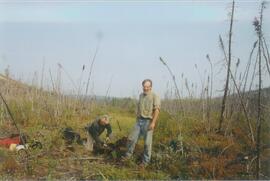
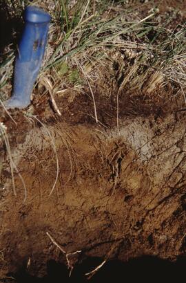
2023.2.2.4.4.119
·
Item
·
2004
Part of Dr. Paul Sanborn fonds
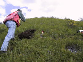
Photograph depicts scientists Paul Sanborn and Rene Barendregt (U Lethbridge) working at the Norman Range site.
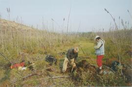
2023.2.2.4.4.118
·
Item
·
2004
Part of Dr. Paul Sanborn fonds
Photograph depicts scientists Alejandra Duk-Rodkin (GSC) and Rene Barendregt (U Lethbridge) working at the Norman Range site.
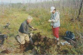
2023.2.2.4.4.117
·
Item
·
2004
Part of Dr. Paul Sanborn fonds
Photograph depicts scientists Alejandra Duk-Rodkin (GSC) and Rene Barendregt (U Lethbridge) working at the Norman Range site.
2023.2.2.4.4.116
·
Item
·
2004
Part of Dr. Paul Sanborn fonds
2023.2.2.4.4.115
·
Item
·
2004
Part of Dr. Paul Sanborn fonds
2023.2.2.4.4.114
·
Item
·
2004
Part of Dr. Paul Sanborn fonds
2023.2.2.4.4.113
·
Item
·
2004
Part of Dr. Paul Sanborn fonds
2023.2.2.4.4.112
·
Item
·
2004
Part of Dr. Paul Sanborn fonds

2023.2.2.4.4.111
·
Item
·
2004
Part of Dr. Paul Sanborn fonds
2023.2.2.4.4.110
·
Item
·
2004
Part of Dr. Paul Sanborn fonds
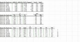
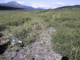
2023.2.2.5.8.08
·
Item
·
2004
Part of Dr. Paul Sanborn fonds
2023.2.2.9.6.14
·
Item
Part of Dr. Paul Sanborn fonds
2023.2.2.9.6.13
·
Item
Part of Dr. Paul Sanborn fonds
2023.2.2.9.5.16
·
Item
Part of Dr. Paul Sanborn fonds
2023.2.2.9.5.17
·
Item
Part of Dr. Paul Sanborn fonds
2023.2.2.9.6.12
·
Item
Part of Dr. Paul Sanborn fonds
2023.2.2.9.5.14
·
Item
Part of Dr. Paul Sanborn fonds
2023.2.2.9.5.15
·
Item
Part of Dr. Paul Sanborn fonds
2023.2.2.9.6.11
·
Item
Part of Dr. Paul Sanborn fonds
2023.2.2.9.5.12
·
Item
Part of Dr. Paul Sanborn fonds
2023.2.2.9.5.13
·
Item
Part of Dr. Paul Sanborn fonds
2023.2.2.9.6.10
·
Item
Part of Dr. Paul Sanborn fonds
2023.2.2.9.5.10
·
Item
Part of Dr. Paul Sanborn fonds
2023.2.2.9.5.11
·
Item
Part of Dr. Paul Sanborn fonds
2023.2.2.9.6.09
·
Item
Part of Dr. Paul Sanborn fonds
2023.2.2.9.5.09
·
Item
Part of Dr. Paul Sanborn fonds
2023.2.2.9.5.08
·
Item
Part of Dr. Paul Sanborn fonds
2023.2.2.9.6.08
·
Item
Part of Dr. Paul Sanborn fonds
2023.2.2.9.5.07
·
Item
Part of Dr. Paul Sanborn fonds
2023.2.2.9.5.06
·
Item
Part of Dr. Paul Sanborn fonds

2023.2.2.7.4.052
·
Item
·
2009
Part of Dr. Paul Sanborn fonds

2023.2.2.7.4.046
·
Item
·
2009
Part of Dr. Paul Sanborn fonds