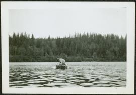
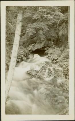
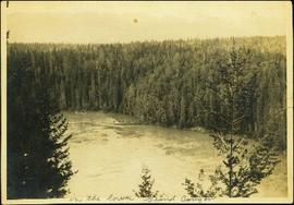
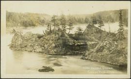
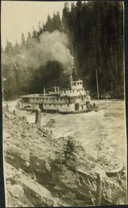
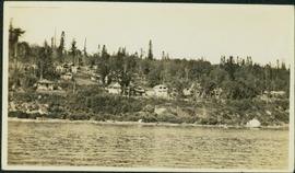
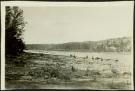
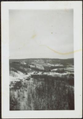
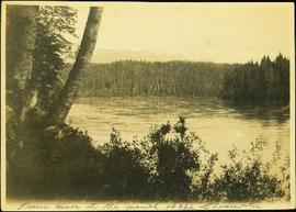
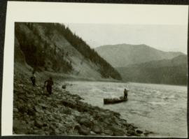
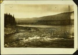
Handwritten caption below this photo reads: "Finlay River Rapids. - 1930."
A small peninsula extends into river in left midground, rapids in foreground, trees and hills on opposite shore in background.
Photograph depicts a man seated with bundles and briefcase in front of two small log cabins with sod roofs. What appears to be an elevated log cache stands to left behind cabins, with a ladder raised to its door. Rocky, dry field crosses foreground, mountains visible in background.
Photograph depicts a woman standing among men aboard a sternwheeler with the word "HAZELTON" above its deck. A man speculated to be the captain stands on deck to the left. Tree branches in foreground, opposite shore and mountains in background.
Close view of bridge built with wooden planks, poles, and wires, braced from below, with triangles built into its frame. The bridge crosses Hagwilget Canyon on the Bulkley River, five kilometres from its confluence with the Skeena River. This is one of the many bridge structures that have crossed this location since at least 1859. Photograph was taken from one side of canyon, near bridge. Opposite canyon wall in background. Typed annotation glued to verso of photograph: "HAGWILGET - 'the gentle or quiet people'."
Photograph depicts two men and a horse on a bridge built with wooden planks, poles, and wires, braced from below, with triangles built into its frame. The bridge crosses Hagwilget Canyon on the Bulkley River, five kilometres from its confluence with the Skeena River. This is one of the many bridge structures that have crossed this location since at least 1859. Photograph was taken from a distance. Rocky riverbank in foreground, opposite shore in background behind bridge. Typed annotation in red ink on verso of photograph: "INDIAN BRIDGE, NEAR HAZELTON, B.C."
Handwritten annotation on verso of photograph: "Early Days on the Cariboo Road. No. 8." Photograph depicts man driving two covered wagons pulled by team of six horses on gravel road. Valley crosses midground, hills in background. Handwritten annotation on recto of photograph: "H. F. Glassey Esq. P.O Box 950 Prince Rupert B.C. Dear Bert: We have been kept very busy have been on committee work all through the convention but it was wonderful will write you a long letter from Vancouver. Mrs Earley wants me to stay until Monday morning train. Met Mr. [Colley?] everything going fine here. I am sure you are busy [...?] Love from Sadie. Mr & Mrs. [Graif?] are living here."
Photograph depicts power plant by waterfall. Extensive construction materials and structures can be seen scattered to left of plant. River in foreground, forest and hills in background. Typed annotation on verso of photograph: "Northern B.C. Power Co. Falls River Plant Prince Rupert B.C."
Photograph depicts dry creek bed, tall banks on either side. Hills and lake cross midground, mountains visible in background. Handwritten annotation on verso of photograph: "Looking down McKee Creek across Atlin Lake Towards Taku Glacier 6/27/37."
Photograph depicts the Atlin townsite, forest in foreground, hills in background. Town stands on edge of lake located in left midground. Handwritten annotation on verso of photograph: "Atlin City B.C., Sept. 3rd 1899. Copyrighted by S.A. Smythe Atlin, B.C."
Photograph depicts men and haul trucks visible in distance on snowy road in tree-covered hills.
Photograph depicts bridge construction approaching unidentified river on opposite shore, unfinished pier in foreground. Steep riverbank in background.
Photograph depicts unidentified river in foreground, trees on cliffs in background.
Photograph depicts small boat on unidentified river or lake, trees on opposite shore in background.
Photograph depicts town buildings and church on shore to right of river winding through hills. Metal bar speculated to be part of a bridge crosses foreground.
Photograph depicts water flowing from ground in forest. Handwritten annotation on recto of photograph: "Atlin, The Grotto, Outlet of a subterranean stream (in limestone) on way to O'Donnell River."
Photograph depicts a group of unidentified buildings in what appears to be an industrial area on opposite shore. River or lake in foreground, tree-covered hills in background.
Photograph depicts canoe floating in water, rocky shore in foreground, opposite shore visible on horizon.
Photograph depicts what appears to be a row of small canoes in still water, opposite shore visible on horizon. Another small boat rests on dock in right foreground.
The pair stands on grassy shore, Sarah on right. Trees, water, bridge, and opposite shore visible in background. Handwritten annotation on recto of photograph: "Sarah + Doris." Both woman are believed to be members of group featured in items 2009.5.2.274 - 2009.5.2.291.
The pair stands on grassy shore, Sarah on right. Trees, water, and bridge visible in background. Handwritten annotation on recto of photograph: "Sarah + Vi." Both woman are believed to be members of group featured in items 2009.5.2.274 - 2009.5.2.291.
Photograph depicts opposite shore in background behind river, bushes and trees in foreground. Handwritten photo caption on verso and recto of this photograph reads: "Fraser River at the mouth of the Clearwater".
Photograph depicts opposite shore in background behind river, and close shore in foreground on right. Men can be seen standing and paddling on canoe in distance. Handwritten photo caption on verso and recto of this photograph reads: "On the Clearwater".
Photograph depicts two men standing and paddling in canoe on river, trees stand above rock face on opposite shore in background. Handwritten photo caption on verso and recto of this photograph reads: "Entering the Grand Canyon."
Photograph depicts men on a scow near opposite shore of river. Treetops in foreground. Photograph taken from above. Handwritten photo caption on verso and recto of this photo reads: "in the lower Grand Canyon".
Photograph depicts a line of men standing on rocky shore and holding a long rope between them, while men on scow float close to shore in distance. Trees on opposite shore in background. Handwritten photo caption on verso and recto of this photo reads: "in the Grand Canyon."
Photograph depicts two men standing in front of a short tent. Cooking supplies are scattered throughout campsite. Trees cross midground, and snow-covered mountains stand in background. Handwritten annotation on recto of photograph: "POTT FALLS ON REDDEER RIVER. A Plate of Beans before Lunch. ON THE RIGHT Bob - Potts. Sampling his own Cooking."
Photograph depicts the rooftops of four wood buildings behind bushes on opposite shore. Forest trees in background. These buildings are speculated to be a Bourchier forestry camp.
Photograph depicts men standing on different deck levels of conveyor on the Fraser River. Wood planks built into shore in foreground, trees on opposite shore in background. Handwritten annotation on verso of photograph reads: "Launching Conveyor", on recto: "Launching the rebuilt steamer Conveyor at Tete Jaune 1912".
Photograph depicts glacier and snow in mountains. Handwritten annotation on verso of photograph reads: "Glacier, Moose River. B.C."
Riverboat floats in midground, canoes float by shore. Trees and hillside on opposite shore in background. Poor image quality.
Photograph depicts a small pass through an island or peninsula on the Fraser River. Photo is believed to have been taken near Stone Creek, south of South Fort George. Annotation on verso of photograph reads: "FORT GEORGE CANYON. CANOE PASS. J. HEAY. PHOTO."
Photograph depicts a paddle wheel conveyor believed to be in distress in the Fort George Canyon on the Fraser River. Rocky bank in foreground, trees on opposite shore in background.
Photograph depicts what appears to be two trains and a long building on high level of river bank. Fraser river in foreground, forest trees on shore in background.
Handwritten annotation on verso of photograph reads: "George St. Prince George BC Photo. S Wrathall". Prince George Hotel and Cafe stand on left side of street in foreground, and many other buildings and businesses can be seen. Vehicles line the street, cut banks visible in background. Photograph believed to have been taken while George Street was being prepared for a new lawyer of asphalt.
Photograph depicts large bridge and dam over a wide river, industrial structures throughout. Hills on opposite shore in background. Handwritten annotation on recto of photograph: "Coulee Dam, This is were[sic] I went this fall. Wished you had of been with me."
River in foreground, trees and cliffs in background.
Photograph depicts people on river shore, and boat and buildings in midground. River bank in foreground, forest in background. Handwritten annotation on verso of photograph: "Giscombe Portage Fraser River", on recto: "Huble & Seaback on Fraser River."
Photograph depicts many buildings among forest trees on hillside of opposite shore. River in foreground.
Violet Baxter's older sister Ellen and younger sister Lucy are among other unknown individuals who stand and sit on a car in the road. Ellen stands second from left, and Lucy sits in back behind other girls. Forest and hillside can be seen in background.
Photograph depicts bridge built with wooden planks and poles, with triangles built into its frame. Water rapids in foreground, opposite shore in background behind bridge. This is speculated to be one of the bridges that crossed the Hagwilget Canyon on the Bulkey River since 1859, five kilometres from its confluence with the Skeena River. See items 2009.5.1.69 - 2009.5.1.71.
Handwritten annotation on recto of photograph: "Omineca Dist Walcott Suspension Bridge West Approach - looking East May 26 - 1932". Photograph depicts two white horses pulling a wagon in front of Walcott bridge. This bridge was moved from its original location in the Hagwilget Canyon, downstream from Walcott on the Bulkley River. It is a pedestrian bridge at the time of this photograph, though it was originally used by motor vehicles. Dirt road leading to bridge in foreground, with lumber and brush piles on either side. Trees and hills on opposite shore in background.
Photograph depicts a man cooking over campfire, log building and forest in background.
Photograph depicts man smoking pipe in area believed to be a mining location, sandy cliffs in background.
Photograph depicts three men wearing suits and ties, posed in front of car in gravel area believed to be at a mining location. Hauling truck crosses road in midground, cliffs and hills in background.
Photograph depicts an unidentified man mining in rocky area, trees and hills in background. Handwritten annotations on verso of photograph: "PLACER MINER WSHING FOR GOLD FINDLAY RIVER BC", "PHOTO WWW".
Photograph depicts men standing on shore near what appears to be a long pier extending into the river. Trees on left, opposite shore in background. Handwritten annotation on recto of photograph: "Pete Joy's Bar Finlay River."
Photograph depicts a man standing in a loaded canoe floating close to shore. Two men stand on rocky shore in left foreground. Tall hills in background, river rapids behind canoe in midground. Handwritten annotation on recto of photograph: "Parle Pas Rapids Peace River."
Photograph depicts Mount Selwyn rising on opposite shore in right midground. River in foreground, mountains in background. Handwritten annotation on recto of photograph: "Mount Selwyn Peace River."
Photograph depicts a team of dogs and sled resting in a very flat snow-covered area. Hills in background. Handwritten annotation on recto of photograph: "ATLIN."
Photograph depicts lumber piles and what appears to be a very long sluicing trough along Otter Creek. Forest and hills in background. Handwritten annotation on verso of photograph: "Otter Creek 6/6/37". See also item 2009.5.2.70.