2008.2.1.20
·
Item
·
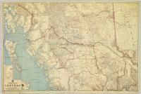
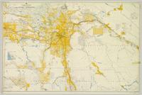
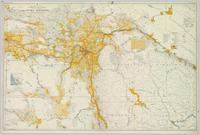
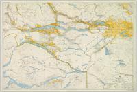
1937
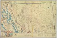
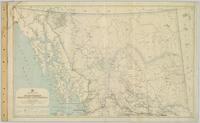
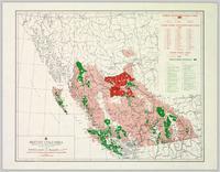
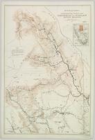
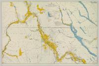
Part of Northern BC Cartographic Collection
Colour-coded map depicts lands surveyed as alienated, available for purchase or lease under Taxation Act, or reserved. Depicts land district boundaries, land recording divisions, triangulation stations, telegraph/telephone lines, communities, bodies of water, and transport routes.