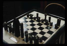
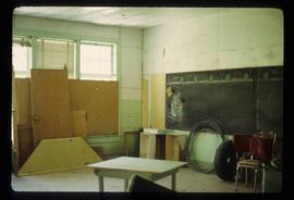
Image depicts the Chimney Lake Lodge.
Image depicts Chimney lake with a number of houses near the shore, and a child in the foreground.
Image depicts a bridge over the Fraser River, located at Chimney Creek, somewhere south-west of Williams Lake, B.C.
Image depicts two children standing near an old car in Island Cache.
Image depicts a sign titled "Chilcotin Wildlife Management Area" somewhere near Riske Creek, B.C. It reads: "This trail has been provided by the Fish and Wildlife Branch in co-operation with Riske Creek Ranching Ltd., as access to the Chilcotin Wildlife Management Area. Please do not leave the the trail as the surrounding land is private property."
Image depicts a group of hikers hiking towards what is possibly the Chilcotin River.
Image depicts what is possibly the Chilcotin River.
File consists of notes, clippings, and reproductions relating to the Chilcotin region. Includes: "CNC Outdoors Club Trip to Farewell Canyon" poster (Nov. 1973).
Item is an original 1950 pre-emptor's map of the Chilcotin region, published by the British Columbia Department of Lands and Forests.
File consists of notes, clippings, and reproductions relating to Chilako River and Indian Reserve No. 4. File contains material regarding the discovery of Indigenous artifacts in an archaeological dig by faculty and students from the University of Northern British Columbia; the establishment of a fur trading fort at Chala-oo-chick for the Hudson's Bay Company; and Indian Reserve No. 4 of the L'heidli T'enneh. Includes photographs depicting Fernie Ollinger's barn on Chilako Station Road and Chilako River (2006).
Image depicts a view of a train passing through an area of Chetwynd, B.C.
Image depicts a number of townhouses in Chetwynd, B.C.
Image depicts a view of a saw mill in Chetwynd, B.C.
Image depicts several businesses in a small section of Chetwynd, B.C. There is a motor hotel and a half-visible sign for an Esso gas station.
Image depicts several houses in Chetwynd, B.C.
Image depicts a view of some farm land in Chetwynd, B.C.
Image depicts a Chevron station as well as two motels in Chetwynd, B.C.
Image depicts a view of Chetwynd, possibly from Highway 97.
Image depicts an old, and seemingly incomplete chess set somewhere in Wells, B.C.
Image depicts the Cheslatta River.
Image depicts what appears to be a tour group at Cheslatta.
Image depicts the Cheslatta Falls.
File contains slides depicting images of Cheslatta from 1991
File contains slides depicting Chemanus, B.C.
Image depicts the wall of a chasm full of trees at an unknown location.
Image depicts a chasm full of trees at an unknown location.
The item is a photograph depicting the top left corner of the Buckhorn Parent-Teacher Association Charter affiliated with the British Columbia Parent-Teacher Federation. The charter contains a list of the members. Annotation on reverse side of photograph states, "1956." The second annotation is crossed out and states, "1956."
File consists of notes, clippings, and reproductions relating to Charles Millar and the Millar Addition in Prince George.
Image depicts a snowman drawn on the chalkboard of what appears to be an unused school, possibly in Lamming Mills, B.C. The slide is labelled "note board school."
Image depicts Central Street West, parallel to Highway 97 in Prince George, B.C. looking north. Shown: Prince George Motors and other car dealerships, Burger King, Grama's Inn, and the Spruceland Shopping Mall sign. Map coordinates 53°54'42.1"N 122°46'53.1"W
File contains slides that reproduce historical photographs of Indigenous peoples of Central Interior, as well as maps.
File consists of notes, clippings, and reproductions relating to British Columbia's central interior forestry industry. Includes material regarding beehive burners; economic viability of timber in Prince George, Quesnel, Burns Lake, and Houston; the Canfor pulp mill in Prince George; and Carrier Lumber Ltd. mill in Prince George. File primarily consists of clipped articles from the Prince George Citizen newspaper, including "Forest Expo 2004" special edition of the Prince George Citizen newspaper (1 June 2004).
The item is a business focused newspaper from Central Interior Business focusing on business and economics in the central interior British Columbia.
File consists of notes, clippings, and reproductions relating to bibliographic references about the central interior of British Columbia. Includes: "Pioneers of the Central Interior" pamphlet from the Prince George Public Library (Nov. 1986) and "Manitoba Department of Tourism and Cultural Affairs" typescript letter from Shirlee Anne Smith to Frank Leonard (9 May 1980).