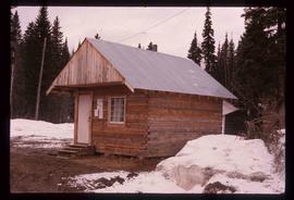
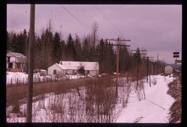
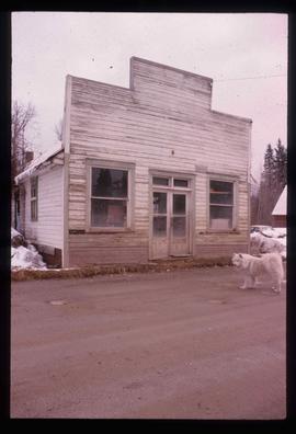
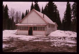
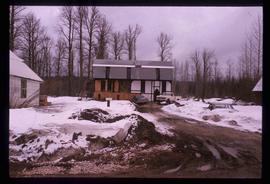
File contains slides depicting a Doukabour community at an unknown location.
File consists of notes and reproductions relating to the Dominion Land Survey system. File primarily consists of photocopies of original township layout systems between 1881 and 1917 and printed secondary sources on the standardization of the Dominon Land Survey system in British Columbia and Alberta.
The item is a photograph depicting an old, weathered general store in Dome Creek. The building is empty and there is a white dog standing out front.
The item is a photograph depicting the front and side of the old Dome Creek church. The door window is boarded up. Annotation on the reverse side of the photograph states, "Dome Cr. church."
Image depicts a small farm located in Dome Creek, B.C.
Image depicts the school and teacherage located in Dome Creek, B.C.
Image depicts a strangely shaped orange vehicle somewhere in Dome Creek, B.C.
Image depicts an old, unused log cabin somewhere in Dome Creek, B.C.
Image depicts a log cabin somewhere in Dome Creek, B.C.
Image depicts a small shack that became the later post office in Dome Creek, B.C.
Image depicts several houses in Dome Creek, B.C.
Image depicts a horse and a barn in Dome Creek, B.C.
Image depicts a farmhouse in Dome Creek, B.C.
Image depicts an old building that used to be a store and post office in Dome Creek, B.C.
Image depicts the community hall in Dome Creek, B.C.
Image depicts what is possibly the CN Station in Dome Creek, B.C.
Image depicts the CN Station in Dome Creek, B.C.
Image depicts a Catholic Church in Dome Creek, B.C.
Image depicts a house somewhere in Dome Creek, B.C.
The item is a photograph looking down Dogwood Street from 17th Avenue, Prince George.
Image depicts a pair of dogs in a forest, possibly somewhere near Woodpecker, B.C.
Image depicts two dogs and numerous chickens in a yard at Island Cache.
Image depicts an unknown individual and a dog on a bridge over what is possibly the Robson River.
Image depicts a dog standing on a path through the woods somewhere in Carp Lake Provincial Park.
Photograph depicting a dog laying in the grass in someone's backyard of a personal residence.
Image depicts a dog in a forest, possibly somewhere near Woodpecker, B.C.
Image depicts a house and numerous rundown vehicles in Dog Creek, B.C.
Image depicts a ferry docked at Haida Gwaii, B.C.
Image depicts numerous docked boats in Prince Rupert, B.C.
Image depicts numerous docked boats somewhere in Prince Rupert, B.C.
Image depicts numerous boats docked in Prince Rupert, B.C.
Image depicts an individual sitting on a dock on a lake somewhere on Haida Gwaii.
Image depicts a dock on a lake in Carp Lake Provincial Park, possibly War Lake.
Image depicts a dock in Prince Rupert, B.C.
Image depicts an unidentified individual diving into a pool of water at an uncertain location.
Image depicts the "Divides Lake Waterfall" as well as a man in front of a helicopter in the foreground.
Image depicts the "Divides Lake Waterfall."
File contains slides depicting images of and around Divide Lake.
Image depicts Divide Lake.
Image depicts a ditch of water at an uncertain location.
Image depicts a section of disturbed ground at an unknown location.
Image depicts an area of disturbed ground, most likely due to a landslide, at an unknown location.
Image depicts a large section of disturbed ground at an unknown location.
Image depicts an area of disturbed ground, most likely due to a landslide, at an unknown location.
File contains slides depicting areas around the Discovery Passage.
Photograph depicts dirt tracks in a field in front of a body of water.
Image depicts a dirt road leading through a forest.