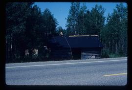
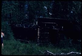
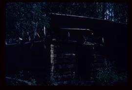
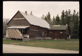
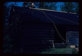
Image depicts a log cabin, with a few unknown individuals working on the roof, in Woodpecker, B.C.
Image depicts the Bachelor's Hall in Woodpecker, B.C.
Photograph depicts the base of a wooden canoe on a wheeled cart, presumably at the Fort St. James historic site.
The item is a photograph of an old wooden garage behind Prince George's first hospital at 1584 8th Avenue, Prince George.
Photograph depicts a wooden building presumably at the Fort St. James historic site.
Photograph depicts a wooden building presumably at the Fort St. James historic site. The photograph is close up to the building, depicting an open door and the wooden panels along the building.
Photograph depicts a wooden building presumably at the Fort St. James historic site.
Photograph depicts a wooden building, presumably at the Fort St. James historic site.
Photograph depicts a wooden and abandoned building, the roof caving in and the sides tarnishing. Photograph taken in an unknown location.
Image depicts a wood pile in Island Cache.
Image depicts two snow sculptures near a wooden bridge on an ice rink, possibly during the Winter City Conference, in Prince George, B.C. Taken at the Prince George Civic Center. Map coordinates 53°54'45.6"N 122°44'59.6"W
The item is a photograph of a wood and white brick house in Prince George. The address is 2755 on an unknown street.
Image depicts an unknown woman with a camera. Nearby are the skeletal remains of an unknown animal. The location is the upper Fraser Canyon.
Image depicts a woman holding a sheet of paper in a room with numerous other unidentified individuals. The man standing behind her is possibly Elmer Mercier, a former Mayor of Prince George, B.C.
Image depicts an unidentified woman with a camera sitting on the bank of a river.
Image depicts a woman standing on a rocky shore somewhere on Haida Gwaii, B.C.
Image depicts a woman on a boat, possibly on War Lake.
Image depicts a woman, wearing clothes reminiscent of traditional First Nations, who appears to be dancing in the street outside of a Native Friendship Centre in Prince George, B.C. A large crowd is looking on.
Image depicts the old community hall located somewhere in the Wistaria Provincial Park.
Image depicts a river, possibly somewhere in the Wistaria Provincial Park.
File consists of notes and reproductions relaintg to the Willow River townsite.
Image depicts a snowy street in Willow River, B.C. There are several buildings, one is an Esso station and another is labelled as "Red & White Food Store."
Image depicts a snowy street in Willow River, B.C. with a row of houses. The white building on the end with the Pepsi sign is the Willow River General Store. Map coordinates 54°04'18.3"N 122°28'14.7"W
Image depicts the Willow River General Store. Map coordinates 54°04'23.7"N 122°28'26.9"W
File consists of notes and reproductions relating to the Willow River Elementary School.
Image depicts a playground in Willow River, B.C. The slide labels it as being a "former hotel site." Map coordinates 54°04'23.7"N 122°28'26.9"W
Image depicts a group of people somewhere in Willow River, B.C. The man in the plaid shirt and beige cap is identified on the slide as being Lloyd Edwards.
Image depicts the cableway in Willow River, B.C.
Image depicts the cableway, stretching over a river, in Willow River, B.C.
Image depicts the cableway in Willow River, B.C.
File consists of notes, clippings, and reproductions relating to the community of Willow River.
Image depicts the St. Joseph's Mission in Williams Lake, B.C.
File contains slides depicting places in the area around Williams Lake, Clinton, and the Fraser Canyon.
Image depicts an aerial view of Williams Lake, B.C.
Image depicts a view of Williams Lake, B.C.
Image depicts an aerial view of Williams Lake, B.C.
File consists of notes and reproductions relating to William Binney Milner, a Vancouver-based financier who owned Eagle Lake Sawmills at Giscome and the Prince George Citizen newspaper. File also includes photographs depicting the exterior of a house at the address 2890 Marine Drive (2005).