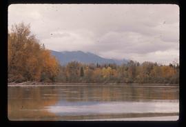
Showing 1985 results

Archival description
1985 results with digital objects Show results with digital objects
Grooving
2012.13.1.124.13 · Item · June 1975
Part of J. Kent Sedgwick fonds

Image depicts an aerial view of a grooved region of land at an uncertain location.

Grooving
2012.13.1.65.40 · Item · June 1975
Part of J. Kent Sedgwick fonds

Image depicts an aerial view of grooves in the land near the Fraser River, possibly caused by glaciers.

Grooving
2012.13.1.65.42 · Item · June 1975
Part of J. Kent Sedgwick fonds

Image depicts a view of grooves in the land near the Fraser River, possibly caused by glaciers.

Grooves
2012.13.1.124.14 · Item · June 1975
Part of J. Kent Sedgwick fonds

Image depicts an aerial view of a grooved region of land at an uncertain location.

Gravel
2012.13.1.124.18 · Item · Oct. 1975
Part of J. Kent Sedgwick fonds

Image depicts layers of gravel at the BCR site in Prince George, B.C.

Gravel
2012.13.1.124.19 · Item · Oct. 1975
Part of J. Kent Sedgwick fonds

Image depicts layers of gravel at the BCR site in Prince George, B.C.

Grade?
2012.13.1.41.05 · Item · 2002
Part of J. Kent Sedgwick fonds

Image depicts a clearing through the woods, possibly an abandoned grade for the BCR. It is possibly located on Iron Road South, near Woodpecker B.C.

Grade?
2012.13.1.41.07 · Item · 2002
Part of J. Kent Sedgwick fonds

Image depicts a clearing through the woods, possibly an abandoned grade for the BCR. It is possibly located on Iron Road South, near Woodpecker B.C.

Giscome Sawmill
2012.13.1.87.176 · Item · [between 1975 and 1995]
Part of J. Kent Sedgwick fonds

Image depicts the Giscome, B.C. mill site looking west. Map coordinates 54°04'18.5"N 122°21'57.7"W

Giscome Quarry
2012.13.1.87.074 · Item · [between 1975 and 1995]
Part of J. Kent Sedgwick fonds

Image depicts what is possibly the quarry located at Eaglet Lake in Giscome, B.C.

Giscome Landscape
2012.13.1.87.071 · Item · [between 1975 and 1995]
Part of J. Kent Sedgwick fonds

Image depicts an open area with Eaglet Lake in the background. It depicts the previous site of the mill at Giscome, B.C. Map coordinates 54°04'19.7"N 122°22'04.7"W

2012.13.1.89.084 · Item · [1980?]
Part of J. Kent Sedgwick fonds

Image depicts Giscome with the school on the left, the remnants of the town site in the middle and the church on the right. Map coordinates 54°03'58.2"N 122°22'04.8"W

Giscome Dairy Farm
2012.13.1.87.083 · Item · [between 1975 and 1995]
Part of J. Kent Sedgwick fonds

Image depicts a large, old and collapsing barn, as well as a nearby house of the dairy farm in Giscome, B.C. Map coordinates 54°03'53.3"N 122°21'22.6"W

Giscome Dairy Farm
2012.13.1.87.141 · Item · [between 1975 and 1995]
Part of J. Kent Sedgwick fonds

Image depicts the dairy farm in Giscome, B.C. Map coordinates 54°03'53.3"N 122°21'22.6"W

Giscome Dairy Farm
2012.13.1.87.152 · Item · [between 1975 and 1995]
Part of J. Kent Sedgwick fonds

Image depicts the dairy farm in Giscome, B.C. Map coordinates 54°03'53.3"N 122°21'22.6"W

Giscome Community Hall
2012.13.1.87.160 · Item · [between 1975 and 1995]
Part of J. Kent Sedgwick fonds

Image depicts the Giscome Community Hall in Giscome, B.C. Map coordinates 54°04'18.5"N 122°21'57.7"W

Giscome CN Station
2012.13.1.87.161 · Item · [between 1975 and 1995]
Part of J. Kent Sedgwick fonds

Image depicts the old CN station in Giscome, B.C. Map coordinates 54°04'20.7"N 122°22'01.1"W

Giscome Bunkhouse
2012.13.1.87.158 · Item · [between 1975 and 1995]
Part of J. Kent Sedgwick fonds

Image depicts the Giscome bunkhouse in Giscome, B.C. Map coordinates 54°04'17.6"N 122°22'06.1"W

2012.13.1.87.087 · Item · [between 1975 and 1995]
Part of J. Kent Sedgwick fonds

Image depicts the Giscome mill site in Giscome, B.C. The railroad tracks are in the foreground. Map coordinates 54°04'17.6"N 122°22'06.1"W

Giscome - Power Poles
2012.13.1.87.098 · Item · [between 1975 and 1995]
Part of J. Kent Sedgwick fonds

Image depicts the remains of a street of houses in Giscome, B.C. The quarry is slightly visible in the background. Map coordinates 54°04'20.9"N 122°21'53.1"W

Giscome - Eaglet Lake
2012.13.1.87.090 · Item · [between 1980 and 2000]
Part of J. Kent Sedgwick fonds

Image depicts mill site and dock in Giscome, B.C. with Eaglet Lake in the background covered in ice. There is a large crowd of people gathered near the dock. Map coordinates 54°04'34.9"N 122°21'50.0"W

Giscome
2012.13.1.87.175 · Item · [between 1975 and 1995]
Part of J. Kent Sedgwick fonds

Image depicts the Giscome, B.C. town site with the Giscome railway station and the Giscome store in the center surrounded by vehicles. Map coordinates 54°04'18.5"N 122°21'57.7"W

Ginter House
2012.13.1.14.03 · Item · Dec. 1997
Part of J. Kent Sedgwick fonds

Image depicts the Ginter House and the surrounding woods, in Prince George, B.C.