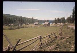
Showing 2097 results

Archival description
Iron Road North
2012.13.1.41.08 · Item · 2002
Part of J. Kent Sedgwick fonds

Image depicts Iron Road North, and a creek surrounded by trees. Located north of Woodpecker, B.C.

Intrusion
2012.13.1.124.01 · Item · 1970
Part of J. Kent Sedgwick fonds

Image depicts what is possibly an intrusive volcanic landform somewhere near Miworth, B.C.

Inlander Hotel
2012.13.1.51.060 · Item · May 1973
Part of J. Kent Sedgwick fonds

Image depicts the Inlander Hotel in Hazelton, B.C. The peak of the Rocher de Boule mountain is visible in the background.

In Memory Of - Grave-Marker
2012.13.1.87.150 · Item · [between 1975 and 1995]
Part of J. Kent Sedgwick fonds

Image depicts a grave-marker with several names, it reads: "In Memory of Edith Golder, Winnifred Golder, Baby Pelton, Mrs. Nazarek, Baby Nazarek, Baby Wazylyk 1915 - 1929." It is located in the Willow River Cemetery.

Ice Rafted Boulders
2012.13.1.125.22 · Item · [1982?]
Part of J. Kent Sedgwick fonds

Image depicts a boulder protruding from layers of sediment with a hammer beside it for size reference. It is located somewhere in Soda Creek, B.C.

Hydraulic
2012.13.1.69.30 · Item · [1981?]
Part of J. Kent Sedgwick fonds

Image depicts the old log buildings of the town of Hydraulic, B.C.

Houses on Stilts
2012.13.1.6.106 · Item · Nov. 1980
Part of J. Kent Sedgwick fonds

Image depicts a number of houses built on stilts over a body of water in an uncertain location.

Houses in Giscome
2012.13.1.87.072 · Item · [between 1975 and 1995]
Part of J. Kent Sedgwick fonds

Image depicts the Giscome B.C. townsite from across the railroad tracks looking southeast. Map coordinates 54°04'19.7"N 122°22'04.7"W

Houses and Train in Giscome
2012.13.1.87.073 · Item · [between 1975 and 1995]
Part of J. Kent Sedgwick fonds

Image depicts the Giscome B.C. townsite from across the railroad tracks looking southeast. Map coordinates 54°04'19.7"N 122°22'04.7"W

Houses and Three Goats
2012.13.1.87.021 · Item · [between 1975 and 1995]
Part of J. Kent Sedgwick fonds

Image depicts several houses, and three goats standing on a narrow dirt road. The location is uncertain, likely Sinclair Mills, B.C.

Houses and a Ballpark
2012.13.1.93.01 · Item · 1978
Part of J. Kent Sedgwick fonds

Image depicts a view of numerous houses and a ballpark at an uncertain location. It is possibly located somewhere in the Peace River Region.

Houses
2012.13.1.22.12 · Item · 1970
Part of J. Kent Sedgwick fonds

Image depicts numerous houses, and an unknown child standing in a street at Island Cache.

Houses
2012.13.1.22.17 · Item · 1970
Part of J. Kent Sedgwick fonds

Image depicts a few houses and a dog on a porch at Island Cache.

House with Ivy
2012.13.1.87.116 · Item · [between 1970 and 1990]
Part of J. Kent Sedgwick fonds

Image depicts a house with ivy growing over it. The location is uncertain.

2012.13.1.87.050 · Item · [between 1975 and 1995]
Part of J. Kent Sedgwick fonds

Image depicts a house being removed from Upper Fraser, B.C. during demolition of town site. A sign on the house reads: "Murray Blackwell House Raising & Moving." Map coordinates 54°06'51.6"N 121°56'26.3"W