Print preview Close

Showing 5139 results

Archival description
3026 results with digital objects Show results with digital objects
Fence
2012.13.1.12.11 · Item · Aug. 1978
Part of J. Kent Sedgwick fonds

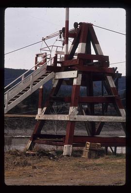
Image depicts a wooden fence at an uncertain location, perhaps somewhere in the Chilcotin region.

Fence
2012.13.1.12.12 · Item · Aug. 1978
Part of J. Kent Sedgwick fonds

Image depicts a wooden fence at somewhere in Meldrum Creek, B.C.

Fence
2012.13.1.12.16 · Item · Sep. 1983
Part of J. Kent Sedgwick fonds

Image depicts a fence somewhere in Anahim Lake, B.C.

Fence and Power Lines
2012.13.1.78.47 · Item · 1982
Part of J. Kent Sedgwick fonds

Image depicts a fence and power lines near the shore on Haida Gwaii. It is possibly a small community such as Masset.

Fenced Off Forest Area
2012.13.1.87.149 · Item · [between 1975 and 1995]
Part of J. Kent Sedgwick fonds

Image depicts two unidentified individuals standing outside a small, enclosed area somewhere in a forest. The location is uncertain.

Fences, Log Construction
2012.13.1.012 · Subseries · [between 1970 and 1985]
Part of J. Kent Sedgwick fonds

File contains slides depicting images of fences and various other forms of log construction, ranging from 1970 to 1985.

Ferries in Prince George
2012.13.2.15.09 · File · [197-], 2005
Part of J. Kent Sedgwick fonds

File consists of notes, clippings, and reproductions relating to ferry boat service in and around Prince George. Includes material regarding the Fraser River Fort George ferry; the Isle Pierre ferry; and the Miworth ferry. File also includes photographs depicting a building at Isle Pierre in the 1970s and the ferry crossing at Isle Pierre in 2005.

Ferry
2012.13.1.50.056 · Item · 1978
Part of J. Kent Sedgwick fonds

Image depicts a structure that appears to be a type of zipline, ferry platform at an unknown location.

Ferry
2012.13.1.50.057 · Item · 1978
Part of J. Kent Sedgwick fonds

Image depicts a structure that appears to be a type of zipline, ferry platform at an unknown location.

2012.13.2.12.03 · File · 1976
Part of J. Kent Sedgwick fonds

File consists of "The Prospect" newspaper, vol. 1 no. 38 described as 'The Last Edition'. "The Prospect" was a regional news-advertiser located in Prince George, and reached Quesnel, Vanderhoof, Mackenzie, Fort St. James, McBride, and other communities within a 100 mile radius.

Finding aid database
2012.13.2.17.03.2 · Item · [2003?]
Part of J. Kent Sedgwick fonds

The item is a computer diskette including one Excel document on Oral Histories of women. Annotations on diskette state, "ORAL HISTORIES DATABASE FINDING AID 1 file only - "Women" EXCEL."

Finish Line
2012.13.1.129.01 · Item · 1971
Part of J. Kent Sedgwick fonds

Image depicts numerous skiers standing near a finish line somewhere on Tabor Mountain in Prince George, B.C.

Fire hall South Fort George
2012.13.3.1.50.2 · Item · [1990]
Part of J. Kent Sedgwick fonds

The item is a photograph depicting the previous fire hall in South Fort George before it was remodeled into a house. Annotations on the reverse side of the photograph state, "S. Ft. Geo fire hall c. 1911 remodeled as house occupied 2009."

2012.13.1.3.149 · Item · Apr. 1999
Part of J. Kent Sedgwick fonds

Image depicts a snow sculpted fire place and couch on a skating rink, possibly during the Winter City Conference, in Prince George, B.C. Taken at the Prince George Civic Center. Map coordinates 53°54'45.6"N 122°44'59.6"W

2012.13.2.06.01 · File · 1980-2006
Part of J. Kent Sedgwick fonds

File consists of notes, clippings, and reproductions relating to fire protection services and fire halls in Prince George. Includes the following clipped articles from the Prince George Citizen newspaper: "Dramatic fires sent businesses up in flames" (May 2004); "Fires were frequent in days of wood stoves" (Aug. 1980); and "Home fires burned too brightly" (May 1999).

2012.13.2.02.33.04 · Item · [1990?]
Part of J. Kent Sedgwick fonds

The item is a reproduction of a survey map drafted in January 1910. The reproduction was likely created in 1990. The subdivision is Lot 936 G. I. Cariboo District, B.C. The area covered is North of Twenty First Avenue, East of Quinn Street, South of Eighth Avenue and West of Carney Street. Annotations highlight "Owner Edgar McMickiny," "696" and "Jordan Brothel" written in red pen pointing to a specific location.

2012.13.3.1.34 · File · 2005
Part of J. Kent Sedgwick fonds

File consists of a note and a reproduction relating to First Methodist Church on Third Avenue, which was later moved to 1389 Ingledew Street in Prince George. File predominantly consists of printed photographs from The Exploration Place Museum database depicting First Methodist Church.

First Nations Drums
2012.13.1.84.27 · Item · 1994
Part of J. Kent Sedgwick fonds

Image depicts several unidentified individuals standing outside a building, and holding intricately painted drums; the woman on the right is Sue Sedgwick. The location is uncertain.

First Nations Drums
2012.13.1.84.29 · Item · 1994
Part of J. Kent Sedgwick fonds

Image depicts several unidentified individuals standing outside a building and holding intricately painted drums; Kent Sedgwick is standing the middle of the group with Sue Sedgwick beside him. The location is uncertain.

First Nations Drums
2012.13.1.84.28 · Item · 1994
Part of J. Kent Sedgwick fonds

Image depicts several unidentified individuals standing outside a building, and holding intricately painted drums. The location is uncertain.

First Nations Drums
2012.13.1.84.26 · Item · 1994
Part of J. Kent Sedgwick fonds

Image depicts several unidentified individuals standing outside a building, and holding intricately painted drums; the woman on the right is Sue Sedgwick. The location is uncertain.

2012.13.3.1.28 · File · 2001-2005
Part of J. Kent Sedgwick fonds

File consists of notes, clippings, and reproductions relating to the first Presbyterian Church built in Central Fort George in 1913. File predominantly consists of photocopies from The Exploration Place Museum database depicting the first Presbyterian Church in Central Fort George.

Fishing
2012.13.1.23.15 · Item · 1973
Part of J. Kent Sedgwick fonds

Image depicts two youths fishing from the bank of the Nechako River on Cottonwood Island.

Fishing
2012.13.1.84.39 · Item · 1994
Part of J. Kent Sedgwick fonds

Image depicts a few unidentified individuals fishing in a river at an uncertain location.

Fishing on McCleary Lake
2012.13.1.55.19 · Item · 1971
Part of J. Kent Sedgwick fonds

Image depicts two individuals fishing in a canoe on McCleary Lake. The slide is also labelled "dolly," likely meaning the fish in the net is a Dolly Varden trout.