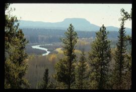
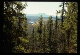
Image depicts a group of unidentified individuals walking along a crevasse filled ridge somewhere in the vicinity of Smithers, B.C. The slide also labels it as a "drift ridge."
The item is a map depicting the Crooked River Provincial Forest area. Sections of the map are highlighted and coordinates are annotated in ink.
Image depicts a view of the Crooked River Provincial Park.
File consists of notes, clippings, and reproductions relating to recreation in the Crooked River area, including Crooked River Provincial Park. Includes: "Mackenzie Community Arts Council" postcard from the Mackenzie Community Arts Council (2001).
Image depicts an unidentified man cross country skiing somewhere on Tabor Mountain in Prince George, B.C.
Image depicts a long line of people cross country skiing somewhere on Tabor Mountain in Prince George, B.C.
File consists of notes, clippings, and reproductions relating to Kent Sedgwick's book chapter "Crossing the Divide Northern Approaches to New Caledonia" from the book "Simon Fraser's New Caledonia: A Geography of Northern B.C". published by the College of New Caledonia. Includes: typescript letter correspondence between Kent Sedgwick and J. Alistair McVey (Sept. 1992); "RE: Book on the Geography of Northern B.C" typescript letter from Jim Windsor to Kent Sedgwick (June 2002); and "BC Studies" typed letter from Cole Harris to Kent Sedgwick (24 Jan. 2001).
File consists of notes and reproductions relating to Kent Sedgwick's article, "Crossing the Divide: Northern Approaches to New Caledonia", which was published in vol. 12 of the Western Geography journal in 2002.
The item is a computer diskette including various word document versions of articles written by Kent Sedgwick. Annotation on the diskette states, "J. Kent Sedgwick Caledonia article and bibliography Word versions."
The item is a photograph depicting a crowd at the unveiling of the L. C. Gunn Park sign.
Image depicts a large crowd of people on a section of the Heritage Trail on Cottonwood Island in Prince George, B.C.
Image depicts a crowd of people on a section of the Heritage Trail on Cottonwood Island in Prince George, B.C.
Image depicts a backyard filled with various items piled against a shed in Island Cache.
Image depicts a crowded cafeteria, most likely somewhere in Hudson's Hope, B.C. The slide is labelled "Camp at H.H."
The item is a photograph depicting a crucifix from the church at Indian Reserve No. 2 in Shelley.
File contains slides depicting quotations and sketched images.
Image depicts an area of cut trees at Island Cache.
The item is a photograph depicting the plaque containing information on the history and significance of the cutbanks in Prince George, BC.
Image depicts two unidentified individuals and a van on a farm at an uncertain location, possibly a place called Cypress Hill, with an atmometer and a sunshine recorder.
File consists of notes, clippings, and reproductions relating to dairying and dairy farming in Prince George. Includes material on Harry Moffat; cattle in Mud River; Mr. Hewlett and Centralia Dairy (established in 1923); Interior Creamery, located at the corner of Brunswick and First Avenue; and pasteurization.
Image depicts the interior of a barn at a dairy farm located somewhere near Quesnel, B.C. Numerous unknown individuals are present.
Image depicts numerous pieces of machinery in the interior of a building at a dairy farm, located somewhere near Quesnel, B.C. Several unknown individuals are present.
The item is a photograph of Dale's Trad'n Post and an empty commercial building on 3rd Avenue in Prince George.
The item is a photograph of Dale's Trad'n Post and Spruce City Resale building on 3rd Avenue in Prince George.
Image depicts a man named Dan Bashaw holding a sandwich and a cup of coffee at an uncertain location.
Image depicts Danskin, B.C.
Image depicts a sawmill in the Danson Industrial Park in Prince George, B.C.
Image depicts a the Danson Industrial Park in Prince George, B.C.
Image depicts light from an unidentified light-source shining on a long, vertical object of an uncertain nature, though it is possibly a tree. The rest of the image is too dark to make out.
File consists of notes, clippings, and reproductions relating to David Thompson, surveyor, cartographer, and fur trader with the Hudson's Bay Company and North West Company.
Image depicts a road with a guardrail and open fields somewhere near Dawson Creek, B.C.
Image depicts a street of businesses in Dawson Creek, B.C.
Image depicts a large building which is labelled "Alberta Pool Elevators Ltd. Dawson Creek," located in Dawson Creek, B.C.
Image depicts the interior of what is possibly a heritage building in Dawson Creek, B.C.
Image depicts a street of businesses and Mile "0" of the Alaskan Highway in Dawson Creek, B.C.
Image depicts Mile "0" of the Alaskan Highway in Dawson Creek, B.C.
Image depicts the Station Museum in Dawson Creek, B.C.
Image depicts the interior of the Station Museum in Dawson Creek, B.C.
Image depicts stuffed wildlife exhibits inside the Station Museum in Dawson Creek, B.C.
Image depicts the Station Museum and the "Alberta Pool Elevators Ltd." building in Dawson Creek, B.C.
File contains slides depicting old geological maps of the Central Interior.
Image depicts a church in Deadman Creek, west of Kamloops, B.C.
Image depicts several children and numerous adults inside a church in Deadman Creek, near Kamloops, B.C.
Image depicts the corner of an old log building in Deadman Creek, near Kamloops, B.C.
Image depicts two children in front of an old log building on the Deadman Creek reserve, located west of Kamloops, B.C.
File contains slides depicting images of areas around Dease Lake, B.C.
Image depicts Upper Fraser residential area during demolition of town site. Map coordinates 54°06'51.6"N 121°56'26.3"W