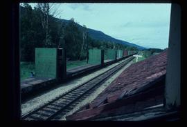
File consists of notes and reproductions relating to the Canadian Northern Railway. File contains material regarding the CNR railway station at Boston Bar; the community and railway stop at Basque; development of the CNR; and the CNR in Lucerne, British Columbia.
File consists of notes and reproductions relating to the land surveys conducted between 1871 and 1876 to find a route across British Columbia for the Canadian Pacific Railway. File contains material regarding surveyor Charles Horetzky; surveyor Sir Sandford Fleming; surveyor Joseph Hunter and the Pine Pass; and the proposed routes for the Canadian Pacific Railway in British Columbia.
Image depicts a car on a dirt road leading through a forest.
Image depicts the train station in Carcross, Y.T.
Image depicts the old, grown-over Cariboo Road at an uncertain location.
File consists of notes and clippings relating to the Cariboo Road. The Cariboo Road (also called the Cariboo Wagon Road, the Great North Road or the Queen's Highway) was a project initiated in 1860 by the Governor of the Colony of British Columbia, James Douglas. The road stretched from Fort Yale to Barkerville, B.C. through hazardous canyon territory in the Interior of British Columbia.
Image depicts the Cariboo Road south of Williams Lake.
Image depicts the Cariboo Road at Hat Creek Ranch, near Highway 99 on the way to Lillooet.
Image depicts the Cariboo Road passing through the Cottonwood House Historic Site.
Image depicts the Cariboo Road in Soda Creek, B.C.
Image depicts a green canoe sitting in the water on the shore of Carp Lake.
Image depicts a red carriage labelled in yellow "B.C. Express Co. No. 20." It is possibly located in Kamloops, B.C.
Image depicts a close-up of the carriage step. It is possibly located in Kamloops, B.C.
Image depicts a truck parked on the side of the Cassiar Highway.
Image depicts a view of Chetwynd, possibly from Highway 97.
Image depicts a view of a train passing through an area of Chetwynd, B.C.
Image depicts two children standing near an old car in Island Cache.
Image depicts the Clayhurst Ferry on the Peace River.
Image depicts a highway, and a section of mountain in the background which is bare due to clear-cut logging. It is possibly somewhere near Prince George, B.C.
Image depicts a camper parked on the side of a narrow road along a cliff as another car approaches; located somewhere near Bralorne, B.C.
Image depicts a camper passing under an overhang as it drives along a narrow road near a cliff; located somewhere near Bralorne, B.C.
Image depicts the CN Building in Prince George, B.C.
Image depicts a number of trains in the CNR train yard taken from River Road in Prince George, B.C. Map coordinates 53°54'51.5"N 122°43'29.6"W
Image depicts a collapsing shack somewhere in the Seton Portage area.
Image depicts a rail road bridge, possibly the Cottonwood Bridge, at an uncertain location.
Image depicts the Cottonwood Bridge.
Image depicts the railway running near Crescent Spur in the Rocky Mountain Trench.
Image depicts a row of houses and the side of a train in Crescent Spur, B.C.
Image depicts a logging truck with its trailer being attached on top of it. A Crestbrook Forest Industries sawmill is located in the background.
Image depicts a man attaching a logging trailer to a crane on a wooden structure to stack the trailer on the truck. A Crestbrook Forest Industries sawmill is located in the background.
Image depicts two unidentified individuals and a van on a farm at an uncertain location, possibly a place called Cypress Hill, with an atmometer and a sunshine recorder.
Image depicts a road with a guardrail and open fields somewhere near Dawson Creek, B.C.
Image depicts a street of businesses and Mile "0" of the Alaskan Highway in Dawson Creek, B.C.
Image depicts Mile "0" of the Alaskan Highway in Dawson Creek, B.C.
Image depicts a dirt road leading through numerous trees toward a mountain. The location is uncertain, likely on the way to Longworth, B.C.
Image depicts a dirt road and a possibly abandoned building at an uncertain location.
Image depicts a dirt road leading through a forest.
Image depicts a dirt road leading through a forest with what appears to be an area for turning around at the end.
Image depicts the "Divides Lake Waterfall" as well as a man in front of a helicopter in the foreground.
Image depicts numerous docked boats in Prince Rupert, B.C.
Image depicts numerous docked boats somewhere in Prince Rupert, B.C.
Image depicts numerous boats docked in Prince Rupert, B.C.
Image depicts a ferry docked at Haida Gwaii, B.C.
Image depicts a house and numerous rundown vehicles in Dog Creek, B.C.
Image depicts the CN Station in Dome Creek, B.C.
Image depicts a strangely shaped orange vehicle somewhere in Dome Creek, B.C.
Image depicts the train tracks at the old Dunster Station in Dunster, B.C.