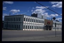
The item is a photograph of Citi Financial and an empty commercial building on 3rd Avenue in Prince George. Scotiabank building is visible in the background.
File consists of notes, clippings, and reproductions relating to the City Beautiful movement across North America. File predominantly consists of photocopied articles: "The City Beautiful" by Fredrick Law Olmsted, Jr.; "The Plan of Chicago 1909" by Amy Diadamo; "Vancouver and the City Beautiful Movement" by Rodger Todhunter; "The Urbanization of America" by Blake McKelvey; and "The Rise of Modern Urban Planning" by Anthony Sutcliffe. File also includes an issue of the "Journal of the Society for the Study of Architecture in Canada", Vol. 32 No. 1 (2007).
The item is a photograph of a photograph depicting Prince George's City Hall circa. 1922 including an approximately 120 word write up describing its history. The building is approximately two stories high. There is an artillery cannon next to the building. A reflection of the photographer is barely visible in the photograph.
The item is a photograph of a photograph depicting Prince George's City Hall circa. 1922 including an approximately 120 word write up describing its history. The building is approximately two stories high. There is an artillery cannon next to the building. A reflection of the photographer is barely visible in the photograph.
The item is a photograph of a photograph depicting Prince George's City Hall circa. 1922 including an approximately 120 word write up describing its history. The building is approximately two stories high. There is an artillery cannon next to the building. A reflection of the photographer is barely visible in the photograph.
Image depicts City Hall in Prince George, B.C.
Image depicts Prince George City Hall. Map coordinates 53°54'46.3"N 122°44'41.9"W
The item is a photograph of a photograph depicting Prince George's City Hall circa. 1922 including an approximately 120 word write up describing its history. The building is approximately two stories high. There is an artillery cannon next to the building. A reflection of the photographer is barely visible in the photograph.
The item is a photograph of a photograph depicting Prince George's City Hall circa. 1922 including an approximately 120 word write up describing its history. The building is approximately two stories high. There is an artillery cannon next to the building. A reflection of the photographer is barely visible in the photograph.
The item is a photograph of a photograph depicting Prince George's City Hall circa. 1922 including an approximately 120 word write up describing its history. The building is approximately two stories high. There is an artillery cannon next to the building. A reflection of the photographer is barely visible in the photograph.
The photograph of the map depicts a map of Prince George, BC with the location of eleven buildings as points of interest and the years they were built. Areas covered on the map are South of the Nechako River, East of the Fraser River, North of Bowser Street, and West of Fraser Street. All street names are written on their specific roads.
The photograph of the map depicts a map of Prince George, BC with the location of eleven buildings as points of interest and the years they were built. Areas covered on the map are South of the Nechako River, East of the Fraser River, North of Bowser Street, and West of Fraser Street. All street names are written on their specific roads.
Map depicts the city of Prince George Boundary expansions since 1913.
Map depicts the city of Prince George with annotations of the boundary expansions from 1915 to 1964.
Map depicts the city of Prince George boundary expansions from 1913 to 1974.
File consists of photocopies and notes relating to the boundary expansions of the city of Prince George since its incorporation. Includes a graph drawn by Kent Sedgwick regarding the addition of land and water each year of the boundary expansion and a "Proclamation" photocopy from the B.C. Gazette (23 Apr. 1953). Also includes 5 maps: "City of Prince George Boundary Expansions since Incorporation in 1915" (1979 or 1980); "City of Prince George" (Feb. 1979); "Map of Prince George" (between 1970 and 1985); "Study Area Boundaries" (Mar. 1977); and "City of Prince George" (Feb. 1972).
Map depicts boundaries of study areas, including major study area, community study area, and the city of Prince George boundaries.
Map depicts the city of Prince George Boundary expansions since incorporation in 1915.
File consists of clippings, letters, notes, and reproductions relating to the development and use of a coat of arms for the city of Prince George. Includes: "Coat of arms committee minutes" (9 Dec. 1994); printed photos of the proposed coat of arms and flag for the city of Prince George (Jan. 1995); "Ceremony for the Presentation of Armorial Bearings and Letters Patent to the City of Prince George" (29 July 1996); an invitation from the office of the mayor (29 July 1996); "Proposed armorial bearings for the city of Prince George"; "Symbolism in the armorial bearings of Prince George, B.C". (12 May 1995); and "The Canada Chart". Also includes a poster entitled "The Canada Chart". Includes the following clipped articles from the Prince George Citizen newspaper: "Coat of arms tell own story"; "City, CNC join old tradition" (30 July 1996); "Coat of arms carved for chamber" (19 Nov. 1996).
File consists of notes, reproductions, clippings, and letters relating to the Junkers aircraft named "The City of Prince George," registration CF-ALX. Includes: "Western Canada Aviation Museum" letter to Dennis McCallum from Karen Schmidt (25 June 1986) and "City of Prince George Junkers F-13 Airplane" typescript document (4 Sept. 1986).
Item is an original map depicting the city of Prince George and its parks and trails. The map was published by the City of Prince George Leisure Services.
File consists of notes and reproductions relating to the planning of the Georges: South Fort George, Central Fort George, and Prince George.
Image depicts the Prince George Civic Centre.
The item is a photograph depicting the Prince George Coliseum from the outside. It shows a full parkin lot, a bus dropping people off and a layer of snow on the ground. The Civic Centre can be seen in the background. The annotation on the back states, "Coliseum Jan. 98."
The item is a photograph depicting a metal swinging gate and cattleguard on Clanston Road. Annotation on reverse side of photograph states, "Clanston Rd."
The item is a photograph depicting Clanston Road. Annotation on reverse side of photograph states, "Clanston Rd."
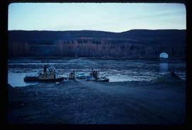
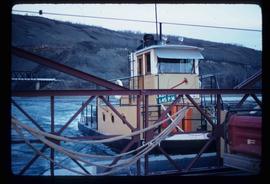
Image depicts the Clayhurst Ferry on the Peace River.
Image depicts the Clayhurst Ferry on the Peace River.
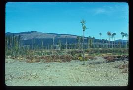
Image depicts a highway, and a section of mountain in the background which is bare due to clear-cut logging. It is possibly somewhere near Prince George, B.C.
Image depicts a logging area, and a section of mountain in the background which is bare due to clear-cut logging. The slide is also labelled "logging show." It is possibly somewhere near Prince George, B.C.
Image depicts a clearing at Island Cache.
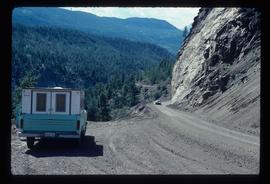
Image depicts a camper parked on the side of a narrow road along a cliff as another car approaches; located somewhere near Bralorne, B.C.
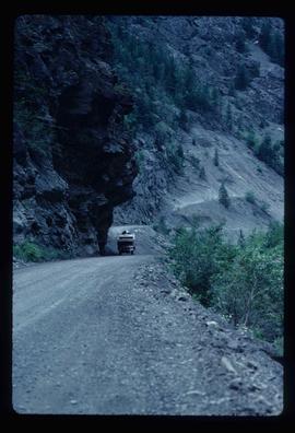
Image depicts a camper passing under an overhang as it drives along a narrow road near a cliff; located somewhere near Bralorne, B.C.
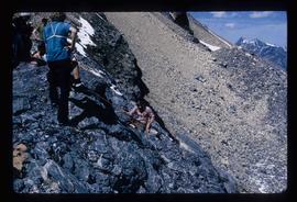
Image depicts a climbing either up or down a rock face.
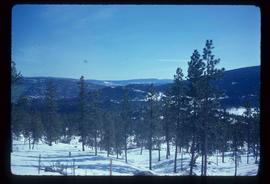
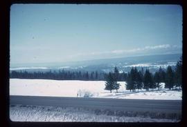
Image depicts a view of the scenery near Clinton, B.C.
Image depicts a view of the scenery near Clinton, B.C.
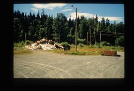
Image depicts Upper Fraser residential area during demolition of town site. Map coordinates 54°06'51.6"N 121°56'26.3"W
File contains slides depicting closeups of flowers at unknown locations.
Item is an original 1977 map depicting Cluculz Lake in British Columbia published by the Province of British Columbia Ministry of Environment. The map includes pen annotations.
Image depicts the CN Building in Prince George, B.C.
Photograph depicts a CN locomotive numbered 2693 with trees along both sides of the railway tracks.
The photograph depicts a CN rail car at the CN roundhouse in Prince George, BC. Reproduction of photograph from 1984.
The item is a photograph depicting men clearing railway tracks at the CN Railway Yard during the Nechako River flood in January 1937.
The item is a photograph depicting the CN Railway Yard during the Nechako River flood in January 1937. Annotation on the photograph states, "Water level at depot - Creamery." Annotation on reverse side of photograph states, "1937 Ice Flood."
The item is a photograph depicting the CN Railway Yard during the Nechako River flood in January 1937.
The item is a photograph depicting men clearing railway tracks at the CN Railway Yard during the Nechako River flood in January 1937.
The item is a photograph depicting the CN Railway Yard during the Nechako River flood in January 1937. Annotation on the photograph states, "Depot - Round House."
The photograph depicts the CN rail yard focusing on Garage 12 of the roundhouse and a CN train engine next to the building. Reproduction of photograph from 1984.
The photograph depicts a CN train engine in the interior of the roundhouse at the CN Railyard in Prince George, B.C. The train's identification number is 1369. Reproduction of photograph from 1984.
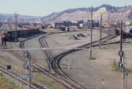
Image depicts a number of trains in the CNR train yard taken from River Road in Prince George, B.C. Map coordinates 53°54'51.5"N 122°43'29.6"W
