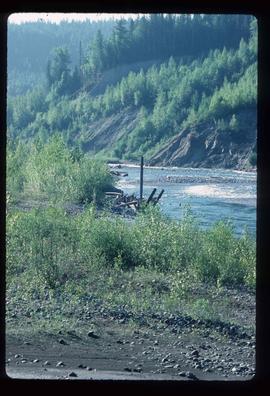
Image depicts a large section of disturbed ground at an unknown location.
Image depicts an area of disturbed ground, most likely due to a landslide, at an unknown location.
Image depicts a dirt road leading through a forest.
Image depicts a dirt road leading through a forest with what appears to be an area for turning around at the end.
Image depicts a dirt road and a possibly abandoned building at an uncertain location.
Image depicts a dirt road leading through numerous trees toward a mountain. The location is uncertain, likely on the way to Longworth, B.C.
Image depicts an old house for sale surrounded by overgrown bushes in Upper Fraser, B.C. Map coordinates 54°07'15.0"N 121°57'02.0"W
Image depicts two dilapidated houses in Sinclair Mills, B.C.
Image depicts a dilapidated house in Sinclair Mills, B.C.
Image depicts an aerial view of Diamond Island, near Quesnel, B.C.
Image depicts a deer on a path somewhere near Bralorne, B.C.
Image depicts debris left in residential area on Giscome, B.C. townsite. Map coordinates 54°04'16.7"N 122°21'55.1"W
Image depicts Upper Fraser residential area during demolition of town site. Map coordinates 54°06'51.6"N 121°56'26.3"W
Image depicts a street of businesses and Mile "0" of the Alaskan Highway in Dawson Creek, B.C.
Image depicts Mile "0" of the Alaskan Highway in Dawson Creek, B.C.
Image depicts a large building which is labelled "Alberta Pool Elevators Ltd. Dawson Creek," located in Dawson Creek, B.C.
Image depicts a street of businesses in Dawson Creek, B.C.
Image depicts a road with a guardrail and open fields somewhere near Dawson Creek, B.C.
Image depicts light from an unidentified light-source shining on a long, vertical object of an uncertain nature, though it is possibly a tree. The rest of the image is too dark to make out.
Image depicts Danskin, B.C.
Image depicts two unidentified individuals and a van on a farm at an uncertain location, possibly a place called Cypress Hill, with an atmometer and a sunshine recorder.
Image depicts an area of cut trees at Island Cache.
Image depicts a large crowd of people on a section of the Heritage Trail on Cottonwood Island in Prince George, B.C.
Image depicts a crowd of people on a section of the Heritage Trail on Cottonwood Island in Prince George, B.C.
Image depicts a long line of people cross country skiing somewhere on Tabor Mountain in Prince George, B.C.
Image depicts an unidentified man cross country skiing somewhere on Tabor Mountain in Prince George, B.C.
Image depicts a group of unidentified individuals walking along a crevasse filled ridge somewhere in the vicinity of Smithers, B.C. The slide also labels it as a "drift ridge."
Image depicts a crevasse filling ridge somewhere in the Bulkley Valley, B.C.
Image depicts a man attaching a logging trailer to a crane on a wooden structure to stack the trailer on the truck. A Crestbrook Forest Industries sawmill is located in the background.
Image depicts a logging truck with its trailer being attached on top of it. A Crestbrook Forest Industries sawmill is located in the background.
Image depicts a row of houses and the side of a train in Crescent Spur, B.C.
Image depicts the railway running near Crescent Spur in the Rocky Mountain Trench.
Image depicts what appears to be a small mill in the community of Crescent Spur, B.C.
Image depicts a church school in the community of Crescent Spur, B.C.
Image depicts a beehive burner in the community of Crescent Spur, B.C.
Image depicts the community of Crescent Spur, B.C.
Image depicts a creek near Quesnelle Forks, B.C.
Image depicts a creek near Iron Road North, north of Woodpecker, B.C.
Image depicts a the Cottonwood Island Nature Park sign and map in Prince George, B.C.
Image depicts Elmer Mercier, a former mayor of Prince George, B.C., cutting the ribbon to open Cottonwood Park's Heritage Trail.
Image depicts a crowd of people in Cottonwood Park in Prince George, B.C.
Image depicts Cottonwood Island.