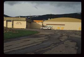
Image depicts the All Saints Anglican Church in McBride, B.C. The slide labels it as having "moved to PG."
Image depicts an abandoned building on the corner of a street in McBride, B.C.
Image depicts an abandoned building on the corner of a street in McBride, B.C. The faded letters on the side read: "McBride Trading Co. Mens Wear, Drugs, Equipment."
Image depicts McBride, B.C.
Image depicts a row of houses in the village of Masset on Haida Gwaii.
The photograph depicts Mark Gabriel Stadium, a baseball stadium in Prince George. The photo was taken in 2005.
Image depicts a marching band with numerous other unidentified individuals. One man is carrying a Canadian flag with the depiction of men in a boat and the words "Canada Sea-to-Sea" on it, and there is a mascot beside him that appears to be a chipmunk in an RCMP uniform.
Image depicts a marching band with numerous other unidentified individuals. One man is carrying a Canadian flag with the depiction of men in a boat and the words "Canada Sea-to-Sea" on it.
The item is a photograph slide depicting a map of Mackenzie Island. The map depicts Central Fort George, South Fort George, Mackenzie Island and the Nechako/Fraser River confluence. Annotation on the slide states, "Mackenzie island."
Image depicts a man holding up a board which appears to have maps of the Cottonwood Park on it.
Image depicts the road to Manson Creek, B.C.
Image depicts the Omineca Museum in Manson Creek, B.C.
Image depicts a creek with a half collapsed shack in the background somewhere in Manson Creek. The slide is labelled "Manson workings."
Image depicts the gas station at Manson Creek, B.C.
Image depicts a man and his family filling up their truck with gas at Manson Creek, B.C.
Image depicts Manson Creek, B.C.
File contains slides depicting places in and around Manson Creek.
Image depicts a snow sculpture of a man with a shovel, possibly during the Winter City Conference, in Prince George, B.C. Taken at the Prince George Civic Center. Map coordinates 53°54'45.6"N 122°44'59.6"W
Image depicts an unidentified man lighting a fire somewhere in South Tweedsmuir Provincial Park.
Image depicts an individual, possibly Kent Sedgwick, standing on a trail through a forest somewhere in or around Seton Portage, B.C.
The item is a photograph depicting a man standing on a cliff overlooking the Fraser River running through Fort George Canyon.
Image depicts an unknown individual climbing the side of a large boulder.
Image depicts an unidentified man standing on a wood bridge somewhere in South Tweedsmuir Provincial Park.
The item is a photograph depicting a man in a black shirt and blue jacket standing in next to CN railcars in Giscome. The sign behind the man reads, "CN Giscome."
Image depicts a man leaning on a rock somewhere on Murray Ridge.
Image depicts an unknown individual reading inside a tent somewhere in Mt. Robson Provincial Park.
Image depicts an unidentified man in a yellow hat who appears to be speaking to large group of people and showing them small pieces of wood. It is possibly an educational event.
Image depicts an unidentified man in a yellow hat who appears to be speaking to large group of people. It is possibly an educational event.
Image depicts a man, possibly Kent Sedgwick, standing next to a monument which states: "In honour of the pioneers of the Ootsa Lake Valley, first settled in 1905." Located somewhere in either the Francois Lake Provincial Park or the Wistaria Provincial Park.
Image depicts a man, with what is possibly the Robson Glacier visible in the background.
Image depicts several buildings along the main street in Stewart, B.C. One of them has been boarded up.
Image depicts the main street of Stewart, B.C.
Image depicts several buildings along the main street in Stewart, B.C.
File contains slides depicting places in and around Mackenzie Town.
Image depicts the Mackenzie Reservoir in Mackenzie, B.C.
The item is a photograph depicting a group of people on either side of the new Alexander Mackenzie monument for the unveiling in Fort George Park. Date handwritten on the reverse side of the photograph states, "July 31/85."
Image depicts numerous vehicles in the parking lot of a mall in Mackenzie, B.C.
Image depicts the Mackenzie Curling Rink.
Image depicts a small section of Mackenzie, with the Mackenzie Curling Rink visible on the right side of the image.
Image depicts numerous vehicles parked outside a building with a sign which reads "Mackenzie Centre;" it is possibly the mall in Mackenzie, B.C.
Image depicts an individual standing next to the world's largest tree crusher in Mackenzie, B.C.
Image depicts the world's largest tree crusher in Mackenzie, B.C.
Image depicts a truck parked on a beach in Mackenzie, B.C.
Image depicts a trailer park somewhere in Mackenzie, B.C.