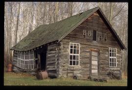
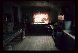
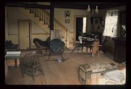
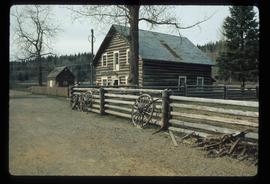
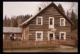
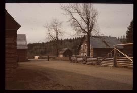
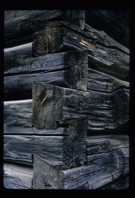
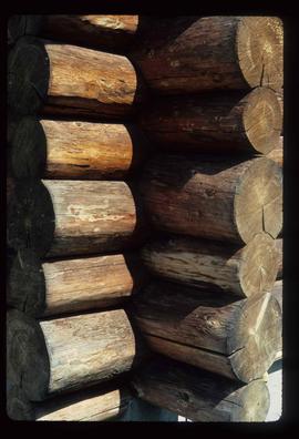
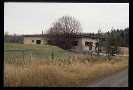
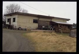
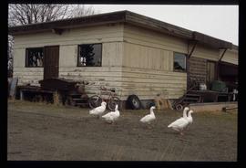
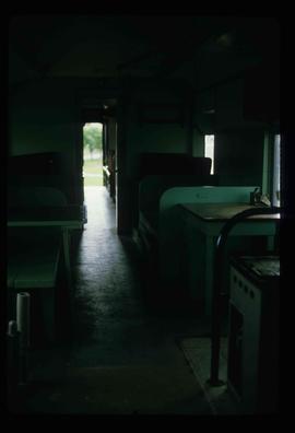
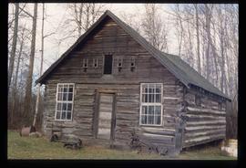
Image depicts the interior of what is possibly a heritage building in Dawson Creek, B.C.
Image depicts a large building which is labelled "Alberta Pool Elevators Ltd. Dawson Creek," located in Dawson Creek, B.C.
Image depicts a street of businesses in Dawson Creek, B.C.
Image depicts a sawmill in the Danson Industrial Park in Prince George, B.C.
Image depicts a the Danson Industrial Park in Prince George, B.C.
Image depicts Danskin, B.C.
The item is a photograph of Dale's Trad'n Post and Spruce City Resale building on 3rd Avenue in Prince George.
The item is a photograph of Dale's Trad'n Post and an empty commercial building on 3rd Avenue in Prince George.
Image depicts numerous pieces of machinery in the interior of a building at a dairy farm, located somewhere near Quesnel, B.C. Several unknown individuals are present.
Image depicts the interior of a barn at a dairy farm located somewhere near Quesnel, B.C. Numerous unknown individuals are present.
Image depicts an area of cut trees at Island Cache.
The item is a photograph depicting a crucifix from the church at Indian Reserve No. 2 in Shelley.
Image depicts a crowded cafeteria, most likely somewhere in Hudson's Hope, B.C. The slide is labelled "Camp at H.H."
Image depicts a backyard filled with various items piled against a shed in Island Cache.
Image depicts a long line of people cross country skiing somewhere on Tabor Mountain in Prince George, B.C.
Image depicts a man attaching a logging trailer to a crane on a wooden structure to stack the trailer on the truck. A Crestbrook Forest Industries sawmill is located in the background.
Image depicts a logging truck with its trailer being attached on top of it. A Crestbrook Forest Industries sawmill is located in the background.
Image depicts a row of houses and the side of a train in Crescent Spur, B.C.
Image depicts what appears to be a small mill in the community of Crescent Spur, B.C.
Image depicts a church school in the community of Crescent Spur, B.C.
Image depicts a beehive burner in the community of Crescent Spur, B.C.
Image depicts the community of Crescent Spur, B.C.
Image depicts an old, collapsing cabin at an uncertain location; possibly Woodpecker B.C.
Image depicts a the Cottonwood Island Nature Park sign and map in Prince George, B.C.
File contains slides depicting Cottonwood Island in Prince George, B.C.
Image depicts the picnic site of the Cottonwood House Historic Site, located on the Barkerville Highway, east of Quesnel, B.C.
Image depicts the kitchen area of the interior of the Cottonwood House.
Image depicts the living area of the interior of the Cottonwood House.
Image depicts the Cottonwood House at the Historic Site located in Barkerville, B.C.
Image depicts the Cottonwood House.
Image depicts the Cottonwood House Historic Site along Barkerville Highway, east of Quesnel, B.C. A sign posted by the fence reads: "For over half a century the Boyd family operated this haven for man and beast. Here weary travellers found lodging, food, and drink. Here fresh horses were hitched to stage-coaches and miners bought supplies. This historic road-house, built in 1864, stood as an oasis of civilization on the frontier of a rich new land."
Image depicts the Cottonwood House.
Image depicts a section of the Heritage Trail on Cottonwood Island in Prince George, B.C.
Image depicts a rail road bridge, possibly the Cottonwood Bridge, at an uncertain location.
Image depicts the Cottonwood Bridge.
Image depicts the corner of a log house, the slide itself labels the picture as being from Barkerville, B.C. and also indicates the corner is an example of a "round log" dovetail joint.
Image depicts the corner of a log house at an unknown location.
Image depicts a cookhouse at Sinclair Mills, B.C.
Image depicts a cookhouse at an uncertain location.
The item is a photograph depicting construction of the Cameron Street bridge in 1916. The photograph is a reproduction of a photograph taken in 1916. The picture depicts the wooden structure of the bridge being built across the Nechako River. Two workshops surrounded by lumber and a large tent are depicted on the side of the river. Annotation on reverse side of the photograph states, "138%"
The item is a photograph depicting construction of the Cameron Street bridge in 1916. The photograph is a reproduction of a photograph taken in 1916. The picture depicts a boat with wooden construction materials on the Nechako River. A workshop and a log building are depicted on the side of the river. Annotation on reverse side of the photograph states, "138%"
The item is a photograph depicting the Cameron Street bridge. The photograph is a reproduction of a photograph taken between 1917 to 1931. The picture depicts an ice jam with snow and ice along the Nechako River reaching the height of the base of the bridge. Annotations on the reverse side of the photograph state, "138% P986.9.9 Ex Pl. = 1922