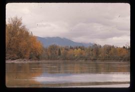
Image depicts a beaver dam somewhere in Hazleton, B.C.
Image depicts Hazelton, B.C.
Image depicts the road leading to the historic Hat Creek Ranch site north of Ashcroft, B.C. Several individuals are sitting on the front porch of the Ranch house.
Image depicts a road leading into a First Nations' Reserve at the head of Harrison Lake.
Image depicts the Hansard railroad bridge taken from the new Hansard vehicle bridge. Map coordinates 54°04'58.1"N 121°50'58.0"W
Image depicts the new Hansard Bridge. Map coordinates 54°04'57.9"N 121°51'10.1"W
Image depicts a hammer sitting in dirt at an uncertain location.
Image depicts a house on Blackwater Road.
Image depicts Haldi Lake near Prince George, B.C.
File contains slides depicting places on Haida Gwaii, formerly known as the Queen Charlotte Islands.
Image depicts a church on a hill in Hagwilget, B.C.
Image depicts a bridge in Hagwilget, B.C.
Image depicts numerous individuals who appear to be searching among the rocks on a ledge at an uncertain location in the Peace River Region.
Image depicts a group of hikers examining something on the ground, most likely the small pink flower that is barely visible in the grass. The location is possibly near Riske Creek.
Image depicts a group of hikers on a hiking trail.
Image depicts a group of people hiking, possibly somewhere near Riske Creek, B.C.
Image depicts a group of people and two vans, apparently preparing to set out on a hike somewhere near Riske Creek, B.C.
Image depicts a group of hikers listening to a man, possibly a guide, speak. The location is possibly near Riske Creek, B.C.
Image depicts a group of hikers, possibly somewhere near Riske Creek, B.C.
Image depicts a group of people standing near a river. A glacier is visible in the background.
Image depicts a group of individuals and a bus with words that read: "Prince George Limousine & Charter." The river in the background is possibly the Peace River, and the location is possibly somewhere near Fort St. John, B.C.
Image depicts an aerial view of a grooved region of land at an uncertain location.
Image depicts an aerial view of grooves in the land near the Fraser River, possibly caused by glaciers.
Image depicts a view of grooves in the land near the Fraser River, possibly caused by glaciers.
Image depicts an aerial view of a grooved region of land at an uncertain location.
Image depicts a small graveyard at an uncertain location.
Image depicts layers of gravel at the BCR site in Prince George, B.C.
Image depicts the grave of John A. Fraser in Barkerville, B.C.
Image depicts the grave of John A. Cameron at Barkerville, B.C.
Image depicts numerous grave markers at an uncertain location.
Image depicts the grave of Frank Russell "Russ" Baker in Fort St. James, B.C.
Image depicts a large, electric shovel at a mine site somewhere in Granisle, B.C.
Image depicts a drill for blasting holes at a mine site somewhere in Granisle, B.C.
Image depicts numerous bags of blasting powder at a mine site somewhere in Granisle, B.C.
Image depicts an 80 tonne truck at a mine site somewhere in Granisle, B.C.
Image depicts the Fraser River and the Grand Trunk Pacific Bridge from Cottonwood Island Park.
File contains slides depicting images of the Fraser Canyon from somewhere around 1975.
Image depicts a grain elevator in Prince Rupert, B.C.
Image depicts a clearing through the woods, possibly an abandoned grade for the BCR. It is possibly located on Iron Road South, near Woodpecker B.C.
Image depicts the Fraser River in the Grand Canyon, B.C.
Image depicts a set of rail road tracks and an old, collapsing log building somewhere in Goat River, B.C.
Image depicts an old, collapsing log building somewhere in Goat River, B.C.
Image depicts the CN Railway and Station at Goat River, B.C.