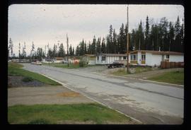
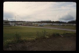
Image depicts a bridge, and the town of Likely on the the other side of a river.
File contains slides depicting places in and around the areas of Likely and Horsefly, B.C.
Image depicts a hotel in Likely, B.C.
Image depicts Lillooet, B.C.
Image depicts a view of Lillooet, B.C.
Image depicts two bridges over the Fraser River, located somewhere in Lillooet, B.C.
Image depicts some farmland in Lillooet, B.C.
File contains slides depicting places around and between Lillooet and Howe Sound.
Image depicts rows of water, possibly being irrigation ditches, somewhere in Lillooet, B.C.
Image depicts a view of the mountains surrounding Lillooet, B.C.
Image depicts a view of the Fraser River and the mountains surrounding Lillooet, B.C.
Image depicts an old church located somewhere in Lillooet, B.C.
File contains slides depicting places in the Lillooet area.
Image depicts an area around Lillooet, B.C. It is possibly the Fraser River running through the Moran Canyon.
Image depicts the Lillooet River at the head of Lillooet Lake.
Image depicts the Lillooet River delta at the head of Lillooet Lake.
Image depicts what is possibly the Lillooet River, full of driftwood.
Image depicts a log cabin and an orange truck somewhere in or near Longworth, B.C.
Image depicts a logging area somewhere near Prince George, B.C.
Image depicts numerous piles of logs, and two unidentified individuals operating an excavator with a "thumb" attachment during the demolition of the Upper Fraser town site. Map coordinates 54°06'51.6"N 121°56'26.3"W
Image depicts a pile of old logs on the bank of the Fraser River with mountains in the background. In the foreground, a set of railway tracks run through an uncertain location, likely Upper Fraser, B.C.
Image depicts a house surrounded by trees and a mountain in the background; it is most likely located somewhere in or near Longworth, B.C.
Image depicts four unidentified individuals walking along the bank of the Fraser River in Longworth, B.C.
Image depicts numerous piles of wood in Longworth, B.C.
Image depicts two unidentified individuals standing next to the train station, and two railway tracks running through Longworth, B.C.
Image depicts the Fraser River and a mountain in Longworth, B.C.
Image depicts several old shacks and some railway tracks running through Longworth, B.C.
Image depicts the post office in Longworth, B.C.
Image depicts several buildings in the community of Loos, B.C.
Image depicts a view of the lower Cayoosh Valley.
Image depicts the lower end of the river channel leading to the Spectacle Lakes.
Image depicts two unknown individuals canoeing on the lower part of Spectacle Lake.
Image depicts numerous condominiums somewhere in Mackenzie, B.C.
Image depicts several apartment buildings and the sign for a Gulf Gas Station in Mackenzie, B.C.
Image depicts a row of houses in Mackenzie, B.C.
Image depicts the frozen Morfee Lake just to the East of Mackenzie, B.C. The slide is also labelled "sub-boreal," referencing that it is a sub-boreal spruce zone.
Image depicts a row of houses in Mackenzie, B.C.
Image depicts a trailer park somewhere in Mackenzie, B.C.
Image depicts a trailer park in Mackenzie, B.C.
Image depicts a truck parked on a beach in Mackenzie, B.C.
Image depicts a small section of Mackenzie, with the Mackenzie Curling Rink visible on the right side of the image.
Image depicts numerous vehicles in the parking lot of a mall in Mackenzie, B.C.
Image depicts the Mackenzie Reservoir in Mackenzie, B.C.