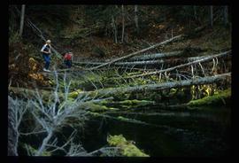
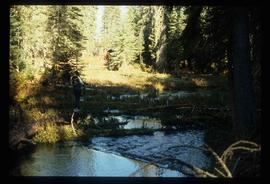
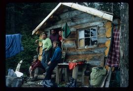
Showing 2093 results

Archival description
1985 results with digital objects Show results with digital objects
Lava Formation?
2012.13.1.50.077 · Item · [1978?]
Part of J. Kent Sedgwick fonds

Image depicts a formation of rock; presumably solidified lava, as the slide is simply labelled "lava." The location of the image is uncertain.

2012.13.2.14.09 · File · 1987-1989
Part of J. Kent Sedgwick fonds

File consists of notes, reproductions, and letters relating to L.C. Gunn Park in Prince George. Includes: "Signage for Gunn Park" letter from Kent Sedgwick to the Mayor and Council (21 Dec. 1989); "L.C. Gunn viewpoint a proposal" documents within a duotang (1987); and "Donation to the City of Prince George" typescript letter from Graham Farstad to the Administration Committee ( 1 June 1988). Includes photographs depicting the opening of L.C. Gunn Park and the sign unveiling (3 Oct. 1988).

2012.13.1.78.25 · Item · 1982
Part of J. Kent Sedgwick fonds

Image depicts numerous boats docked by the Prince Rupert Fishermen's Co-operative Association from the deck of a ferry, possibly as it's leaving Prince Rupert, most likely for Haida Gwaii.

Leo Creek - Office Building?
2012.13.1.62.22 · Item · June 1978
Part of J. Kent Sedgwick fonds

Image depicts a building, possibly an office building, next to a set of rail road tracks in Leo Creek, B.C. An unknown individual is present, and a number of barrels and culverts are visible in the foreground.

Likely
2012.13.1.69.31 · Item · [1981?]
Part of J. Kent Sedgwick fonds

Image depicts a bridge, and the town of Likely on the the other side of a river.

Likely - Horsefly
2012.13.1.069 · Subseries · [between 1976 and 1981]
Part of J. Kent Sedgwick fonds

File contains slides depicting places in and around the areas of Likely and Horsefly, B.C.

Lillooet Area
2012.13.1.053 · Subseries · [between 1971 and 1982]
Part of J. Kent Sedgwick fonds

File contains slides depicting places in the Lillooet area.

Livingston Springs
2012.13.1.4.25 · Item · 16 Mar. 1988
Part of J. Kent Sedgwick fonds

Image depicts numerous fallen trees and two unknown individuals somewhere in the Crooked River Provincial Park, near the Livingston Springs.

Livingston Springs
2012.13.1.4.26 · Item · 16 Mar. 1988
Part of J. Kent Sedgwick fonds

Image depicts the Livingston Springs in the Crooked River Provincial Park, with an unknown individual present.

Logging
2012.13.1.3.043 · Item · Nov. 1977
Part of J. Kent Sedgwick fonds

Image depicts an area undergoing logging somewhere in Prince George, B.C.

Logging
2012.13.1.122.12 · Item · 1977
Part of J. Kent Sedgwick fonds

Image depicts a logging area somewhere near Prince George, B.C.

Logging
2012.13.1.122.13 · Item · 1977
Part of J. Kent Sedgwick fonds

Image depicts a logging area somewhere near Prince George, B.C.

Logs and Machinery
2012.13.1.87.056 · Item · [between 1975 and 1995]
Part of J. Kent Sedgwick fonds

Image depicts numerous piles of logs, and two unidentified individuals operating an excavator with a "thumb" attachment during the demolition of the Upper Fraser town site. Map coordinates 54°06'51.6"N 121°56'26.3"W

2012.13.1.87.013 · Item · [between 1975 and 1995]
Part of J. Kent Sedgwick fonds

Image depicts a pile of old logs on the bank of the Fraser River with mountains in the background. In the foreground, a set of railway tracks run through an uncertain location, likely Upper Fraser, B.C.

Longworth - Railway Tracks
2012.13.1.87.031 · Item · [between 1975 and 1995]
Part of J. Kent Sedgwick fonds

Image depicts two unidentified individuals standing next to the train station, and two railway tracks running through Longworth, B.C.