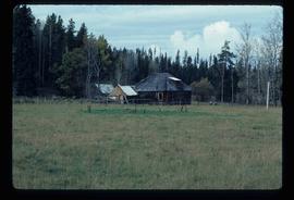
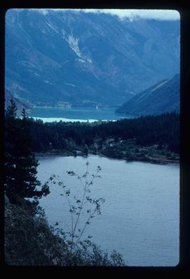
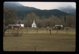
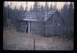
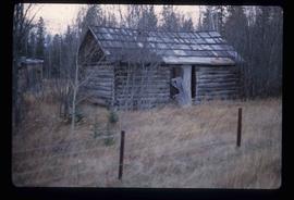
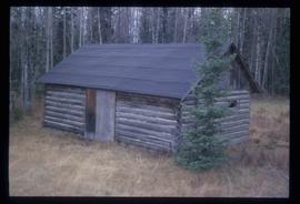
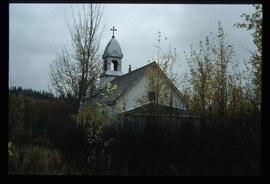
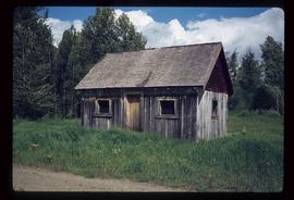
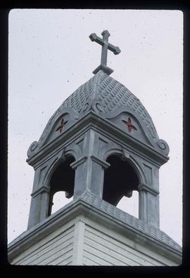
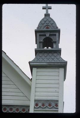
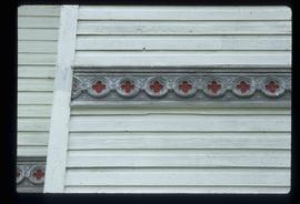
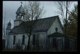
Image depicts the teacherage for the Salmon School, located in the Prince George vicinity.
Image depicts an old log cabin in Salmon Valley.
Image depicts an old log house with a collapsing roof in Salmon Valley.
Image depicts an old Catholic church in Salmon Valley.
Image depicts the Salvation Army on Ospika Boulevard in Prince George, B.C. Map coordinates 53°55'02.6"N 122°47'41.6"W.
Image depicts the Salvation Army on Ospika Boulevard in Prince George, B.C. Map coordinates 53°55'02.6"N 122°47'41.6"W
Image depicts logs being stripped of their bark at a saw mill in Prince George, B.C.
Image depicts the interior of a saw mill somewhere in Prince George, B.C.
Image depicts logs being cut into planks in the interior of a saw mill somewhere in Prince George, B.C.
Image depicts wood planks in the interior of a saw mill somewhere in Prince George, B.C.
Image depicts a saw mill, possibly Lakeland Mills, with a beehive burner and numerous piles of logs in the foreground, in Prince George, B.C.
Image depicts numerous stripped logs and several unidentified individuals in hard hats at a saw mill somewhere in Prince George, B.C.
Image depicts a saw cutting a log in half at a saw mill in Prince George, B.C.
Image depicts numerous blocks of wood planks at a saw mill, possibly Lakeland Mills, somewhere in Prince George, B.C.
Image depicts machinery in a saw mill somewhere in Prince George, B.C.
Image depicts machinery stripping a log of its bark in a saw mill somewhere in Prince George, B.C.
Image depicts numerous buildings at an uncertain location. A beehive burner and what appears to be a large pile of wood is visible in the background.
Image depicts a school and playground, possibly in New Aiyansh, B.C.
Image depicts a view of Seton Portage in the trees, located between the two lakes, Seton and Anderson.
Image depicts a small shack on the shore of a lake near Seton Portage; it is likely either Anderson or Seton Lake.
Image depicts a river somewhere in Seton Portage, B.C.
Image depicts a church and several houses in Seton Portage, B.C.
Image depicts numerous houses and a tractor in Seton Portage, B.C.
Image depicts a type of gate system for the river water, possibly controlling irrigation, located somewhere in Seton Portage, B.C.
Image depicts a river somewhere in or near Seton Portage, B.C.
Image depicts the train station in Seton Portage, B.C.
Image depicts the Seymour Subdivision in Prince George, B.C.
Image depicts a wood shack, likely near McLeod Lake.
Image depicts a shack in Woodpecker, B.C. The slide itself is labelled "seed plant" for unknown reasons.
Image depicts a shack in Woodpecker, B.C. The previous slide of the same building is labelled "seed plant" for unknown reasons.
Image depicts a woman, possibly Sue Sedgwick, sitting in a shack on a beach on Haida Gwaii.
Image depicts two old shacks and a mountain in the background. Possibly located in or near Longworth, B.C.
Image depicts a shed in an unknown location.
Image depicts an old shed in Woodpecker, B.C.
Image depicts a shed on the shore somewhere on Haida Gwaii.
Image depicts a number of sheds in Island Cache.
Image depicts a small section of the boarded up church in Shelley, B.C.
Image depicts a section of the boarded up church at Shelley, prior to its restoration.
Image depicts a small section of the boarded up church in Shelley, B.C.
Image depicts a close-up of the designs on the outside of the boarded up church in Shelley, B.C.
Image depicts the church after its restoration in Shelley, B.C.
Image depicts several ships on the water in Prince Rupert, B.C.
Image depicts a beehive burner covered in snow in Sinclair Mills, B.C. Map coordinates 54°01'17.4"N 121°40'53.0"W
Image depicts railway tracks and buildings with a beehive burner on the left. The location is likely Sinclair Mills, B.C. Map coordinates 54°01'17.4"N 121°40'53.0"W
Image depicts one of the main streets, Broadway, in Skagway, Alaska.