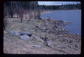
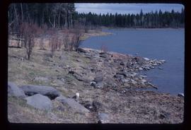
Showing 3024 results

Archival description
3024 results with digital objects Show results with digital objects
Sawmill - Wood Planks
2012.13.1.122.10 · Item · Oct. 1975
Part of J. Kent Sedgwick fonds

Image depicts numerous blocks of wood planks at a saw mill, possibly Lakeland Mills, somewhere in Prince George, B.C.

Sawmill - Saw
2012.13.1.122.18 · Item · June 1980
Part of J. Kent Sedgwick fonds

Image depicts a saw cutting a log in half at a saw mill in Prince George, B.C.

Sawmill - People and Logs
2012.13.1.122.22 · Item · June 1980
Part of J. Kent Sedgwick fonds

Image depicts numerous stripped logs and several unidentified individuals in hard hats at a saw mill somewhere in Prince George, B.C.

Sawmill - Lakeland Mills?
2012.13.1.122.07 · Item · Oct. 1975
Part of J. Kent Sedgwick fonds

Image depicts a saw mill, possibly Lakeland Mills, with a beehive burner and numerous piles of logs in the foreground, in Prince George, B.C.

Sawmill - Interior
2012.13.1.122.24 · Item · June 1980
Part of J. Kent Sedgwick fonds

Image depicts logs being cut into planks in the interior of a saw mill somewhere in Prince George, B.C.

Sawmill
2012.13.1.122.15 · Item · [1979?]
Part of J. Kent Sedgwick fonds

Image depicts logs being stripped of their bark at a saw mill in Prince George, B.C.

Sand Beds
2012.13.1.124.17 · Item · Oct. 1975
Part of J. Kent Sedgwick fonds

Image depicts sand beds with a shovel present for size reference. The slide places it at the "BCR site," possibly in Prince George, B.C.

Salvation Army
2012.13.1.3.112 · Item · 12 Oct. 1989
Part of J. Kent Sedgwick fonds

Image depicts the Salvation Army on Ospika Boulevard in Prince George, B.C. Map coordinates 53°55'02.6"N 122°47'41.6"W.

Salvation Army
2012.13.1.3.114 · Item · 12 Oct. 1989
Part of J. Kent Sedgwick fonds

Image depicts the Salvation Army on Ospika Boulevard in Prince George, B.C. Map coordinates 53°55'02.6"N 122°47'41.6"W

Ruined Cars
2012.13.1.22.16 · Item · 1970
Part of J. Kent Sedgwick fonds

Image depicts several old, ruined cars and an unknown individual in Island Cache.

Rudi's Bridge
2012.13.1.50.059 · Item · 1978
Part of J. Kent Sedgwick fonds

Image depicts a small foot bridge at an unknown location. The slide is simply labelled "Rudi's Bridge."

Rocky Shore
2012.13.1.65.72 · Item · May 1984
Part of J. Kent Sedgwick fonds

Image depicts the rocky shore of an unidentified body of water, possibly near Meldrum Creek, B.C.

Rocky Shore
2012.13.1.65.70 · Item · May 1984
Part of J. Kent Sedgwick fonds

Image depicts the rocky shore of an unidentified body of water, possibly near Meldrum Creek, B.C.

Rocky Mountain Trench
2012.13.1.86.02 · Item · Oct. 1975
Part of J. Kent Sedgwick fonds

Image depicts a heavily forested area located in the Rocky Mountain Trench, possibly near Dome Creek or Lamming Mills, B.C.

Rocky Mountain Trench
2012.13.1.86.01 · Item · Oct. 1975
Part of J. Kent Sedgwick fonds

Image depicts a heavily forested area located in the Rocky Mountain Trench, possibly near Dome Creek or Lamming Mills, B.C.

Rock Formations
2012.13.1.65.52 · Item · [1976?]
Part of J. Kent Sedgwick fonds

Image depicts ridge-like rock formations at an uncertain location, though possibly somewhere near the Fraser River.

Robin Hood Flour
2012.13.1.50.068 · Item · [1978?]
Part of J. Kent Sedgwick fonds

Image depicts an old log cabin with the sign "Robin Hood Flour" on it at an uncertain location. It is possibly at the 153 Mile House.

Road to Skagway
2012.13.1.98.01 · Item · 1999
Part of J. Kent Sedgwick fonds

Image depicts the road to Skagway, Alaska. Possibly located on the Klondike Highway in British Columbia with Tutshi Lake on the left.