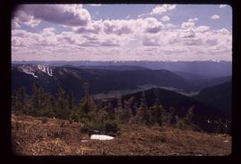
File consists of aerial photographs depicting the Fraser River Big Bend, where the Fraser River changes direction from westbound to southbound at its "Big Bend" near the Huble Homestead Historic Site, 45 km north of Prince George, British Columbia.
The item is a photographic reprint originally taken in 1936. The photograph depicts the Fraser River flood in Prince George in June 1936. Buildings are shown among the raised flood waters. Annotations on the reverse side of the photograph state, "983.11.3 slide 6.3 x 9.5" crossed out is "6 1/2 x 10."
The item is a photographic reprint originally taken in 1936. The photograph depicts the Fraser River flood in Prince George in June 1936. A man on a raft is portrayed near a woman on a bridge with water coming up to the bottom of the bridge. Annotations on the reverse side of the photograph state, "983.16.5 slide 5.7 x 9.5" and crossed out is "6 x 10."
Image depicts the Fraser Valley, looking north, possibly from Marguerite, B.C.
Image depicts the small town of Fraser, B.C. Located on the Klondike Highway.
File consists of notes, clippings, and reproductions relating to the Fraser-Fort George Museum Society Museum Publications committee consisting of Kent Sedgwick, Keith Gordon, and Denise McCallum and publishing local histories through the museum. The file primarily consists of material regarding the re-publication of "History of Prince George" by Rev. F.E. Runnalls. Includes photographs titled "Runnall's Book" and depicting historical Prince George and Rev. Runnalls.
Image depicts a view of the Fraser-Nechako confluence from the Prince George cutbanks.
The item is a photograph of the Freemason Building at 480 Vancouver Street, Prince George. The photograph is taken from the corner of Vancouver Street and 4th Avenue.
This item is a photograph of the Freemason building at 480 Vancouver Street, Prince George.
The item is a photograph depicting the Friendship Centre building at 1600 3 Avenue Prince George. The building's colour is blue and white.
File consists of notes and reproductions relating to the local history project done by June Chamberland and her book "From Broadaxe to Clay Chinking: Stories about the Pioneers in and around the Prince George area" winning the Jeanne Clarke history award. The book includes a chapter "Introduction to Early Agricultural Settlement in the Prince George Area" by Kent Sedgwick. Includes a CD titled "June photos" containing photographs depicting interviewees of the project (2003).
Image depicts a view of Prince George from Carney Hill.
Image depicts the Fraser River from the vantage point of the cutbanks in Prince George, B.C.
Image depicts a view of the Sugarbowl Grizzly Den Protected Area from Raven Peak.
Image depicts a view of the Sugarbowl Grizzly Den Protected Area from Raven Peak. The slide itself is labelled "towards cabin."
Image depicts a view of the landscape surrounding Tabor Mountain in Prince George, B.C.
Image depicts the area surrounding Tabor Mountain. Prince George is slightly visible on the left side of the image in the background.
Image depicts the area surrounding Tabor Mountain. Prince George is slightly visible in the background.
The photograph depicts three metal fuel tanks at the exterior of the CN roundhouse in Prince George, BC. Reproduction of photograph from 1984.
Image depicts the Fulton River.
Image depicts the entrance of the Fulton River.
Image depicts a number of people standing at what appears to be a farm fishery [?] on the Fulton River.
File contains slides depicting subjects related to the Fur Trade.
Subseries consists of materials collected and created by Kent Sedgwick for research regarding fur trade history in British Columbia. Includes histories of the Hudson's Bay Company; historic trails utilized for fur trade; fur trade by the North West Company in the interior of British Columbia; Simon Fraser, a Canadian explorer and fur trader with the North West Company; and David Thompson, a surveyor, cartographer, and fur trader with the Hudson's Bay Company.
Image depicts a woman named "Gail" on a trail to Portage Lake.
Image depicts two women sitting on a fallen tree on the shore of a lake, possibly Portage Lake; the woman in blue is "Gail," and the woman in red is Sue Sedgwick.
Image depicts Gang Ranch in the Upper Fraser Canyon.
Image depicts a road near or on Gang Ranch in the Upper Fraser Canyon.
Image depicts a stream and field at Gang Ranch in the Upper Fraser Canyon.
Image depicts the Fraser River, and a sign pointing towards Gang Ranch, in the Upper Fraser Canyon.
Image depicts the Fraser River, and a sign pointing towards Gang Ranch with an unknown individual hugging it, in the Upper Fraser Canyon.
Image depicts the general store and post office on Gang Ranch.
Image depicts an area of hill at Gang Ranch.
Image depicts the house of the owner of Gang Ranch.
Image depicts a view of the property of the Gang Ranch.
Image depicts a fence and the property of the Gang Ranch.
Image depicts the Gang Ranch House in the Upper Fraser Canyon.
Image depicts Gang Ranch, with a sign warning that the area is patrolled by Range and Logging Patrols, in the Upper Fraser Canyon.
Image depicts the Upper Fraser Canyon from what appears to be the entrance to Gang Ranch.
Image depicts a wooden structure at Gang Ranch. It is possibility an elevated water trough.
Image depicts the Gang Ranch house.