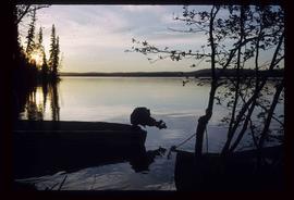
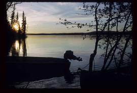
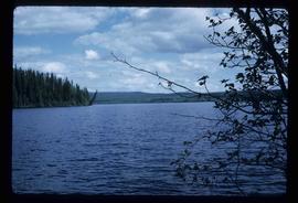
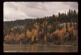
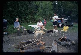
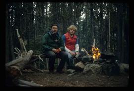
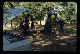
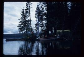
Image depicts a campsite on the shore of Carp Lake.
Image depicts two boats on the shore of Carp Lake.
Image depicts Carp Lake.
Image depicts miocene gravels on Carney Hill in Prince George, B.C.
Image depicts a small slope on Carney Hill in Prince George, B.C.
Image depicts the abandoned Cariboo Rooms, and a liquor store in Wells, B.C.
Image depicts an old, boarded up building labelled as "Cariboo Rooms" in Wells, B.C.
Image depicts the Cariboo Road in Soda Creek, B.C.
Image depicts the Cariboo Road passing through the Cottonwood House Historic Site.
Image depicts the old, grown-over Cariboo Road at an uncertain location.
Image depicts the Cariboo Road south of Williams Lake.
Image depicts the Cariboo Road at Hat Creek Ranch, near Highway 99 on the way to Lillooet.
Image depicts the Cariboo River.
Image depicts a Cariboo Ranch style house at College Heights in Prince George, B.C.
Image depicts the Cariboo Lake, with the roof of an old log cabin visible.
Image depicts the Cariboo Falls.
Image depicts a log house at an uncertain location; the slide is simply labelled "Cariboo."
Image depicts the train station in Carcross, Y.T.
Image depicts Bennett Lake near Carcross, Y.T.
Image depicts a car on a dirt road leading through a forest.
Photograph depicts a monument and grave stone for Captain Frank Odin of the Steamboat Charlotte. Annotation on verso: "Capt. Odin Monument, Soda Creek cemetery, 2010".
Image depicts a view of the ridge above the Fraser River which forms the Grand Canyon, B.C.
Image depicts a church and several other buildings in Canoe Creek.
Image depicts a house located somewhere in or near Canoe Creek.
Image depicts a view of Canoe Creek.
Image depicts the BC Packers Ltd. cannery in Prince Rupert, B.C.
The item is a map that depicts Canadian National Railway plans along Hammond street and the Fraser River. Includes the railway property, private property, proposed streets, and government owned property in the Prince George area.
Image depicts the Canadian National Railway Yards in Prince George, B.C.
Image depicts numerous piles of wood planks at the Canadian National Railway Yards in Prince George, B.C. The cutbanks are seen in the background.
Photograph depicts Canada Trust/ Realtor at 1633 4th Avenue.
The item is a photograph depicting the exterior view of the front of The Health and Welfare Canada Medical Services building at 1294 3rd Avenue, Prince George. There is a grey and red Ford pickup truck parked in front of the building. Part of Household Finance HFC at 1272 3rd Avenue can be seen. Photograph originally taken between 1978 and 1979.
The item is a photograph depicting the exterior view of the front of The Health and Welfare Canada Medical Services building at 1294 3rd Avenue, Prince George. There is a grey and red Ford pickup truck parked in front of the building. Photograph originally taken between 1978 and 1979.
The item is a photograph depicting the exterior view of the front of The Health and Welfare Canada Medical Services building at 1294 3rd Avenue, Prince George. Savers Optical can be seen in the background. Photograph originally taken between 1978 and 1979.
Map depicts to Canadian federal electoral districts for the 1993 federal election.
Image depicts a man at a campsite somewhere near Murray Ridge.
Image depicts Sue Sedgwick seated in a lawn chair near a campfire and several other unidentified individuals, as well as three dogs. The location is uncertain.
The item is a photograph depicting a campground at Likely, BC. There are three camping trailers and Quesnel River can be seen in the background.
Photograph depicting a campground with log cabins and an open field surrounded by trees, presumably in Quesnelle Forks.
Photograph depicting a campground and open field surrounded by trees, presumably in Quesnelle Forks.
Photograph depicting a campground with log cabins and an open field surrounded by trees, presumably in Quesnelle Forks.
Photograph depicting a river with rocks lining the shore and trees in the background, presumably at the campground in Quesnelle forks.
Image depicts Kent Sedgwick (the man with a pipe in green) and an unknown individual sitting around a campfire somewhere in South Tweedsmuir Provincial Park.
Image depicts numerous campers and other vehicles in Tumbler Ridge, B.C.
Photograph depicting a camp ground, with fifth wheel's and vehicles parked in front of a lake, presumably taken at Quesnelle Forks campground.
Image depicts a group of unknown individuals sitting around a camp fire at an uncertain location.
Image depicts a camp of people with Mt. Robson and the Berg Glacier in the background.